
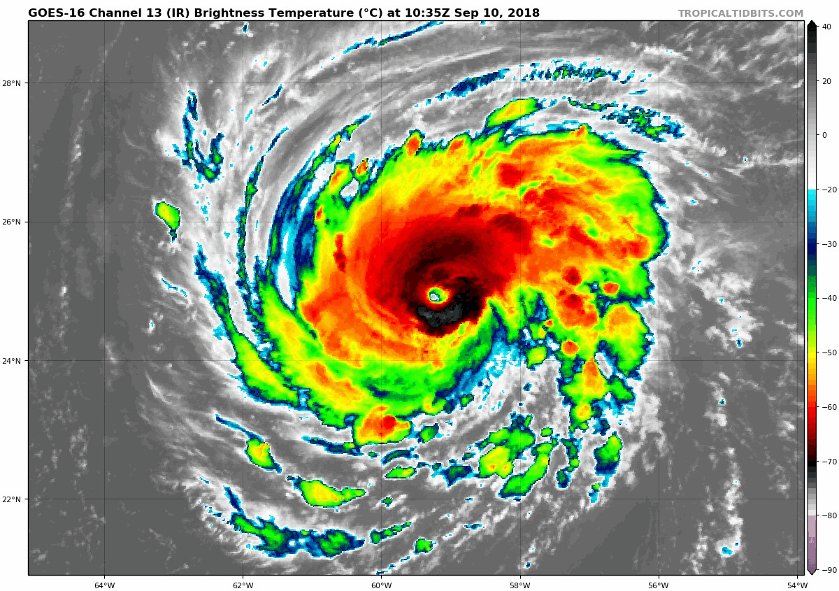
Hurricane Florence continues to intensify in the eastern Atlantic as it moves westward towards the east coast. Winds are currently estimated at 115 mph, making Florence a Category 3 storm. Further strengthening is expected over the coming days, and the storm is expected to be a Category 4, with winds up to 150 mph by Thursday.
The storm is expected to continue on a WNW trajectory over the coming days, approaching the Carolina coastline on Thursday. The storm is then expected to slowly move inland, bringing very heavy rainfall to parts of the Mid-Atlantic.
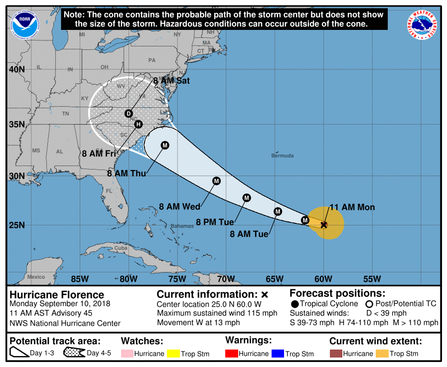
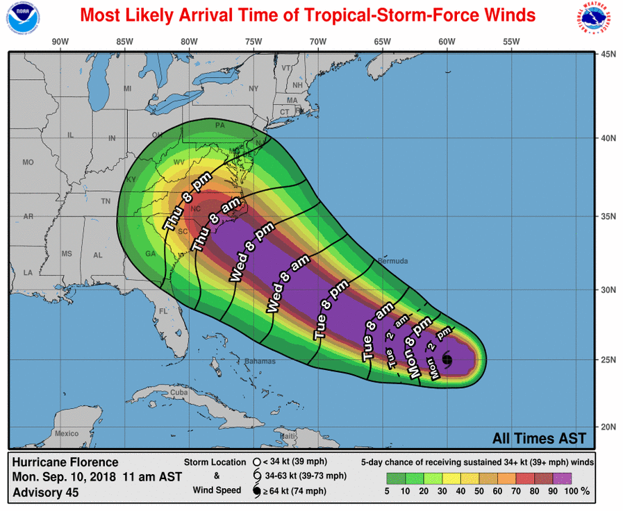
Landfall is still several days away and the exact location of landfall, as well as the storm motion once inland, is still to be determined. Regardless, effects from the storm will be felt across a large area, likely including in Maryland in some fashion. While we will not see the intense hurricane force winds, it is possible that we will see gusty winds and heavy rainfall starting Friday and into the weekend. Additionally, coastal flooding, beach erosion and dangerous rip currents are likely along the beaches.
At this point, it is still too early to know the exact impact the storm will have on our state. While coastal impacts are likely, the rain and wind impact is less known. Very heavy rainfall and strong winds are likely across the Carolinas and into Virginia, whether Maryland sees significant rainfall or wind is still to be determined.
I will post more updates as the forecast becomes clearer over the coming days.
Want the latest blog posts emailed to you?