
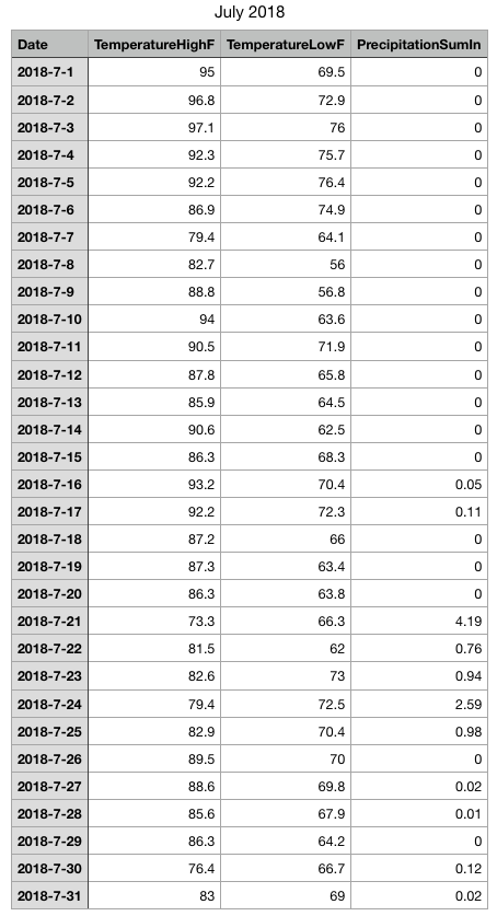
The first part of July was hot and dry across the state. From the 1st through the 15th, my weather station in Odenton recorded no rain at all. Additionally, it was HOT. The average high temperature for the first 15 days was 89.75.
The pattern flipped around mid-month and rainfall amounts went up (dramatically), while the temperature dipped. From July 16 through July 31, my station recorded 9.79″ of rainfall, and the average high temperature was 84.71.
Here are my station stats:
While nearly 10″ of rain in 16 days is impressive, many areas received much more in that period.
Check out the observed totals for the month:
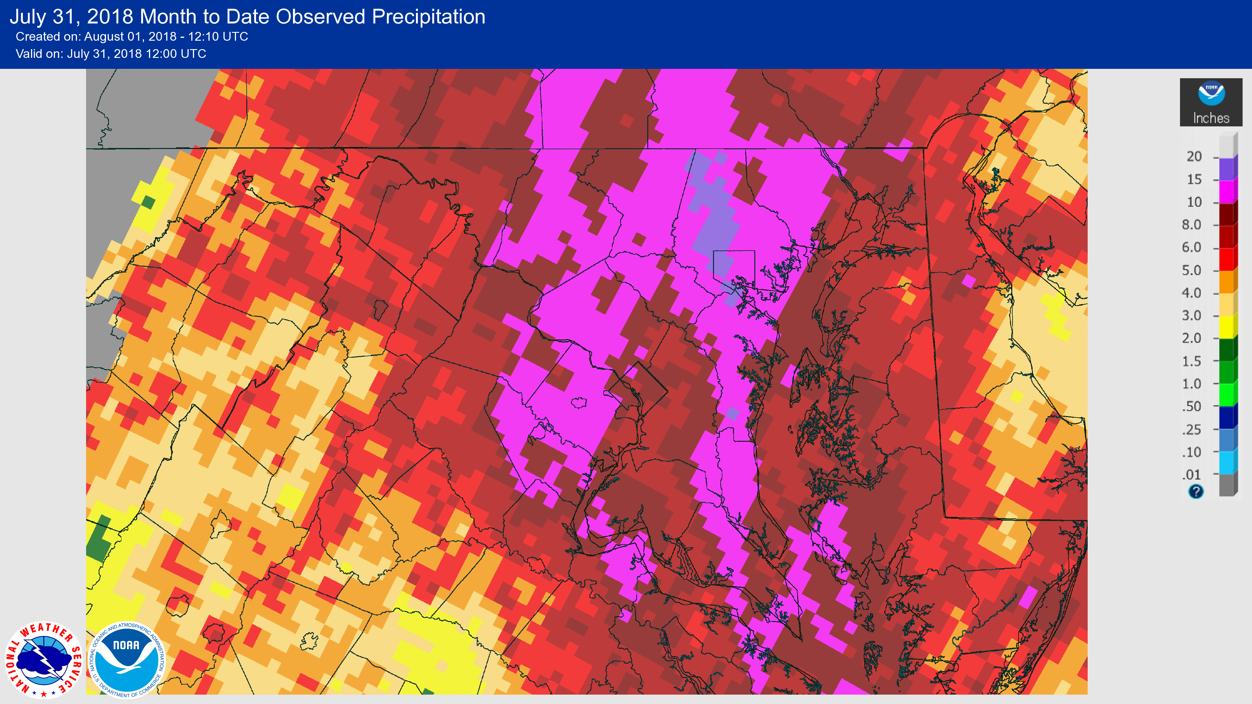
Impressive totals of 10″ to nearly 20″ can be found in most of central Maryland.
As you can imagine, this amount of rainfall was WAY above normal. Here is the Departure from Normal for the month:
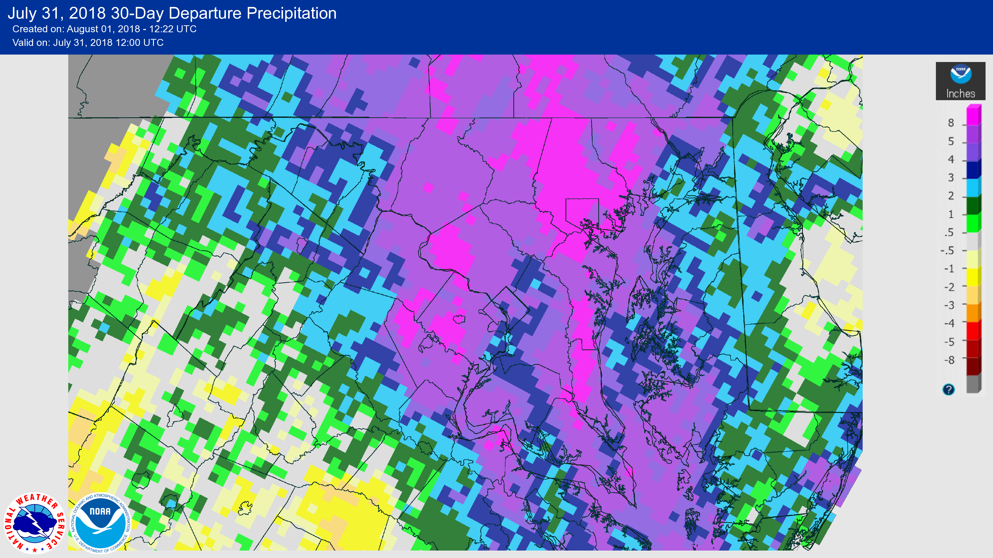
Areas of central Maryland were upwards of 8″ above normal!
As we head into August, we maintain a cooler and wetter than normal pattern, so rain chances stick around, but hopefully not to the degree we saw over the past 2+ weeks.
Want the latest blog posts emailed to you?