
A Winter Weather Advisory has been issued for: Allegeny, Anne Arundel, Baltimore, Baltimore City, Caroline, Carroll, Cecil, Frederick, Garrett, Harford, Howard, Kent, Montgomery, Prince George’s, Queen Anne’s, Talbot and Washington counties.
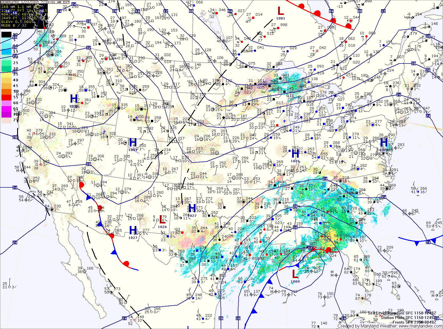
The track of the system combined with the lack of a strong cold air source means that we will see a wintry mix across the state. The precipitation will likely start as snow or snow and sleet across most of central and northern Maryland. In southern and eastern Maryland temperatures will be warm enough for rain, possibly mixed with snow at times.
As the atmosphere warms tonight, most areas will transition to a rain snow mix and then eventually all rain. The exception will be western Maryland, where colder air should hold on, keeping the precipitation predominately snow.
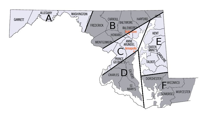
Zone B: The precipitation will likely stay a mixture of snow and sleet, with a transition to a rain/snow mix at times through the night and into tomorrow before tapering off during the late morning. 1-2″ of snow and sleet accumulation is possible.
Zone C: The snow and sleet mix will changeover to mostly rain tonight. The rain may change back over to a mix before ending tomorrow afternoon. Any snow or sleet accumulation would be minimal, less than an inch.
Zones D, E and F: Rain, possibly mixed with snow at times this evening, change to all rain overnight. The rain may mix with or end as a brief period of snow tomorrow afternoon. No snow accumulation is expected.
The system will pull away tomorrow afternoon and we will have a brief respite on Sunday. Expect partly sunny skies, with highs in the upper 30s.
The next system will head out of central Canada and move towards the mid-atlantic coast Sunday night into Monday. This system looks to rapidly develop near our area, bringing another round of wintry weather. At this time, it looks as though cold air will filter into place and support mainly snow.
There will be a sharp gradient to the snowfall and the exact track will determine where that snow falls. At this time, it appears the storm will be close enough for several inches of snow Sunday night into Monday. The details of this system will come into focus later today and tomorrow and this forecast will be updated as the situation becomes clearer.
Behind that system, very cold air will pour into the region. Highs for the remainder of the week look to be in the upper 20s to low 30s.