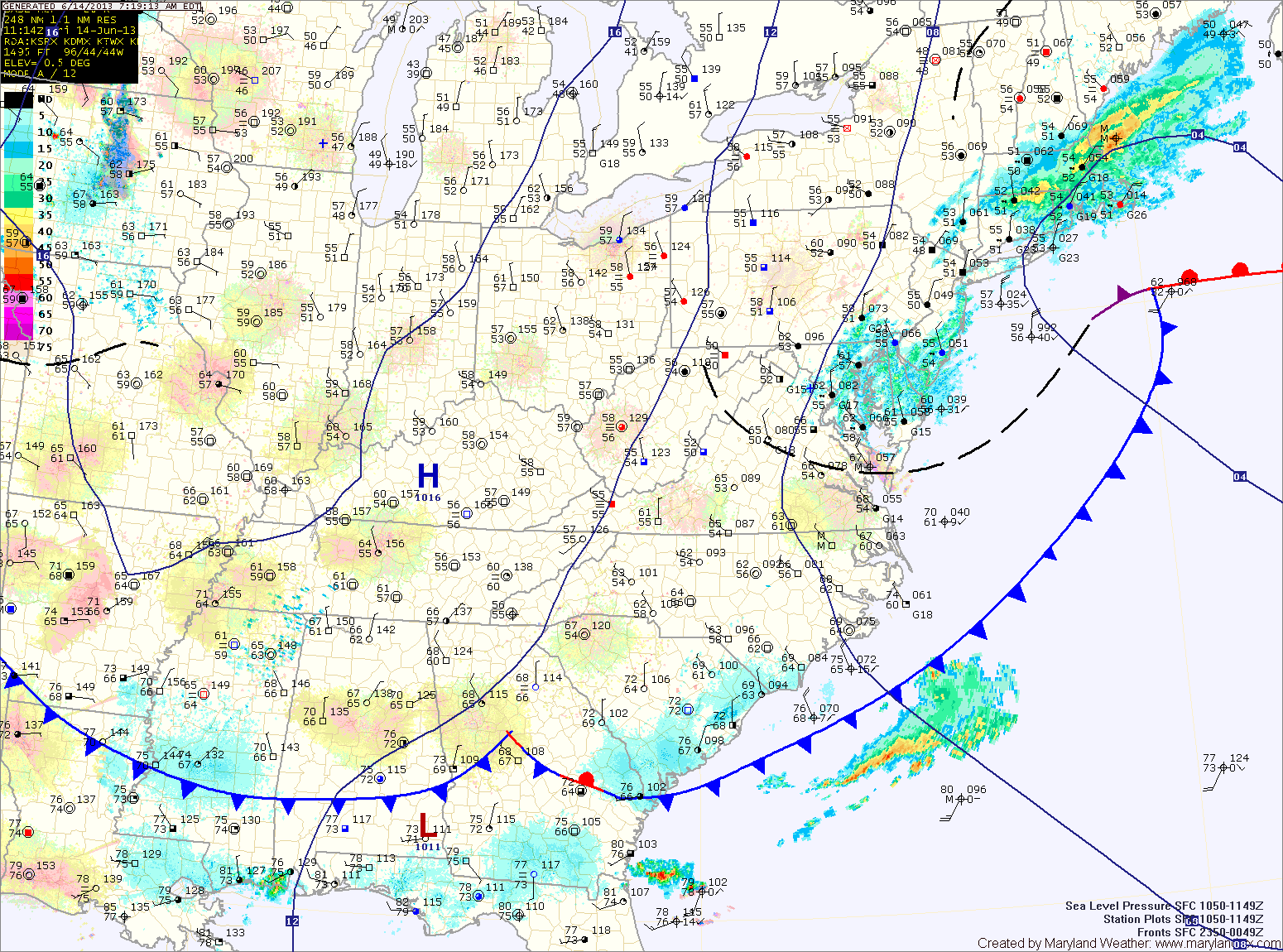
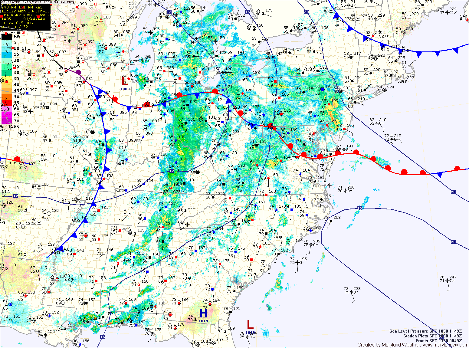
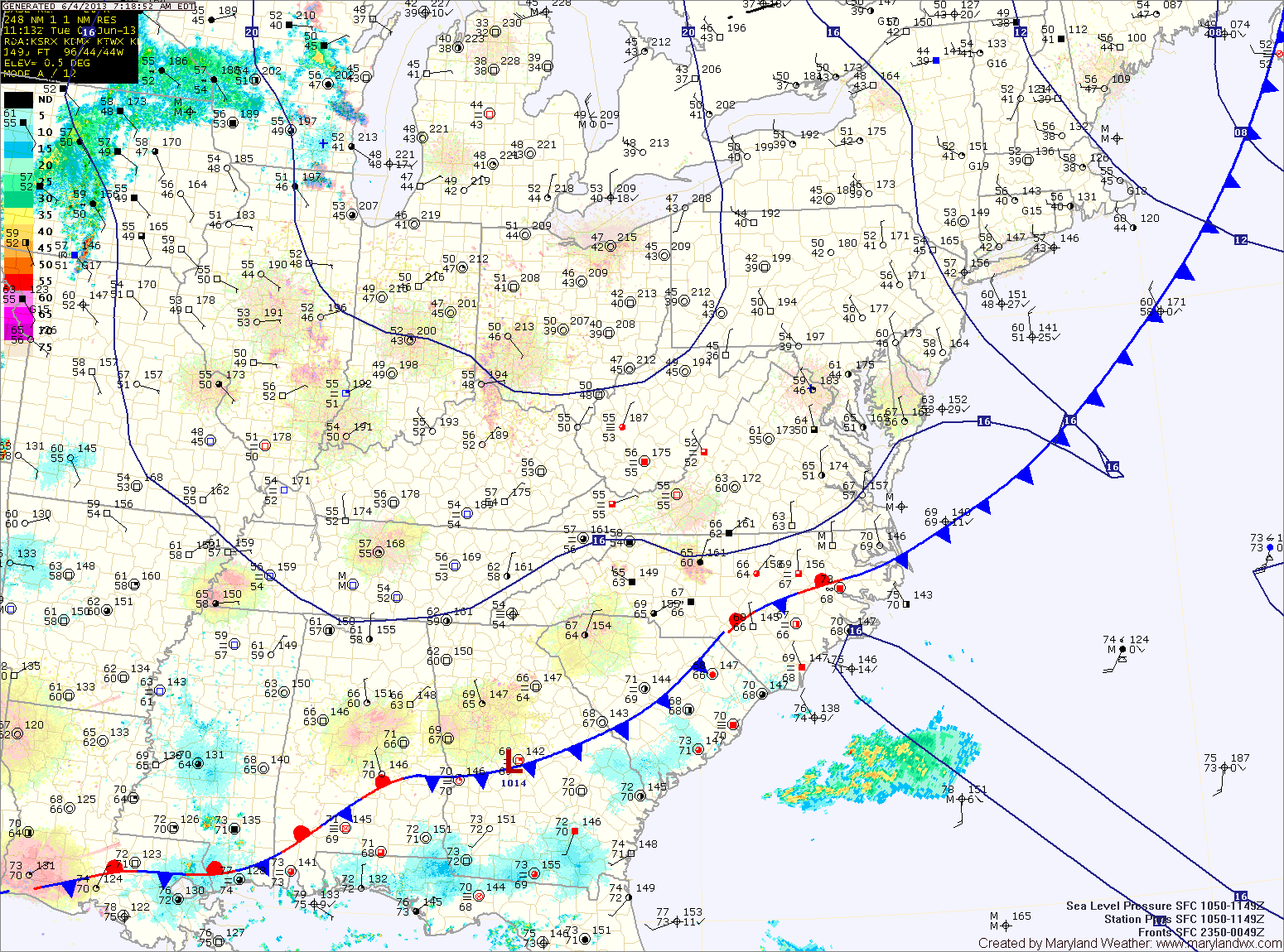
Current Surface MapThe front and storm system responsible for yesterday’s severe weather have move out of the area. Some left over sprinkles are currently affecting central and eastern Maryland but they will continue to slide through and will end over the next few hours.
Expect decreasing clouds this afternoon and highs in the upper 70s to around 80.
Tomorrow will be pleasant, with ample sunshine and highs in the low 80s with low humidity.
High pressure will slide off the Carolina coast Saturday night, setting up southerly flow while a cold front moves southward towards the area. This will cause temperatures to warm, humidity to increase and touch off an isolated afternoon shower or thunderstorm. Highs on Sunday will be in the mid 80s.
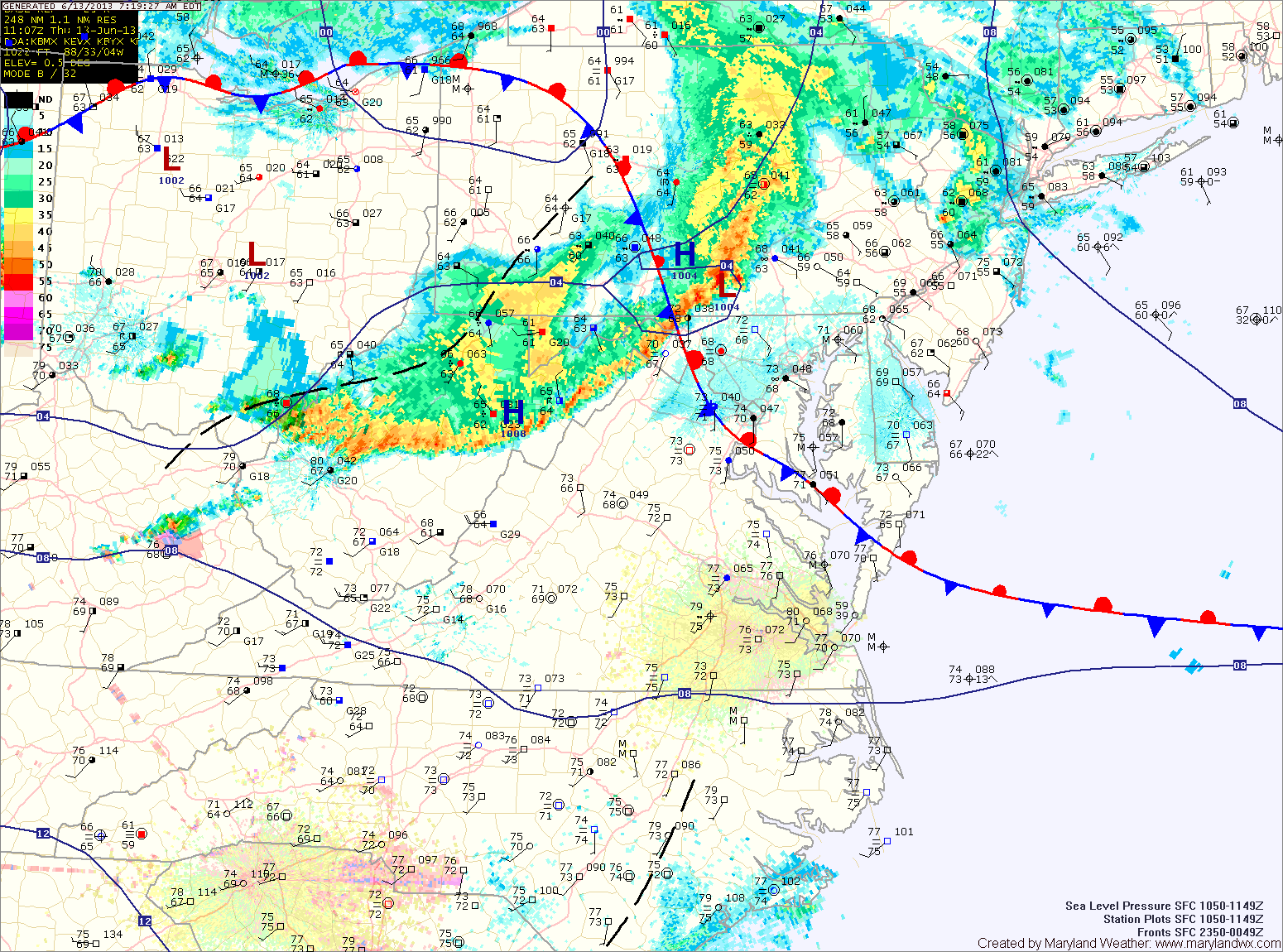
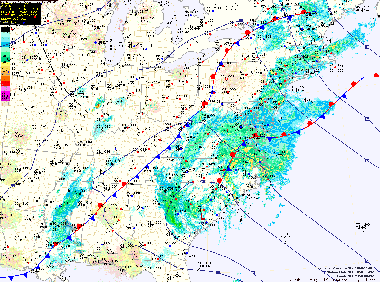
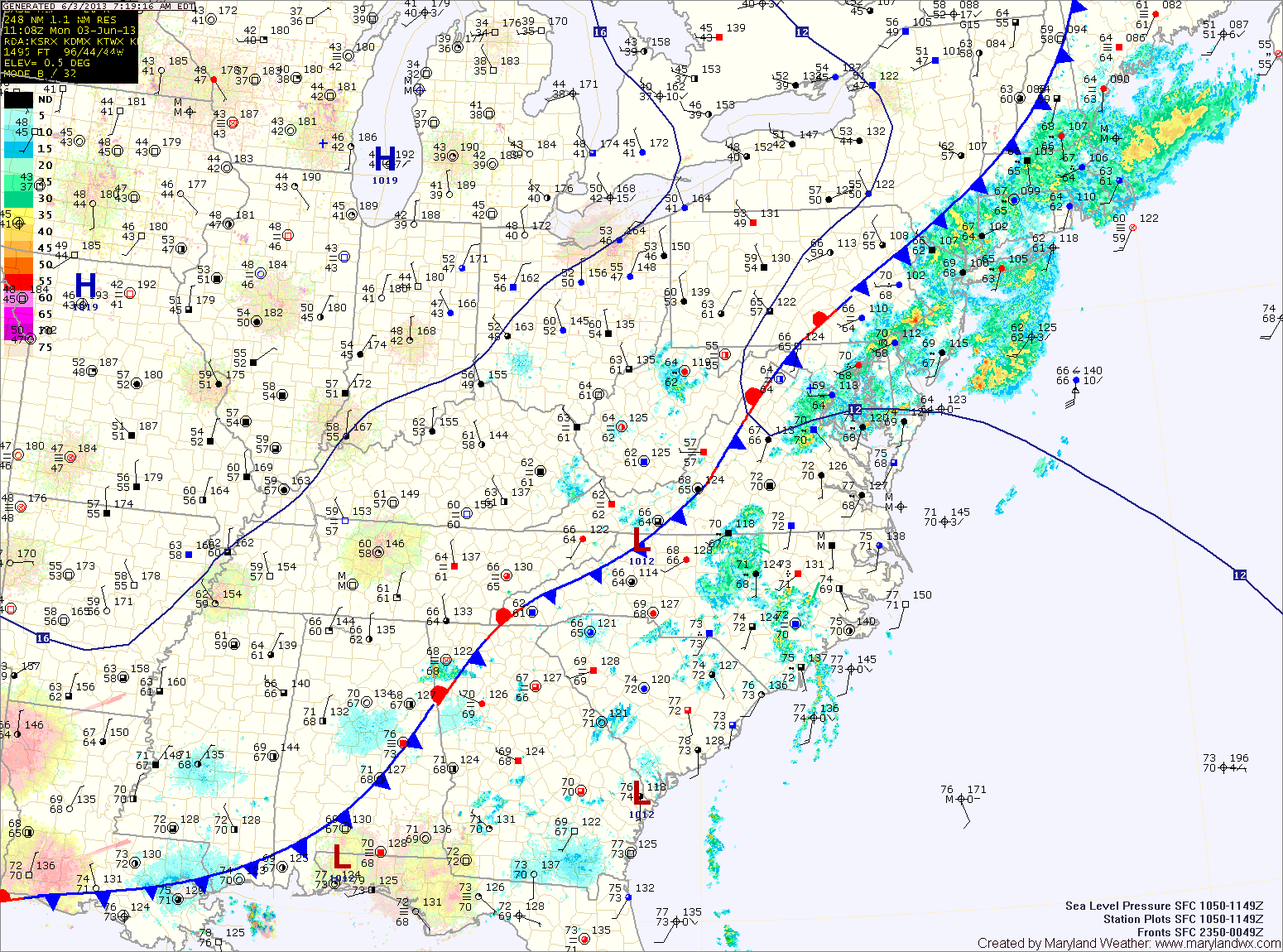
Current Surface MapAn area of low pressure moving into a very unstable atmosphere has touched off a line of thunderstorms this morning. The line is currently moving into central Maryland. A Severe Thunderstorm Watch is in effect for this line. Expect frequent lightning, very heavy rainfall, large hail and strong gusty winds with this line of storms.
Light rain will continue behind the line for a few hours. As the low moves to our north this afternoon, winds will turn southerly and the atmosphere will destabilize again. Another round of severe thunderstorms is expected this afternoon and evening across the area. These storms will be capable of producing large hail, damaging winds, heavy rainfall and tornadoes. It will be warm, humid and windy today, with highs in the upper 80s to low 90s and winds gusting to 35mph.
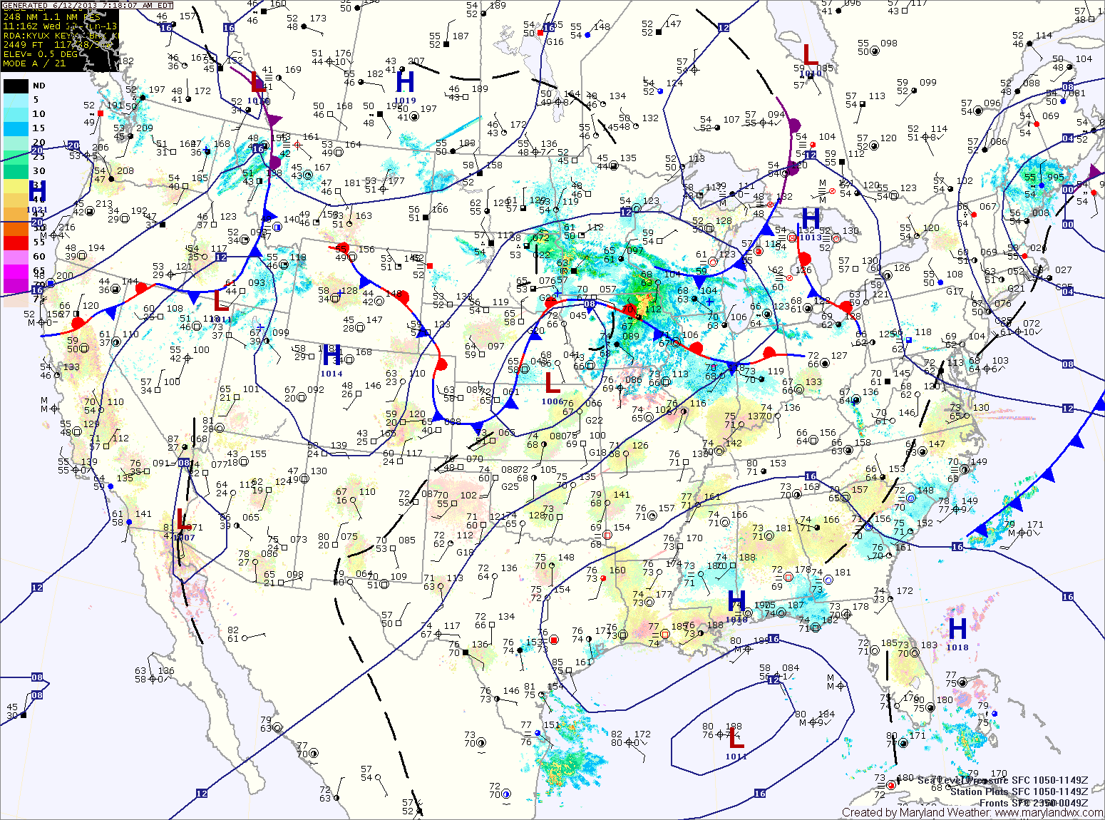
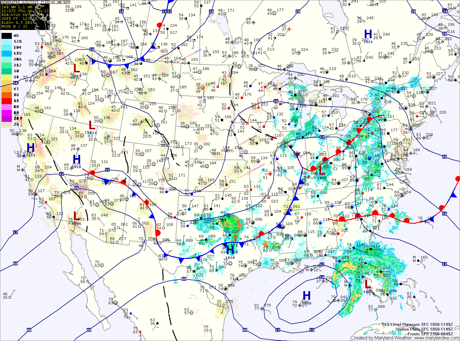
Current Surface MapA frontal boundary is stalling out to our south. As it does, an area of low pressure will ride along the front, bringing showers and thunderstorms to the area tonight and tomorrow.
Meanwhile, today will be partly sunny, warm and humid with an isolated shower or thunderstorm possible this afternoon. Highs will be in the upper 80s to around 90.
Thunderstorm activity will actually increase tonight as a piece of energy moves through the area. Some of these storms may become severe with damaging winds and heavy rainfall.
A thunderstorm complex over the midwest will move eastward tomorrow morning, bringing a chance of morning rain or thunderstorms to the area. Regardless of that system, as the low and cold front approach, all signs point to strong to severe thunderstorms developing over the area by afternoon. A wide-spread severe weather event is looking likely tomorrow afternoon, with damaging winds, large hail, heavy rainfall and isolated tornadoes possible across the entire state but especially along central and eastern Maryland. Highs will be in the upper 80s.
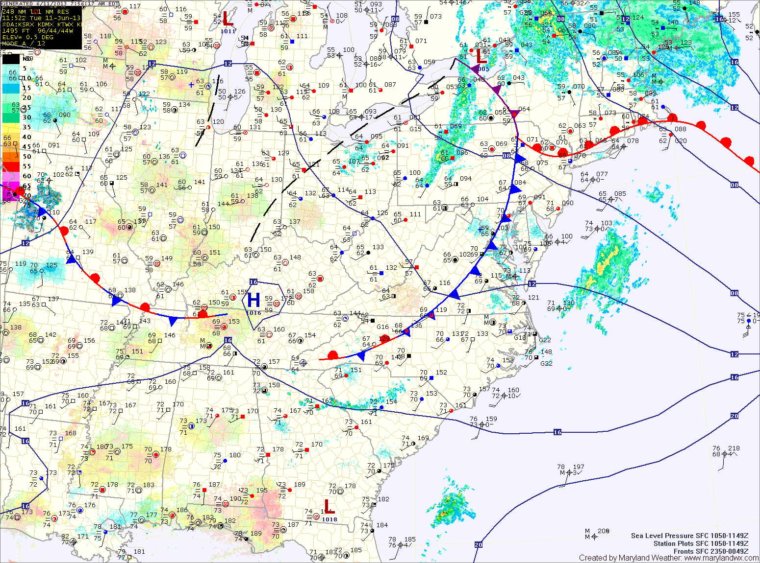
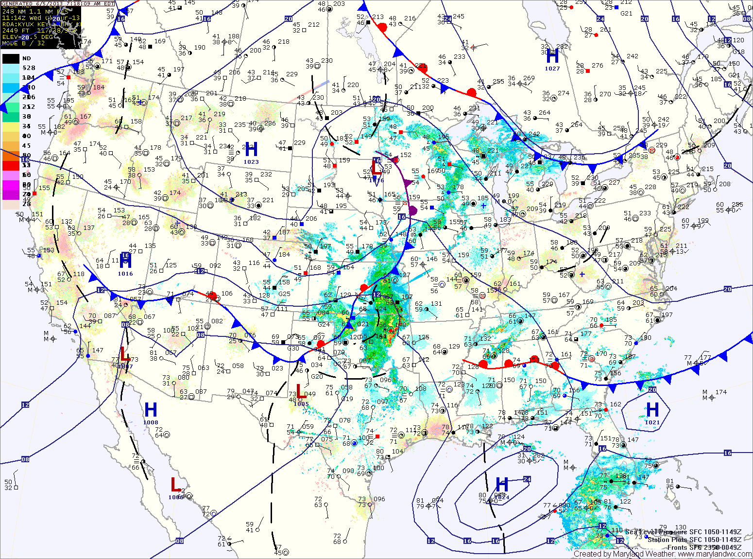
Current Surface MapToday will offer a brief respite from the heavy rainfall events that have been affecting the area lately. A cold front is currently moving through the state and until it clears the area, a slight chance of showers exists.
The front should push off the coast by this afternoon, ending the rain threat. Highs today will be in the low to mid 80s under eventual partly sunny skies.
High pressure builds in briefly this afternoon and tonight before the next rain maker begins to take aim on the area. The cold front that is currently pushing through will stall out to our south and remain stationary through Thursday.
For tomorrow, thunderstorms over the midwest may ride along the boundary and affect our area during the afternoon and evening. These storms could be severe with damaging winds, heavy rainfall and isolated tornadoes. Highs will be in the mid to upper 80s.
Current Surface MapAs a warm front moves northward today and a cold front approaches from the west, several rounds of heavy rainfall will move through today. Additionally, thunderstorms are likely this afternoon, producing locally heavy rainfall and strong gusty winds.
A Flash Flood Watch is in effect for all of central Maryland, while a general Flood Watch is in effect for the Eastern Shore. Highs today will be in the mid 70s.
Rainfall will begin to taper off later tonight as the cold front moves through.
The front will clear the area tomorrow morning, but will stall out to our south. This will allow for a slight chance of an afternoon shower or thunderstorm. Highs will be in the low 80s.
Current Surface MapTropical Storm Andrea will continue to move northeastward along a frontal boundary today and tonight, bringing heavy rainfall and scattered thunderstorms to the area. Highs today will be in the mid 70s.
Over an inch of rain has fallen across most of the state and another 2-3 inches with isolated spots over 4 are possible today and tonight. Consequently, a Flash Flood Watch is in effect for most of the state, east of the mountains through tonight.
Rain from Andrea will taper off around midnight tonight as the storm system races off to the northeast. Behind the system, warm, moist, tropical air will be left in place. This will set the stage for a muggy Saturday with scattered afternoon showers and thunderstorms. Highs will be around 80 degrees.
Current Surface MapA cold front to the west will help draw Tropical Storm Andrea up the coast. The two features will combine to bring heavy rainfall to the region.
Expect showers to move in from the west this afternoon as the cold front approaches. Highs today will be in the mid 70s.
As Andrea moves up the coast and interacts with the front, rainfall will become heavier tonight and tomorrow. Locally heavy rainfall will continue tomorrow and into tomorrow night. Rainfall totals of over 2″ will be likely in many areas. Highs tomorrow will be in the mid 70s.
Current Surface MapToday will be mostly sunny with highs in the upper 70s to around 80. Clouds will increase tonight as moisture begins to move into the region.
Clouds will continue to develop through the day tomorrow, with a slight chance of showers possible by late afternoon. Highs will be in the upper 70s.
Showers will increase in coverage and intensity tomorrow night as a frontal boundary interacts with a system in the Gulf of Mexico, spreading tropical moisture up the east coast.
Friday looks to be wet, with showers and possibly thunderstorms through the day. Highs will be in the upper 70s.
Current Surface MapThe cold front has pushed off the coast and much cooler and drier air has begun to move into the region.
Highs today will be in the upper 70s under mostly sunny skies.
It will remain mostly sunny tomorrow, with highs around 80 degrees.
Scattered showers and thunderstorms return to the forecast on Thursday, with rain chances increasing Thursday night and Friday. Highs on Thursday will be in the upper 70s to around 80.
Current Surface MapA cold front continues to move towards the state this morning and will move through this afternoon. Ahead of the front, scattered showers and thunderstorms are possible through this morning and into the afternoon.
The front will clear the state today, bringing an end to the rain threat and ushering in drier air. Highs today will top out in the upper 70s to around 80.
High pressure moves in tomorrow, setting up a pleasant and dry stretch for the next few days. Highs tomorrow will be in the mid 70s under sunny skies.
Wednesday will be mostly sunny, with highs in the mid to upper 70s.