
The front should push off the coast by this afternoon, ending the rain threat. Highs today will be in the low to mid 80s under eventual partly sunny skies.
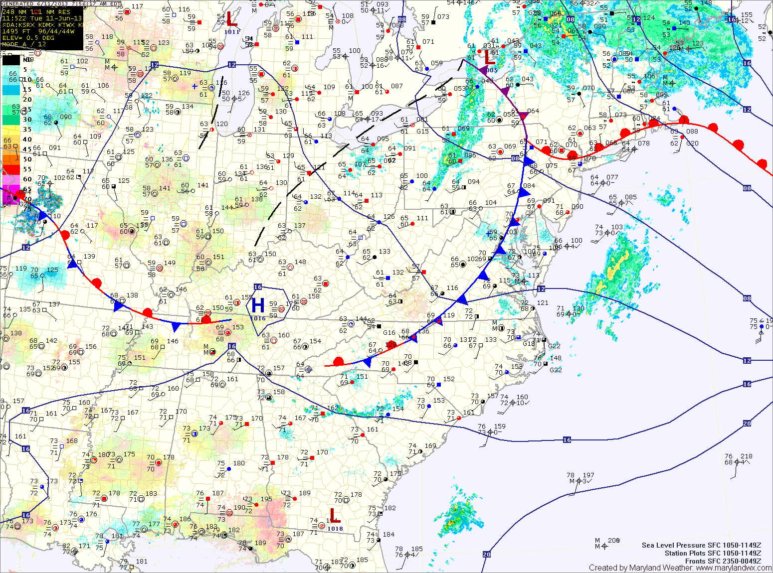
High pressure builds in briefly this afternoon and tonight before the next rain maker begins to take aim on the area. The cold front that is currently pushing through will stall out to our south and remain stationary through Thursday.
For tomorrow, thunderstorms over the midwest may ride along the boundary and affect our area during the afternoon and evening. These storms could be severe with damaging winds, heavy rainfall and isolated tornadoes. Highs will be in the mid to upper 80s.
Shower and storm activity will increase on Thursday as an area of low pressure moves along the front. This low will also drag a cold front through and clear out the stationary boundary. The showers and storms will likely produce more heavy rainfall. Highs on Thursday will be in the mid 80s.
The front will clear the area on Thursday night or Friday morning and high pressure will return for Friday afternoon through Saturday and into Sunday. Highs Friday and Saturday will be around 80 degrees, warming into the mid 80s on Sunday.
Clouds will increase during the day on Sunday as the next weather maker enters the area, bringing more showers and thunderstorms Sunday night and Monday.
Yesterday’s Weather Station Stats:
High Temp: 77.9°
Low Temp: 68.8°
Rain: 1.35″