
An area of low pressure will move by to our northwest tonight through tomorrow, followed by a cold front on Saturday morning.
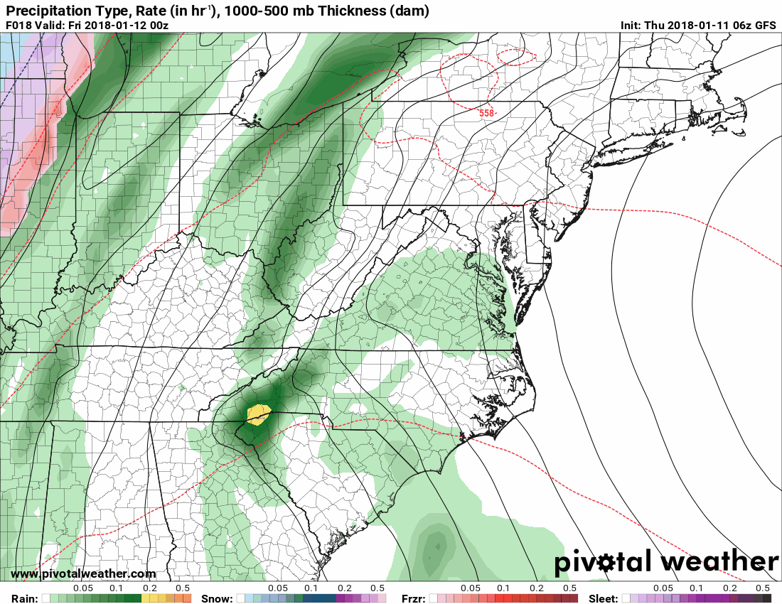
With the storm moving to our west, we will be on the warm side of the system with strong southerly flow pulling moisture and warmer air into our area. Highs will be in the 50s today and could reach the mid to upper 60s tomorrow. Expect rain to develop this afternoon and evening, with periods of rain, possibly moderate to heavy at times through tomorrow, with another round tomorrow night into Saturday morning. A cold front will cause temperatures to drop Saturday morning and there is the possibility that the rain could end as a wintry mix, especially over the western portions of the state.
Here is the GFS for 7PM tonight through 2PM Saturday, showing the system and cold front move through:
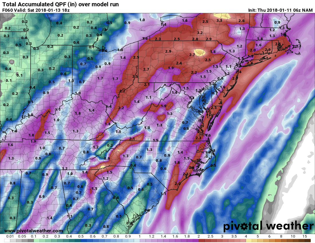
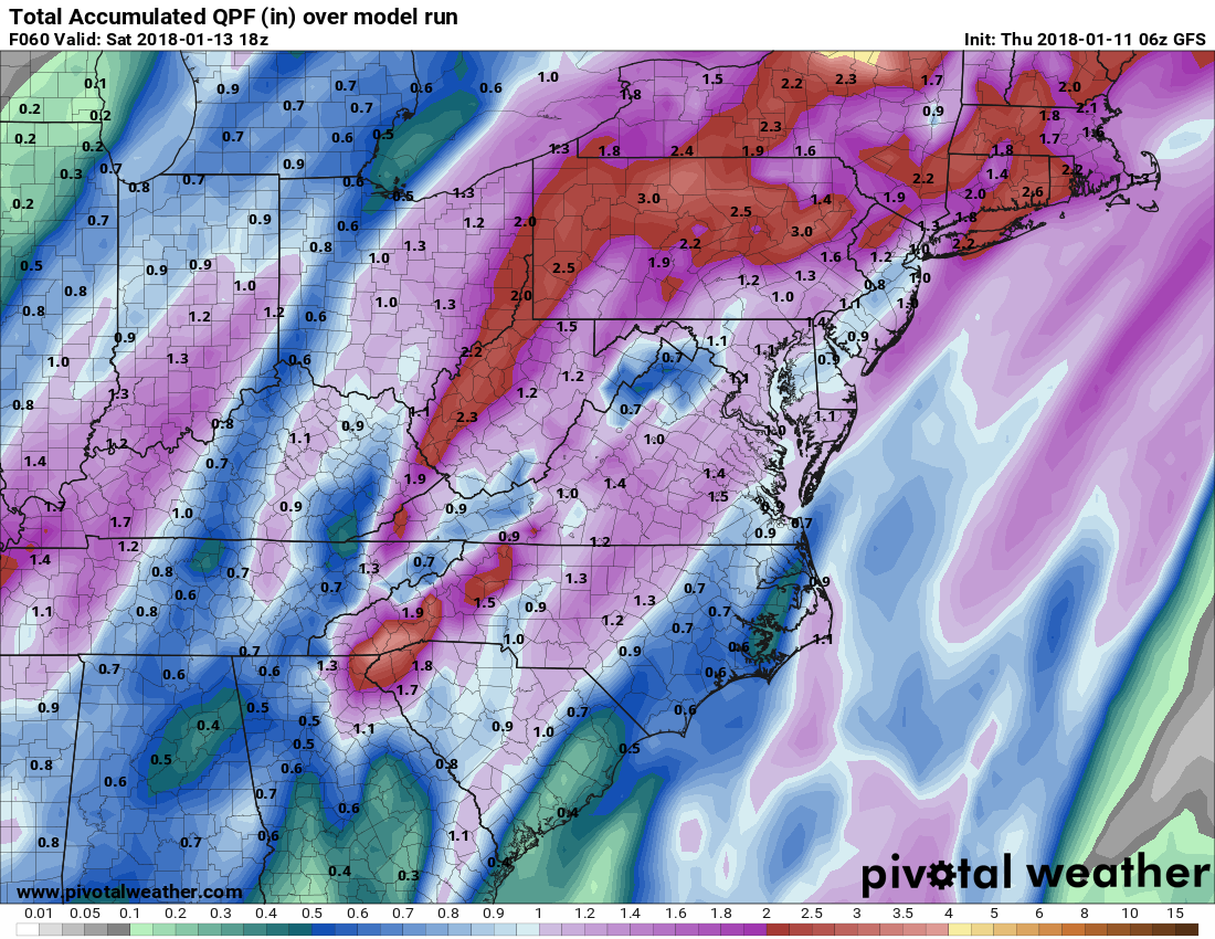
When all is said and done Saturday, over an inch of much needed rain is expected across the state.
Here is the expected rainfall by 2PM Saturday from the NAM and GFS:
As I mentioned, much colder air will flow in behind the cold front as Canadian high pressure builds in. Temperatures will fall through the day Saturday, and highs on Sunday will range from the 10s in the mountains to near 30 elsewhere.
The cold air will stick around into next week with another system bringing a chance of snow Tuesday or Wednesday next week.
Want the latest blog posts emailed to you?