
 ---
---
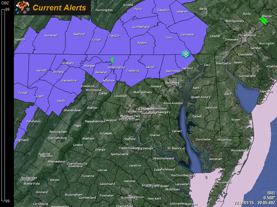
A *WINTER WEATHER ADVISORY* has been issued for: Allegany, Baltimore, Carroll, Frederick, Garrett, Harford, and Washington counties.
---
A *SPECIAL WEATHER STATEMENT* has been issued for the Baltimore and Washington, DC metro areas for a potentially hazardous Wednesday morning commute.
---
A cold front will move into the region tomorrow and pass through tomorrow night into Wednesday morning, bringing light snowfall with it.
Light snow will push into western portions of the state during the late afternoon and evening hours, reaching the metro areas after dark, and the Eastern Shore during the early morning hours on Wednesday.
The snow will taper off from west to east during the morning hours on Wednesday.
In general, light snowfall accumulations of 1-3 inches are expected, with highest amounts in western Maryland and along the Mason-Dixon line and lowest amounts across southern Maryland and the lower Eastern Shore.
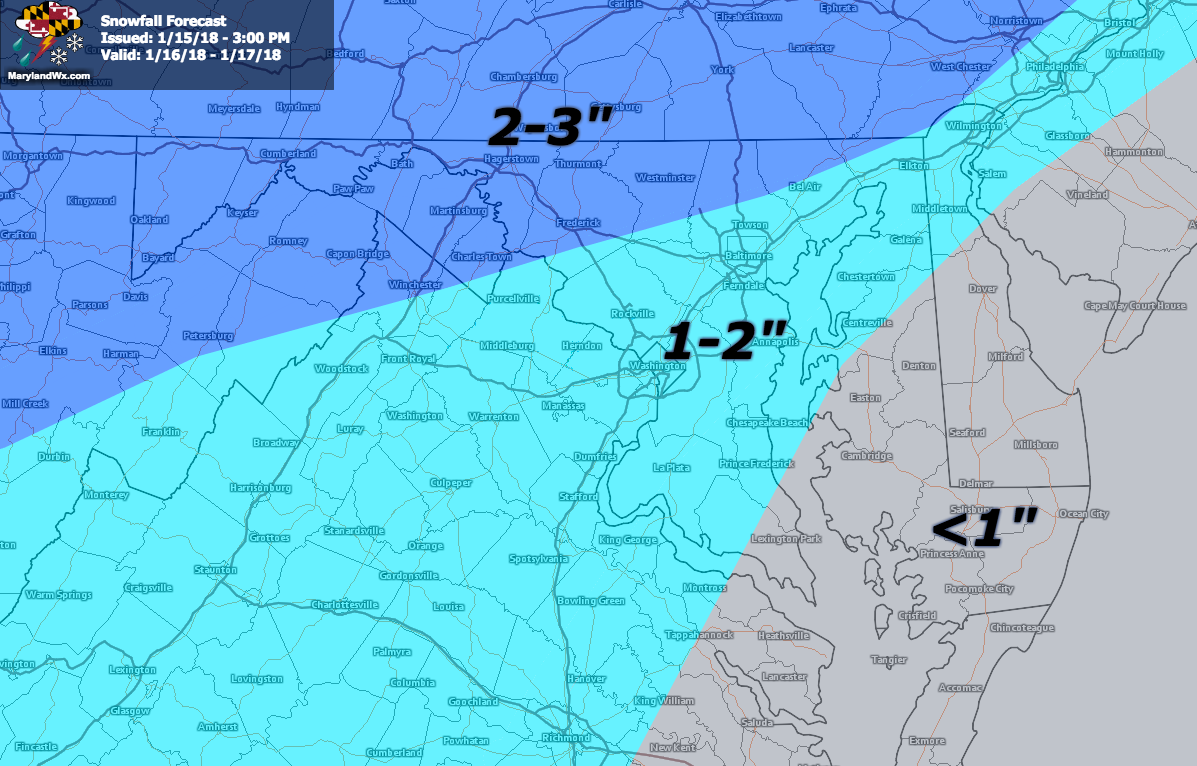
While the snowfall will generally be light, it will impact the Wednesday morning commute. Untreated surfaces will likely become snow-covered and icy in spots. Temperatures will rise into the upper 20s to low 30s Wednesday afternoon, but will stay below freezing in most spots, allowing icy spots to persist throughout the day.
We will see a warming trend through the remainder of the work week and into the weekend with highs in the upper 30s on Thursday, reaching the 40s to perhaps 50s by Saturday and Sunday.
Want the latest blog posts emailed to you?