
 ---
---
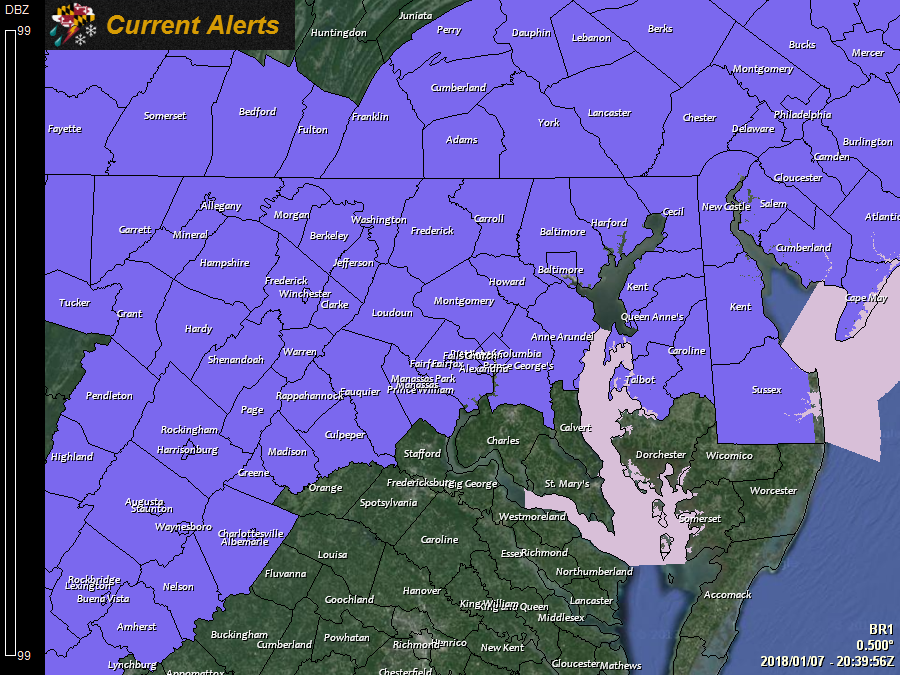
A *WINTER WEATHER ADVISORY* has been issued for: Allegany, Anne Arundel, Baltimore, Caroline, Carroll, Cecil, Frederick, Garrett, Harford, Howard, Kent, Montgomery, Prince George's, Queen Anne's, Talbot, and Washington counties.
---
A *SPECIAL WEATHER STATEMENT* has been issued for the Baltimore and Washington, DC metro areas for a potentially hazardous evening commute.
---
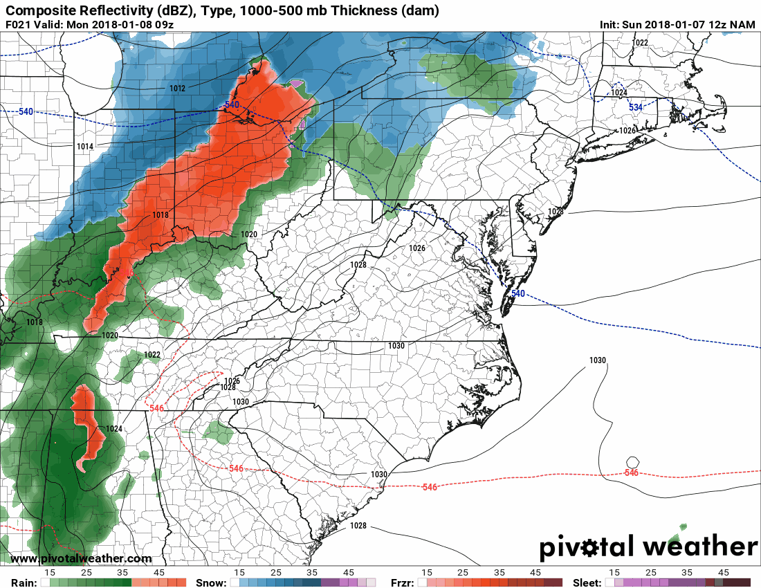
A weak storm system will cross the state tomorrow, bringing a light wintry mix to most areas, mainly during the afternoon and evening hours.
Temperatures will rise tomorrow afternoon, possibly above freezing tomorrow, but with a prolonged period of Arctic cold, all surfaces are well below freezing, setting the stage for a potential icing event, regardless of the air temperatures and precip type.
Precipitation will enter western portions of the state during the morning hours, spreading eastward, and entering the metro areas by late morning to early afternoon. Light freezing rain or plain rain will continue through the evening commute, tapering off and pushing eastward and out of the state tomorrow night.
Here is the NAM output for 4AM tomorrow to 1AM on Tuesday, showing the wintry mix moving through:
All in all, there will not be much in the way of total precipitation, but with extremely cold surfaces, it will not take much to create extremely slick conditions, especially on untreated surfaces.
Be sure to stay alert for the latest information regarding this event, and prepare for a potentially icy commute tomorrow evening.
Want the latest blog posts emailed to you?