
Expect showers and possibly thunderstorms to move into the area later this morning and into the afternoon. Highs today will be near 80°.
Rain will continue tonight and into tomorrow until the front clears the state by tomorrow evening, tapering the rain to scattered showers.
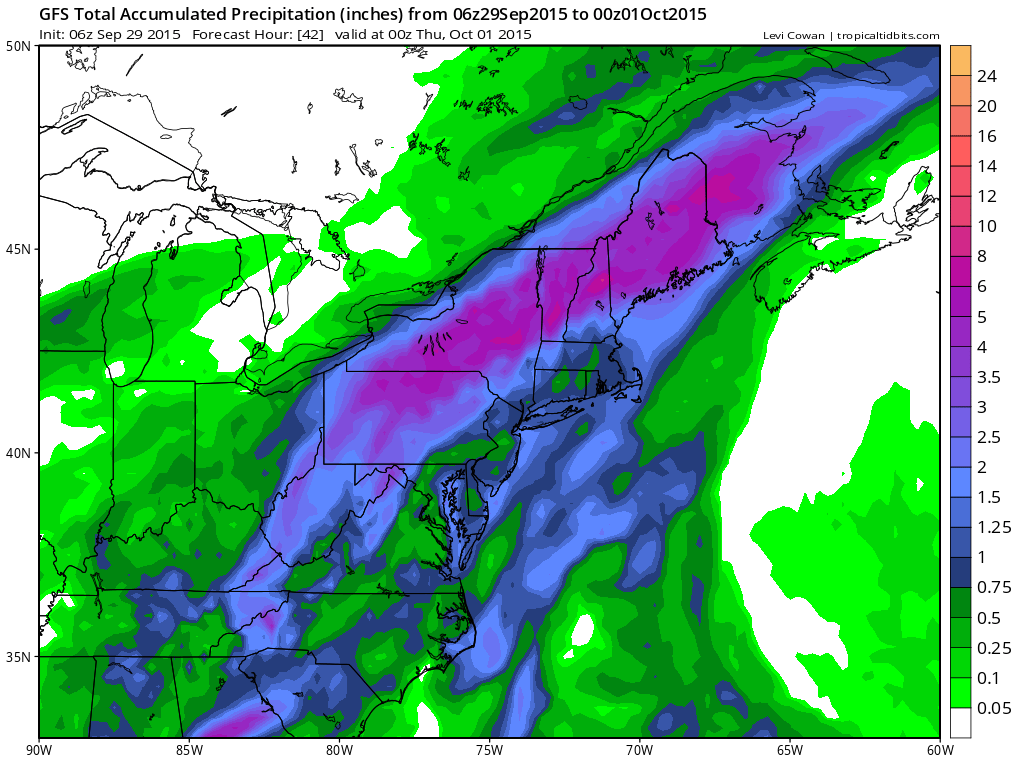
When all is said and done, rainfall totals of over 2″ are likely in the mountains (where a Flash Flood Watch has been issued) with a half inch to an inch possible elsewhere. Highs will be in the mid 70s tomorrow.
Thursday will feature cooler conditions with scattered showers. Highs will be in the mid 60s.
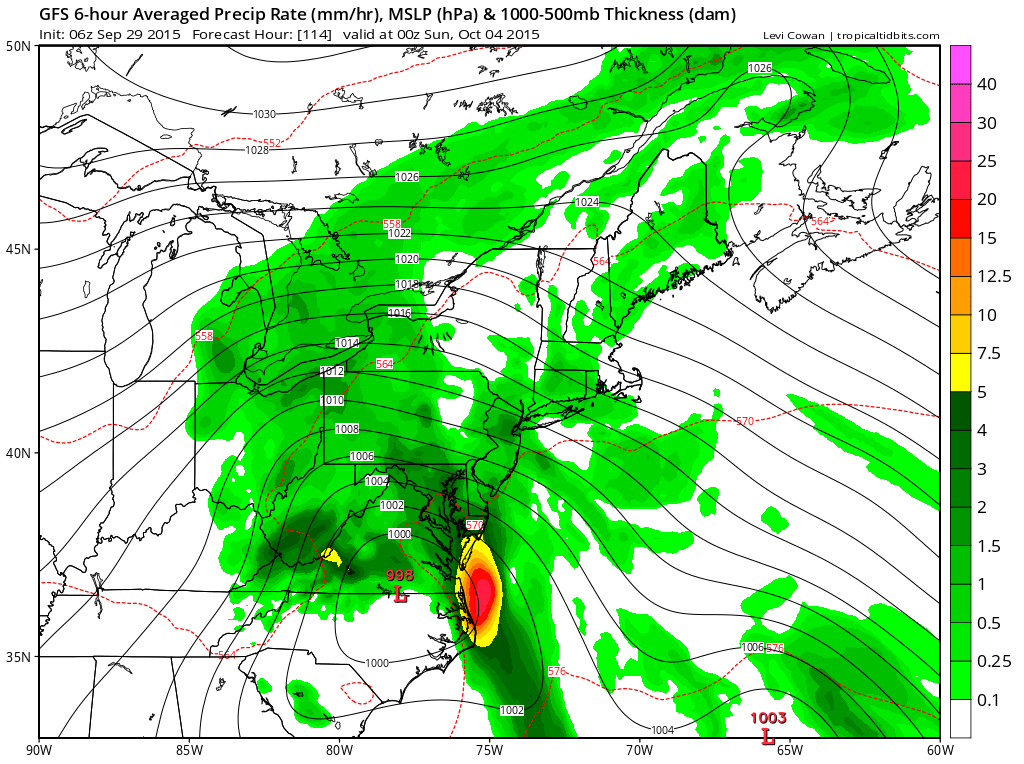
Rain chances will increase again on Friday as Tropical Storm Joaquin moves up the coast and interacts with the stalled cold front, making rain likely Friday and Saturday especially across central and eastern portions of the state.
The details of this part of the forecast will be worked out over the next few days.
Stay up to date with storm information on your favorite social media site!
Follow me on Twitter, Facebook and Google+!