
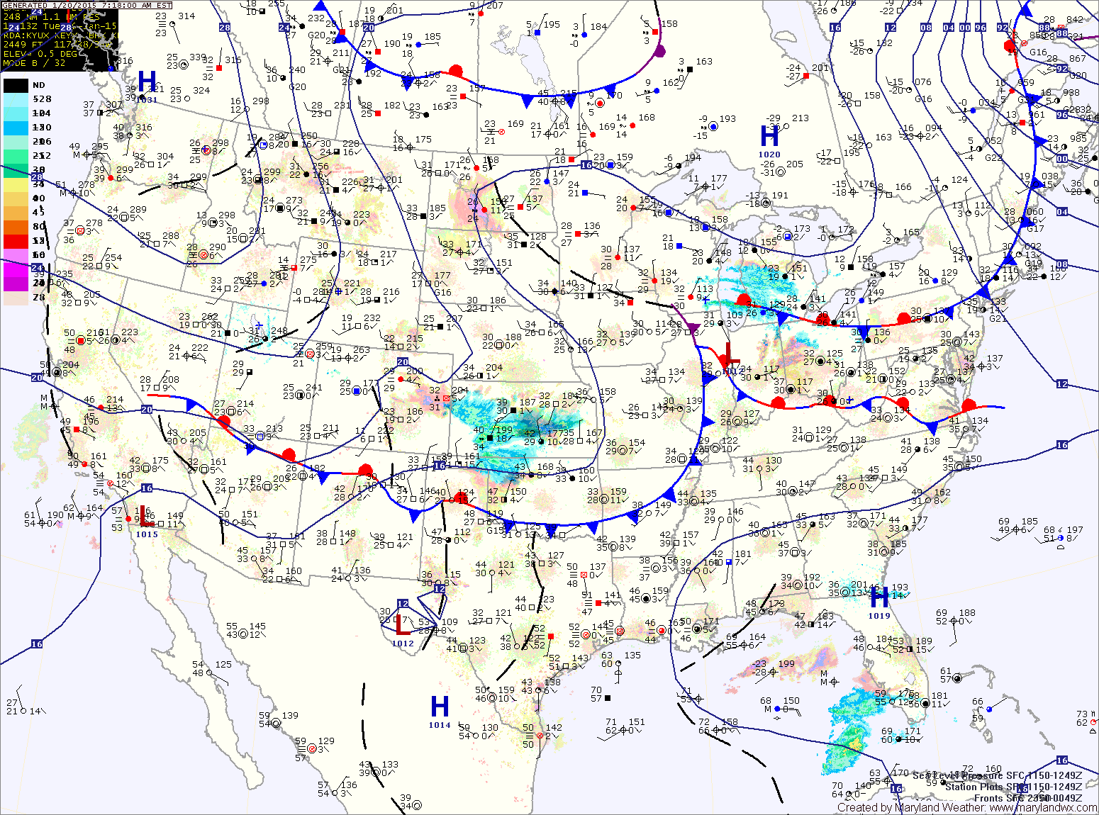
A clipper low will move across the midwest and towards our area tonight and tomorrow. This low will spread light snow across the state beginning during the early morning hours. The snow may mix with rain during the afternoon hours as temperatures warm into the low 30s.
The system will pull away from the area during the evening hours, bringing an end to the snow.
High pressure returns to end the work week, with partly sunny skies on Thursday and mostly sunny skies on Friday. Highs both days will be around 40.
As we move into the weekend, the models are developing a coastal system that may impact the area late Saturday into Sunday.