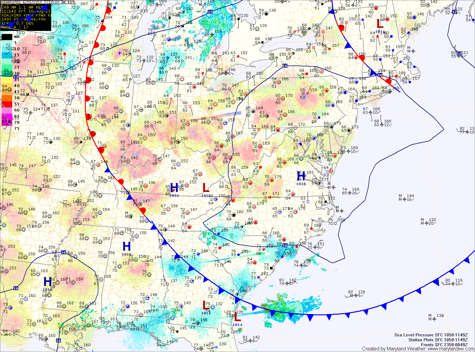
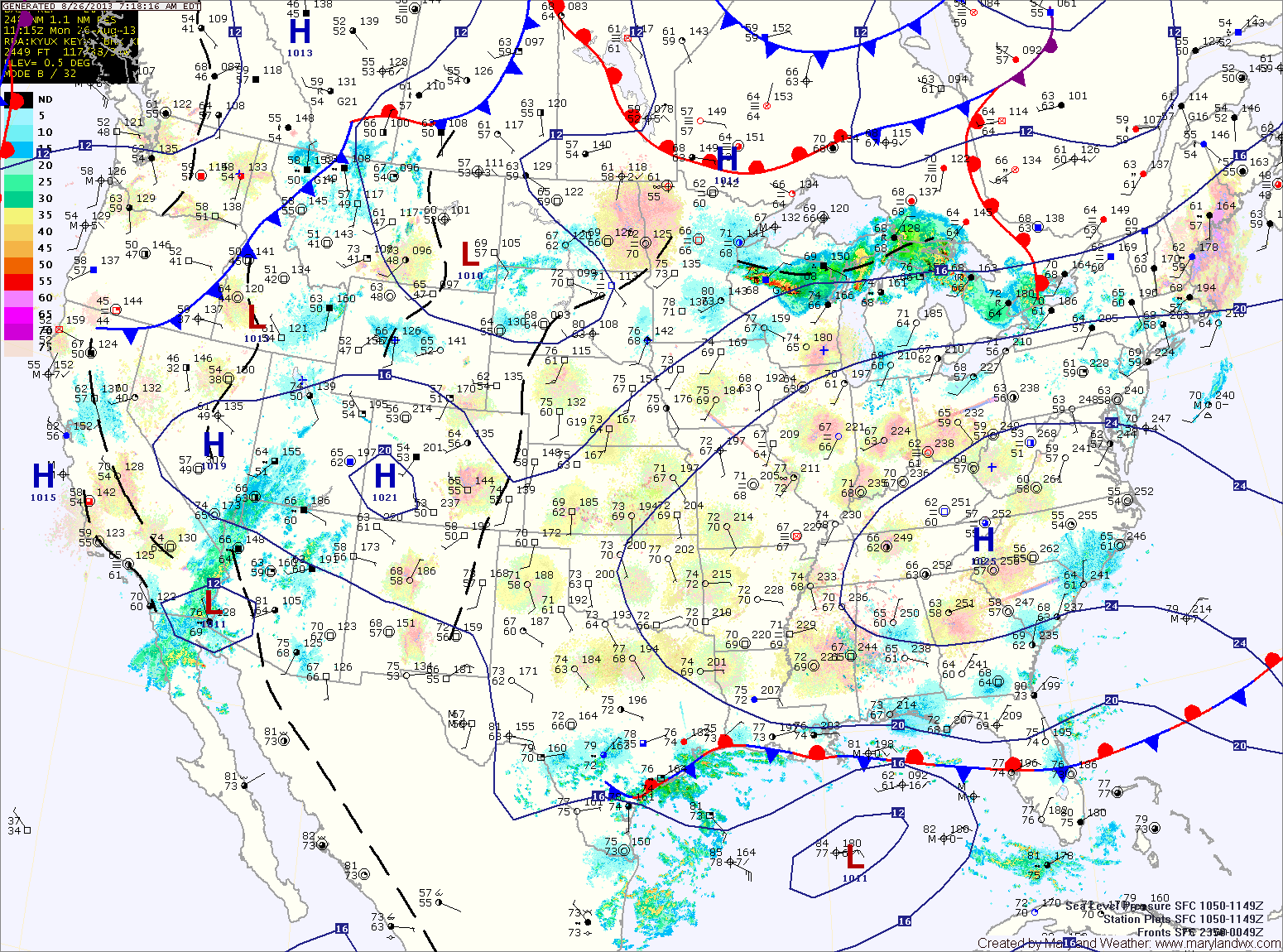
Current Surface MapHigh pressure has moved over head today. Early morning clouds will decrease as we move into the afternoon leading to mostly sunny skies. Highs today will be in the mid 80s.
The high will move off the coast tonight into tomorrow. This will result in southerly flow developing Saturday. Temperatures will increase, as will the humidity. Highs will be around 90 degrees.
The humidity will continue to increase sunny, as will shower and thunderstorm chances. Highs on Sunday will again be around 90 degrees.
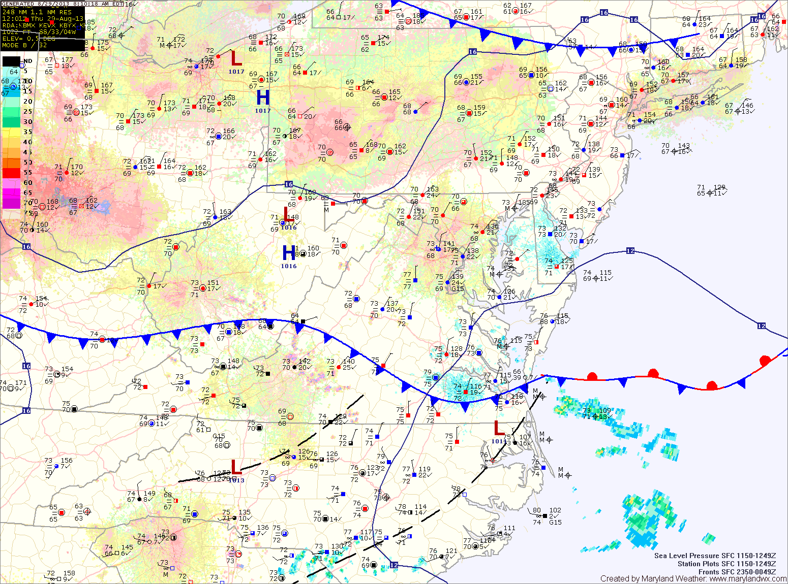
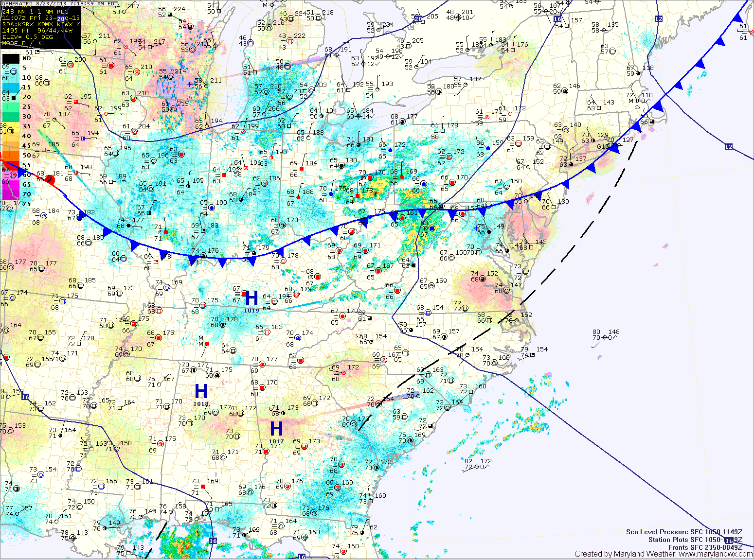
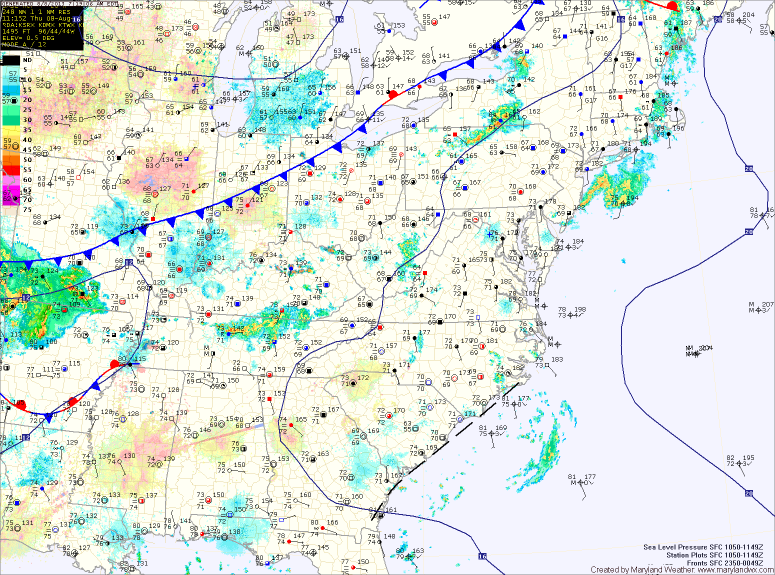
Current Surface MapA frontal boundary has moved through and is now to our south. In its wake, low level moisture is in place. This is manifesting as areas of drizzle and fog. High pressure will continue to move into the area today, dislodging the moisture and leading to decreasing clouds this afternoon. Highs today will be in the low 80s.
High pressure will continue to build in tomorrow. As a result, expect a mix of clouds and highs in the mid 80s.
The high pressure will move to our south and off the coast by Saturday. As it does, southerly flow around the high will pump warmer air and higher humidity into the area. This will provide a slight chance of an isolated shower or thunderstorm during the afternoon hours. Highs on Saturday will be in the upper 80s to near 90.
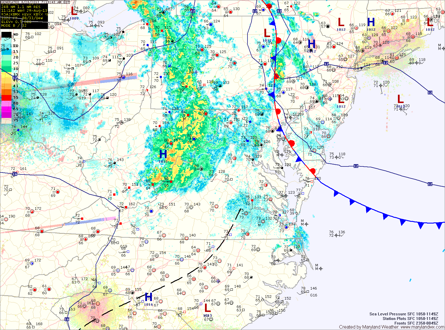
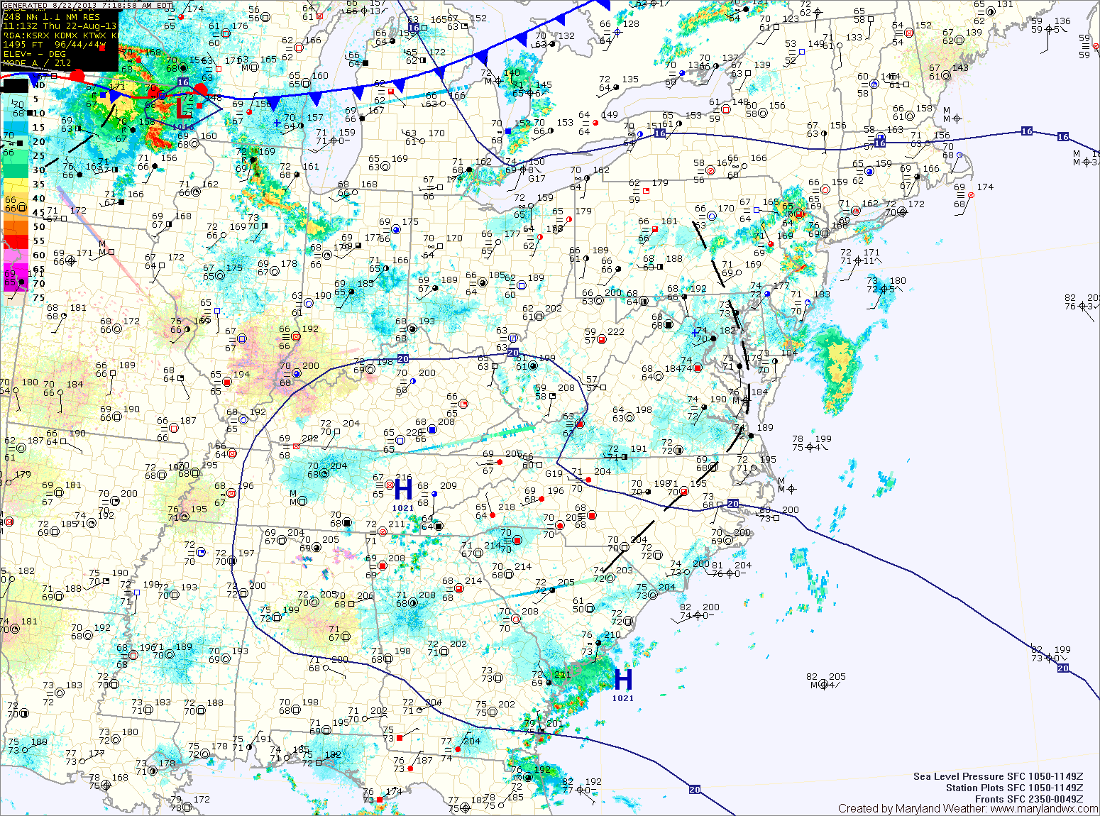
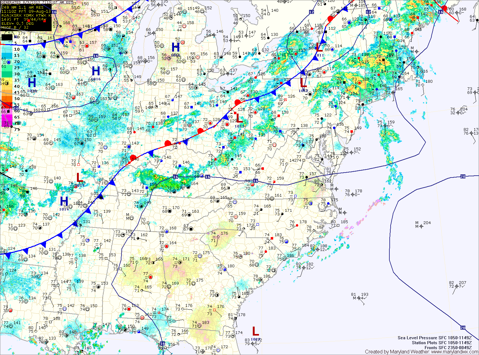
Current Surface MapA weak frontal boundary will slip southward into the area today. An area of showers has developed along the boundary, mainly across western Maryland this morning. More showers and storms are expected to develop this afternoon and evening across most of the state. Highs today will be in the mid to upper 80s.
The front will push southward overnight and into the Carolinas tomorrow. As a result, expect a mix of clouds and sun tomorrow with highs in the mid 80s.
High pressure will build in Friday, bringing a return to mostly sunny skies. Highs will be in the mid 80s.
Current Surface MapScattered showers and thunderstorms will be possible this afternoon. Highs will be in the upper 80s.
A cold front will move into and through the region tomorrow, bringing another round of showers and thunderstorms tonight and through the day tomorrow. Highs will be in the upper 80s.
Behind the front, high pressure will build in, bringing in another stretch of sunny and dry conditions. Thursday and Friday will be mostly sunny with highs in the mid to upper 80s.
Current Surface MapWith high pressure moving off the coast today, expect one more nice day albeit with increasing clouds this afternoon. Highs will be in the mid 80s.
A disturbance will bring a slight chance of showers tonight and a chance of thunderstorms tomorrow. Highs tomorrow will be in the upper 80s.
Thunderstorm chances will increase on Wednesday and Wednesday night as a cold front moves through. Highs will be in the upper 80s.
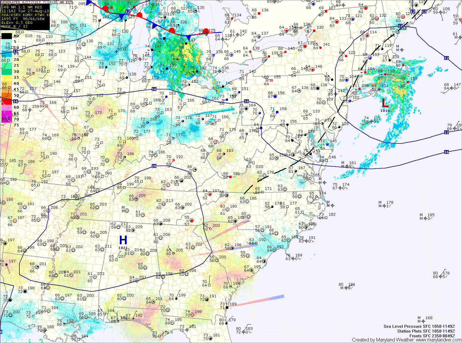
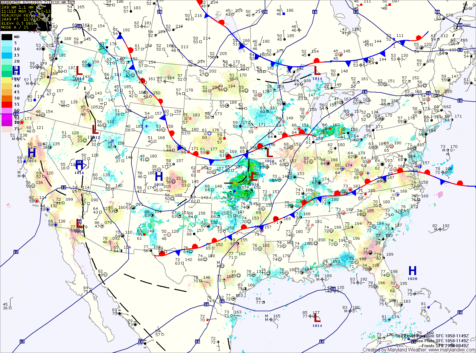
Current Surface MapA cold front is currently pushing through the state from the north. Meanwhile, an area of showers is moving from west to east along the front. The showers will continue to affect the mountains before moving eastward into central Maryland later this morning or early afternoon. Southern portions of the state will see the best chance of showers as the front pushes this activity southward as it moves east. Highs today will be in the mid 80s.
High pressure takes control this weekend. Expect mostly sunny skies both Saturday and Sunday with highs in the low 80s both days.
Current Surface MapToday will be warm and humid with afternoon sunshine. The sunshine will lead to some instability which will support scattered afternoon showers and thunderstorms. Highs will be in the upper 80s.
A cold front will approach tonight and cross the area tomorrow. The front will bring another chance of afternoon thunderstorms as it passes through. Highs will be in the mid to upper 80s.
Behind the front, a nice stretch of weather is expected for the weekend and into next week. Highs on Saturday and Sunday will be in the low 80s under mostly sunny skies.
Current Surface MapToday will feature more clouds than sun and humid conditions. Highs will be in the upper 80s.
A cold front will cross the area tomorrow, bringing showers and thunderstorms with it. Some of the storms could produce locally heavy rain and gusty winds. Highs will be in the low to mid 80s.
Behind the front, high pressure will bring cooler and drier air into the region for the remainder of the work week. Expect mostly sunny skies on Wednesday with highs in the upper 70s to low 80s.
Current Surface MapA cold front will continue to slowly move our way today. Ahead of the front, warm and muggy air are in place. Expect showers and thunderstorms to become numerous this afternoon and evening. Some of the storms could produce locally heavy rain and gusty winds. Highs today will be in the mid to upper 80s.
The front will sag through the area tonight, continuing rain chances. It now appears that the front will stall out far enough south of the area to provide a mostly dry weekend. Tomorrow will feature variable clouds with highs in the mid to upper 80s.
The front will begin to move back northward as a warm front on Sunday but the majority of the day should be dry. There is a slight chance of an afternoon or evening thunderstorm. Highs will be in the mid 80s.
Current Surface MapA cold front will remain to our west today as ample moisture continues to stream up the coast. The result will be another round of scattered showers and thunderstorms this afternoon. Some of the storms could produce locally heavy rainfall and strong gusty winds. Highs today will be in the mid 80s.
Isolated storms will be possible overnight while there is a better chance of storms tomorrow as the front moves closer. Highs will be in the mid 80s.
The front will move into the area Saturday and likely stall near or south of the state. Isolated to scattered afternoon and evening thunderstorms will be possible on Saturday. Highs will be in the upper 80s to near 90.