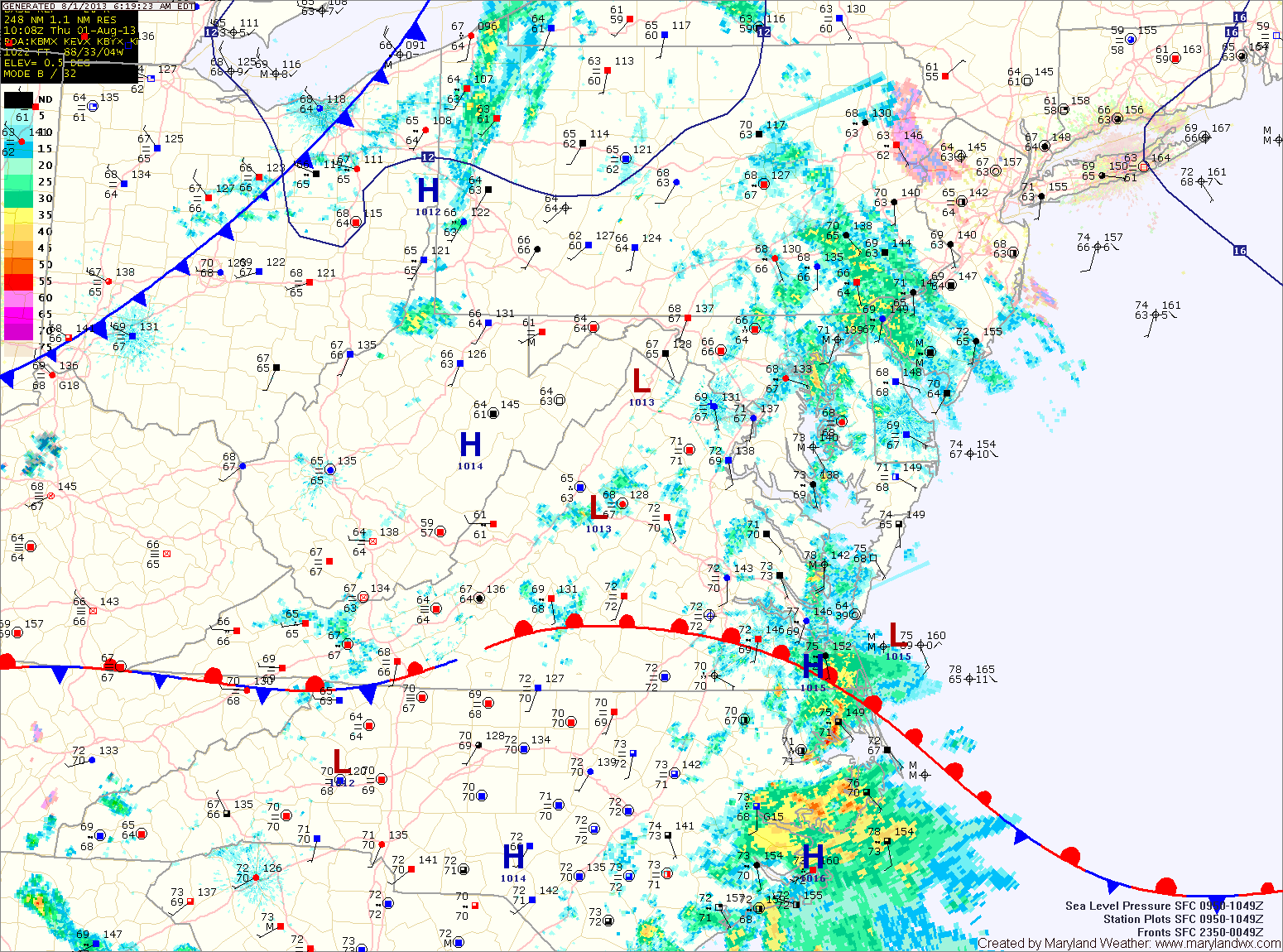
Current Surface MapWith high pressure off the coast and southerly and easterly flow in place, scattered showers and thunderstorms will be possible again today. Highs will be around 80 degrees under cloudy skies.
Thunderstorms are more likely tomorrow afternoon. Some of these storms could produce locally heavy rainfall. Highs will be in the low to mid 80s.
Storm chances persist Thursday night and Friday. Highs on Friday will be in the mid to upper 80s.
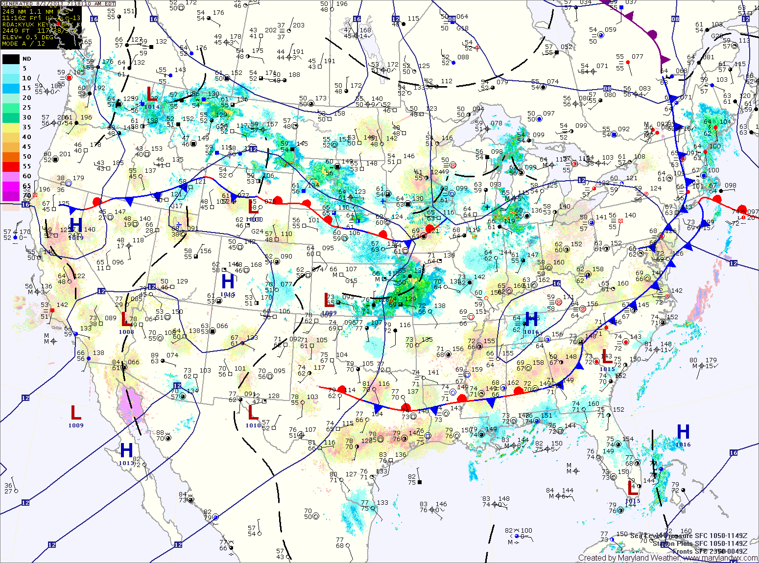
Current Surface MapHigh pressure has moved off the coast and southerly flow is transporting tropical moisture up the coast. Today will be mostly cloudy with areas of showers and thunderstorms. Highs will be in the upper 70s.
Showers and storms will be possible through tonight and again tomorrow. Highs tomorrow will be around 80 degrees.
There will be a bit more sunshine on Thursday and as a result, stronger thunderstorms are possible during the afternoon and evening. Highs will be in the low to mid 80s.
A cold front will approach on Friday, bringing another chance of thunderstorms during the afternoon hours. The front will move through late Friday night setting up a nice weekend. Highs on Friday will be in the mid to upper 80s.
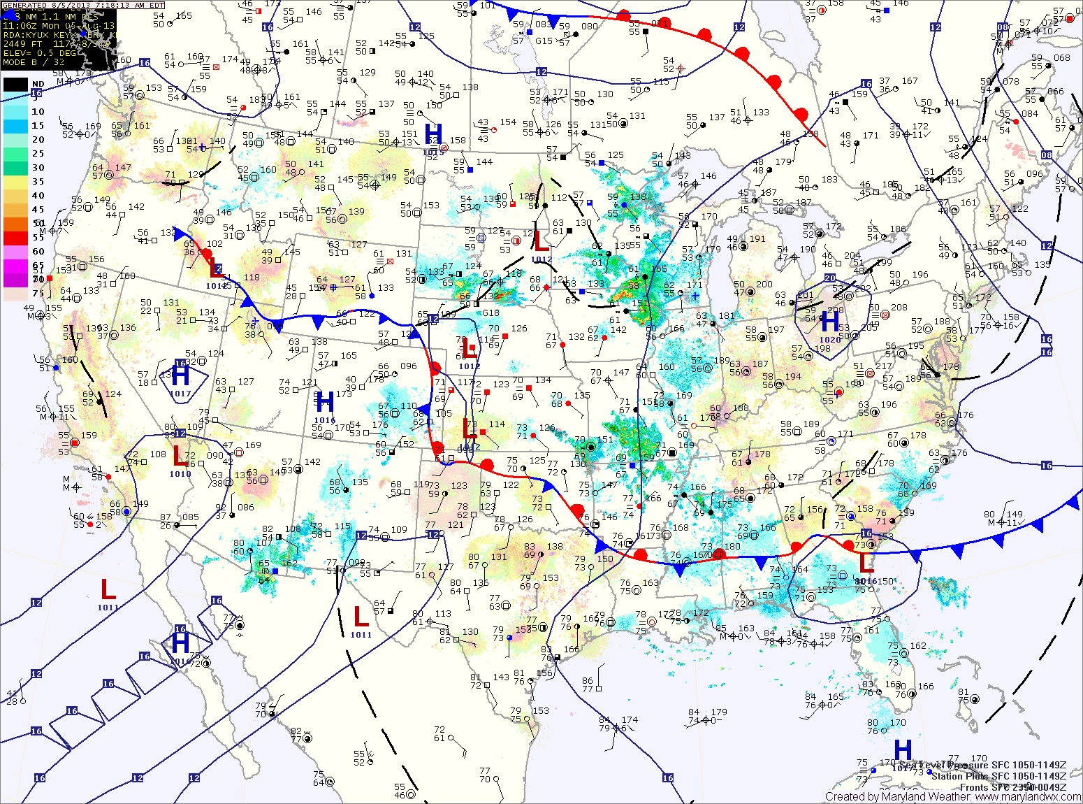
Current Surface MapHigh pressure will give us one more nice day today under sunny skies with low humidity. Highs will be in the low 80s.
A warm front will push through the area tonight, allowing the humidity to return. This will result in scattered showers and possibly a thunderstorm tomorrow. Highs will be in the upper 70s to low 80s.
Showers and thunderstorms will be possible again on Wednesday and Thursday with highs on Wednesday in the upper 70s to low 80s and low to mid 80s on Thursday.
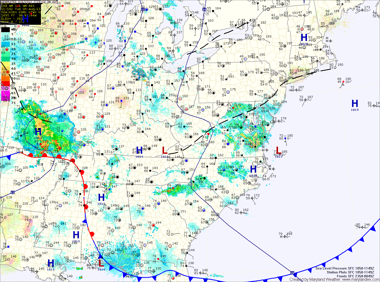
Current Surface MapFollowing a frontal passage, high pressure is working into the region and will bring lower humidity levels and mostly sunny skies today. Highs will be in the mid to upper 80s.
Another cold front will approach from the west tomorrow. This front will bring showers and thunderstorms to the state as it moves in tomorrow evening and tomorrow night. Highs will be in the mid 80s.
The front moves through tomorrow night, allowing high pressure to build back in on Sunday. Expect early morning clouds to give way to a mostly sunny afternoon with highs in the low to mid 80s.
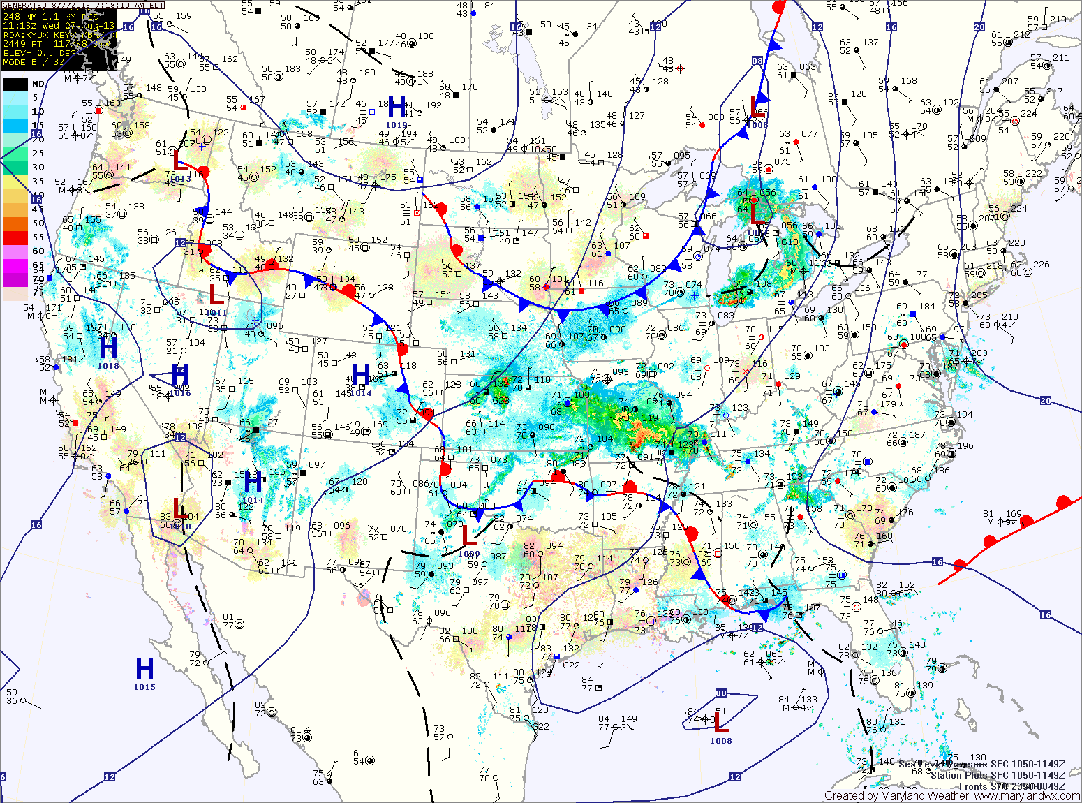
Current Surface MapA cold front is moving towards the area this morning. Ahead of the front, showers have developed and are moving through the area. The shower activity should wind down as we move through late morning.
The cold front will move into the region this afternoon, spreading another round of showers and thunderstorms into the area. Some of the storms could produce locally heavy rainfall and gusty winds. Highs today will be in the low to mid 80s.
The front pushes through this evening, bringing an end to the rainfall.
High pressure will build in behind the front, leading to a dry and sunny Friday. Highs will be in the mid to upper 80s.