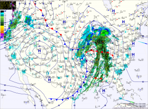
Windy and Cold Weekend

Current Surface Map
Current Surface Map
Today is the first day of winter and it will certainly feel like it!

The cold front that brought heavy rain and wind to the area last night has pushed off the coast and colder air is beginning to filter into the region.

Winds will increase through the day today as the storm intensifies to our north. Highs today were reached at 2:40 this morning and will continue to drop through the day, into the 30s this evening.

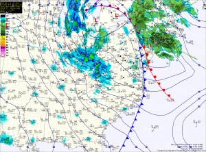
Winds will gust to around 30mph this afternoon, making it feel even colder. There may be a sprinkle or flurry this afternoon as well.

In far western Maryland, snow will continue to fall and combine with the strong winds to produce blizzard conditions at times through tomorrow.

Strong Cold Front Brings Rain and Wind

Current Surface Map
Current Surface Map
An intense area of low pressure continues to strengthen over the midwest while it drags a cold front across the country. The front will approach the area this afternoon spreading rain into the area by sunset.

The rain will be heavy at times, accompanied with strong gusty winds. A thunderstorm is possible during the overnight as well.

Winter begins at 6:12 tomorrow morning and the front will be pushing through around that time. Expect wind gusts to near 40mph tomorrow, as temperatures fall from the low 40s into the 30s during the day.