
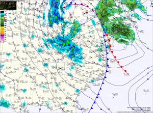
The cold front that brought heavy rain and wind to the area last night has pushed off the coast and colder air is beginning to filter into the region.
Winds will increase through the day today as the storm intensifies to our north. Highs today were reached at 2:40 this morning and will continue to drop through the day, into the 30s this evening.
Winds will gust to around 30mph this afternoon, making it feel even colder. There may be a sprinkle or flurry this afternoon as well.
In far western Maryland, snow will continue to fall and combine with the strong winds to produce blizzard conditions at times through tomorrow.
Elsewhere, tomorrow will feature a mix of clouds and sun and even stronger winds. A High Wind Watch is in effect, as winds will gust to near 60mph. Highs will be in the low 40s.
Sunday will have a bit more sunshine, but it will remain cold with highs in the low to mid 40s. The winds will finally begin to wind down as high pressure begins to move in, but it will still be breezy with gusts to 25mph.
Clouds will increase on Monday as a weak system approaches from the south west. It will push through Monday night and Tuesday morning, bringing light rain to the area. Highs both days will be in the mid 40s.
A stronger storm system may affect the area during the middle to latter portion of next week.
Yesterday’s Weather Station Stats:
High Temp: 50.2°
Low Temp: 32.7°
Rain: 0.58″