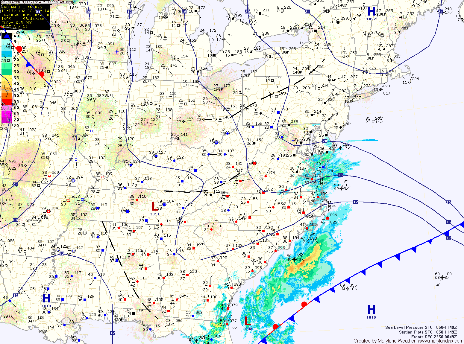
Current Surface MapA WINTER WEATHER ADVISORY is in effect this morning for Calvert, Charles and St. Mary’s counties.
Today will be generally cloudy as low pressure to our south and high pressure to our north combine to form easterly flow off of the ocean, resulting in clouds and perhaps some freezing drizzle across southern Maryland this morning. Highs today will be around 40.
Clouds and periods of drizzle will continue tonight, with the drizzle becoming a bit more widespread. Freezing drizzle is possible once again late tonight or early tomorrow morning as temperatures drop to near freezing.
As the latest storm system pulls away from the area, expect areas of light snow or flurries to continue over the next few hours, gradually coming to an end.
The storm generally behaved as expected, except it was colder to start and the area of heavier snow set up farther north than anticipated. Bands of heavy snow set up over central Maryland, greatly increasing snow totals. In general, 5-10″ fell across central and southern Maryland, with lesser amounts to the north. It was a tricky forecast and we certainly got a lot more snow than forecast, thanks to the enhanced banding.
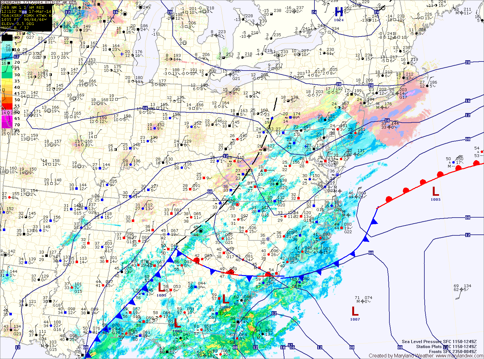
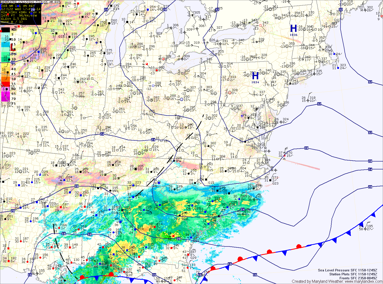
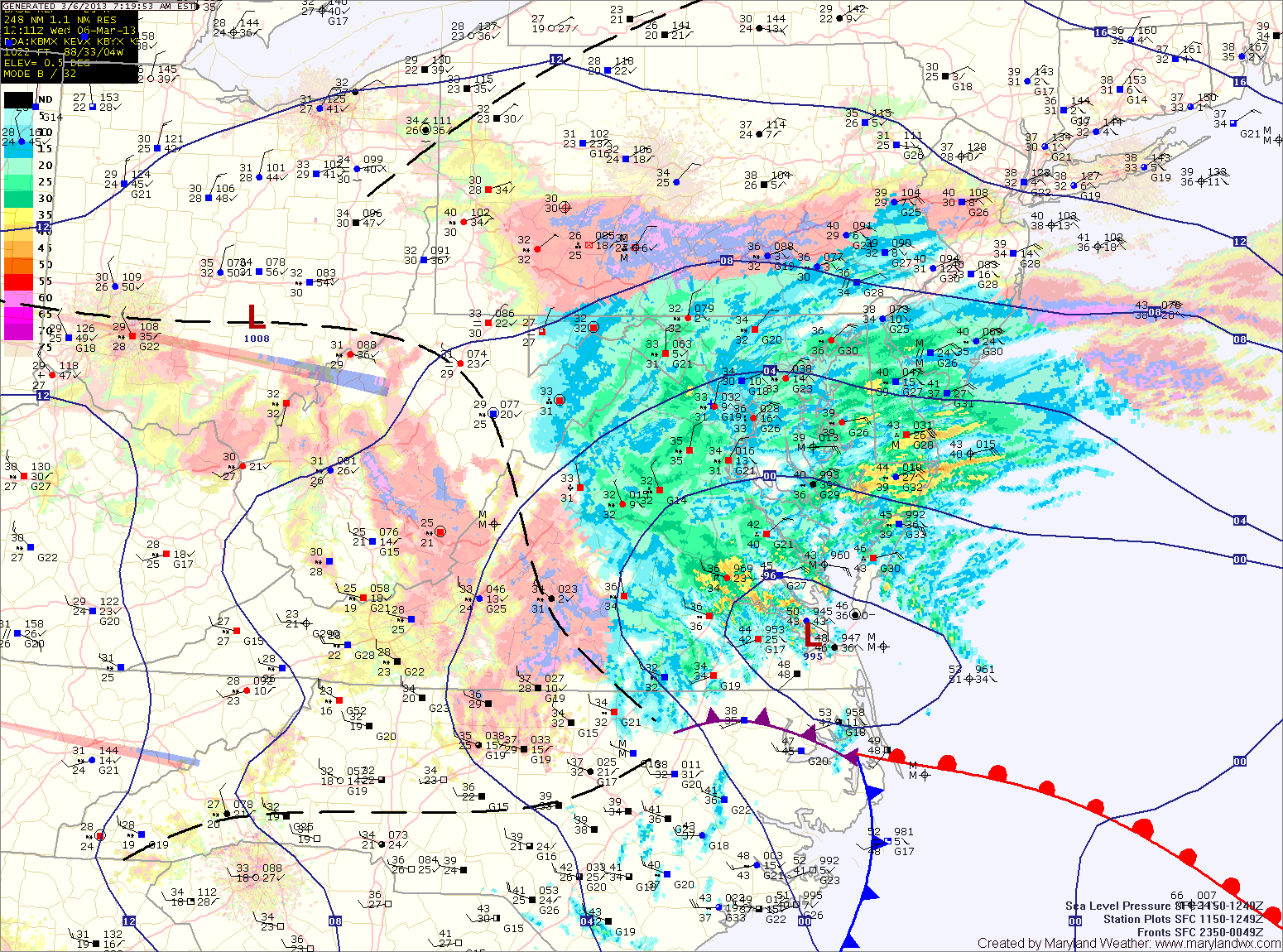
Current Surface MapA WINTER WEATHER ADVISORY is in effect for Calvert, Charles, and St. Mary’s counties until noon.
An area of low pressure is moving northeastward off the Carolina coast. The storm will stay well to our south but the northern fringe may spread some light precipitation into the southern and eastern portions of the state.
At the onset, it will be cold enough for any precip that falls to fall in the form of sleet or freezing rain. Temperatures will climb above freezing later this morning, turning any remaining precip over to plain rain. Light showers may persist through the afternoon and into tonight.
Highs today will be around 40 under cloudy skies.
High pressure builds in tomorrow, leading to a pleasant day, with partly sunny skies and highs in the mid 50s.
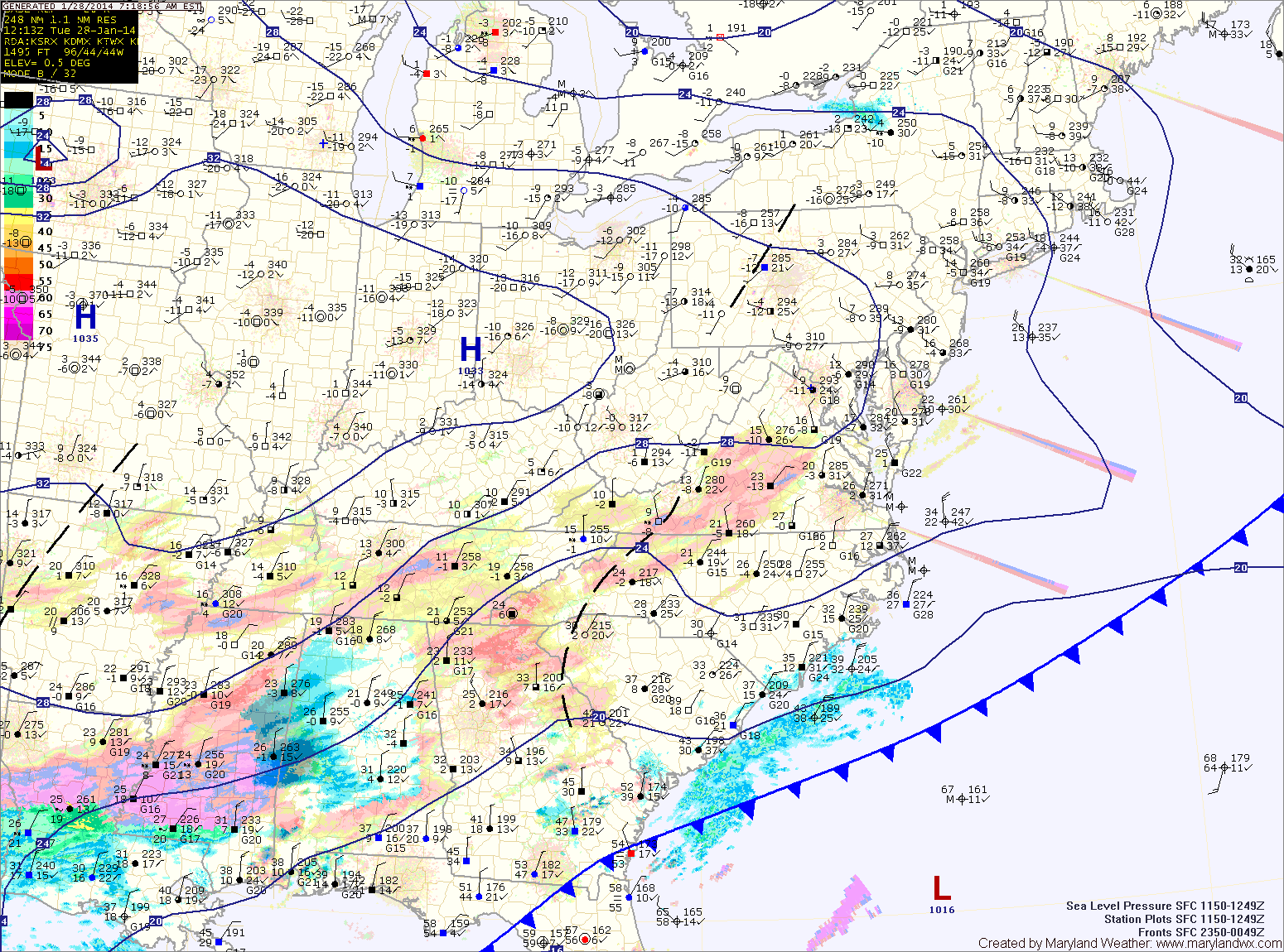
Current Surface MapA Winter Weather Advisory is in effect this morning for central Maryland and Garrett County.
Light snow has overspread the area and will last through the morning. Generally an inch or two of accumulation is expected. Localized spots of up to 3 inches are possible before it ends this afternoon.
Sunshine will break through the clouds this afternoon and it will turn windy. Highs will top out in the low 30s.
Much colder air will move in tonight on gusty northwest winds. Overnight lows will fall into the teens in most places.
A Winter Storm Warning remains in effect until tomorrow morning for all Maryland counties north and west of I-95. A Winter Storm Warning remains in effect until this afternoon for…
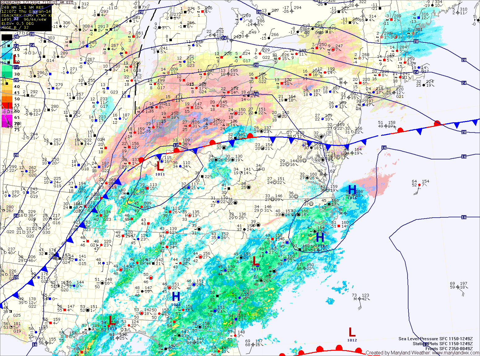
Current Surface MapA Winter Storm Warning goes into effect tonight through tomorrow afternoon for all Maryland counties except Calvert, St. Mary’s, Somerset, Wicomico and Worcester.
A Winter Weather Advisory goes into effect tonight through tomorrow afternoon for Calvert, St. Mary’s, Somerset and Wicomico counties.
An area of low pressure developing along the Gulf coast will intensify as it moves up the eastern seaboard tonight and tomorrow spreading wintry precipitation into the area.
Expect snow to develop from south to north tonight between 8pm and midnight. The snow will become heavy at times overnight and into tomorrow morning. The low will pass very close to the Delmarva coast tomorrow morning, drawing warmer air into the eastern part of the state and changing the snow over to sleet and or rain. That mix will likely push westward, reaching the I-95 corridor, cutting down snow totals.
West of I-95 should remain mostly snow, with sleet mixing in at times. As is usual with coastal storms, north and west of I-95 will see the heaviest snowfall.
Snowfall Forecast (from southeast to northwest):
-Lower eastern shore: 2-4″ then rain
(Somerset, Wicomico, Worcester)
-Central and northern eastern shore: 4-6″ then sleet and rain
(Dorechester, Kent, Queen Annes, Talbot)
-Lower southern Maryland: 3-5″ then sleet and rain
(Calvert, St. Marys)
-From the bay to I-95: 5-10″, mixing with sleet and rain at times Thursday afternoon
(Anne Arundel, Prince Georges, Charles, Baltimore City)
-Western and northern I-95 counties: 6-12″ with some mixing
(Montgomery, Howard, Northern Baltimore, Harford, Cecil)
-West of I-95: 8-12+”
(Carroll, Frederick, Washington)
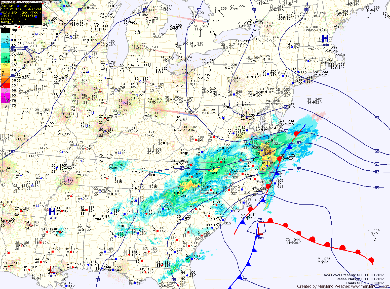
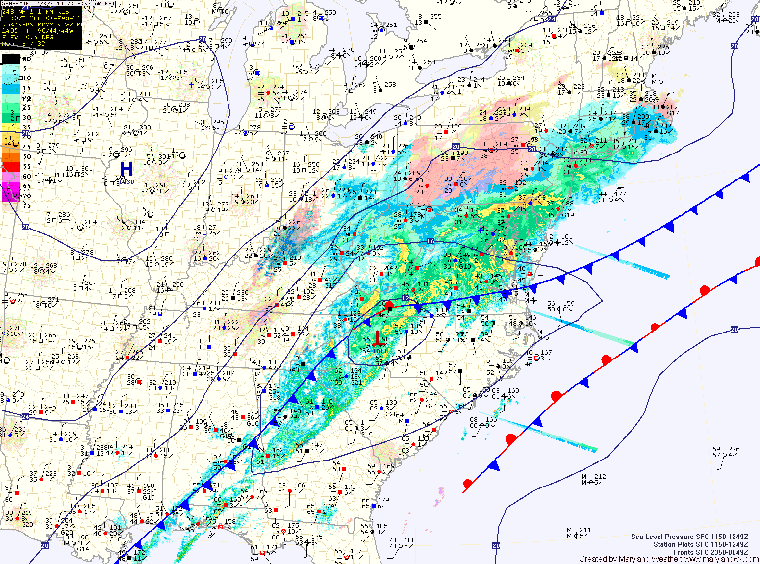
Current Surface MapAn area of low pressure has brought precipitation to the area this morning. Colder air working in from the northwest is changing it to snow. This changeover will continue through the morning hours from northwest to southeast.
A Winter Storm Warning is in effect for the counties north and west of I-95. In these areas, the changeover has already occurred and up to 6″ of snow may fall.
Further south, along I-95, a Winter Weather Advisory is in effect. 1-3″ of snow is expected in these areas.
South and east of there, the rain will change over to snow later and a trace to perhaps an inch is expected. Souther Maryland and the lower eastern shore may not change over at all.
Current Surface MapToday will be generally cloudy and cold throughout the state as an area of low pressure develops over the deep south and moves towards the Carolina coast. Highs will top out around 20 degrees.
A Wind Chill Advisory is in effect through mid morning as wind chills drop to below 0 at times.
Widespread heavy snowfall is expected across most of Virginia and the Carolinas where up to a foot of snow may fall. We will be on the northern fringe of the storm here in Maryland. That said, lower southern Maryland and the lower eastern shore will likely see snow develop late this afternoon and into tonight. 1-2″ of snow is possible across St. Mary’s and Calvert counties while the eastern shore may see upwards of 4 inches.
Current Surface MapA storm system is still on track to bring precipitation to the area this evening into tomorrow. The precip will start as rain or a rain/snow mix this evening then change to snow tonight.
Generally, 1-3″ are likely across central and southern Maryland while 2-4″ are likely across northern Maryland. A Winter Weather Advisory is in effect for that area.
The storm will strengthen rapidly as it pulls north of the area tonight into tomorrow. Winds will pick up, gusting to around 30mph as colder air is pulled into the area. Highs tomorrow will only be in the upper teens to around 20.
Temperatures will warm this weekend as southerly flow develops. Saturday will be mostly sunny with highs in the low to mid 30s.
Current Surface MapA Winter Storm Warning is in effect for all counties west of the Bay. A Winter Weather Advisory is in effect for the Eastern Shore. Yesterday’s forecast remains on track.
Projected Snow Totals by County:
12+”: Garrett
8-12″: Allegany, Washington
6-10″: Frederick, Carroll, Montgomery, Howard, N. Baltimore
4-8″: Anne Arundel, S. Baltimore, Baltimore City, Cecil, Harford, Kent, Prince Georges (the higher amounts further from the Bay)
2-4″: Calvert, Charles, Queen Annes, Talbot
1-3″: Caroline, Dorchester, St. Marys, Wicomico
Trace-1″: Somerset, Worcester
Currently, the area of low pressure is situated near the Tidewater of Virginia. As the low moves slowly eastward today, it will strengthen and winds in our area will shift from easterly to more northerly and colder air will be drawn in. As this happens, the rain and rain/snow mix will turn over to snow and become heavy at times as we move through the afternoon and into tonight.