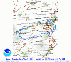
Severe Thunderstorm Watch

THE NWS STORM PREDICTION CENTER HAS ISSUED A SEVERE THUNDERSTORM WATCH EFFECTIVE THIS SUNDAY AFTERNOON AND EVENING FROM 1:45 PM UNTIL 10:00 PM EDT.

HAIL TO 2 INCHES IN DIAMETER…THUNDERSTORM WIND GUSTS TO 70 MPH…AND DANGEROUS LIGHTNING ARE POSSIBLE.

Scattered Showers and Thunderstorms Today
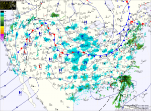
Current Surface Map
A cold front will move through the state today. Ahead of the front, showers and thunderstorms are developing. These showers and storms will affect the western part of the state by late morning and move eastward through the day. Some of the storms may become strong this afternoon as they move through central Maryland bringing gusty winds and large hail. Highs today will push into the mid 80s.

The front should clear the state tonight, bringing an end to the rain and allowing high pressure to move in with cooler air. Tomorrow will be pleasant, with highs around 80 degrees under sunny skies. Wednesday will be a few degrees warmer, but still extremely nice for late June.

Severe weather day
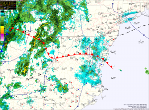
Current Surface Map
Today is the first day of Meteorological Summer and to mark the occasion, it looks like we will be dealing with a rather widespread severe weather event.

A warm front is currently working it’s way through the state, allowing moisture and warmer temperatures to stream northward. This feature, combined with a cold front approaching from the west will provide the forcing necessary for shower and thunderstorm development.

At this time, it appears enough instability and lift will be present for some of these storms to become severe and produce damaging winds, large hail, torrential rain and possibly tornadoes.

Scattered showers and storms again today
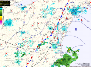
Current Surface Map
Low pressure continues to sit across the eastern US, bringing unsettled weather to the region. Expect showers and thunderstorms to develop this afternoon, bringing locally heavy rain, gusty winds and possibly small hail. Highs today will be near 80.

The trough of low pressure will begin to weaken tomorrow, but will still provide a focus for showers and thunderstorms. Highs tomorrow will again be near 80 degrees.

Friday will be a transition day, as the trough weakens and is pushed out by an area of high pressure. Isolated showers and thunderstorms will still be possible, but will not be as widespread as they have been. Highs will begin to creep upwards, reaching the mid 80s.

Isolated showers and storms this afternoon
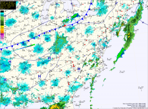
Current Surface Map
A cold front will move through the state tonight bringing with cooler and drier air with it but before it does, we will have one more day of warm and humid conditions.

The moist airmass will also allow another round of showers and thunderstorms to develop this afternoon. Today’s activity will be more isolated and will be more confined to areas along the bay. Some of these storms may become severe, with large hail and damaging wind being the primary threats. Highs today will push into the low to mid 80s.

Scattered showers and thunderstorms possible again this afternoon
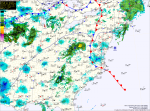
Current Surface Map
An upper level disturbance will move through the area today, followed by a cold front tonight. These features will touch off showers and thunderstorms as it moves through, especially east of the mountains. Expect today’s storms to be organized and affect more areas than in the past few days. Any storms that do form will be capable of becoming severe with large hail and damaging winds as the primary threats.

Be sure to stay alert for any watches and warnings that may be issued this afternoon. High temperatures today will resemble the past few days as well. Cooler along and east of the bay where highs in the mid 70s are expected, rising into the 80s further west.

Another tricky temperature day
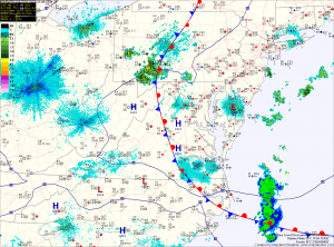
Current Surface Map
Just like yesterday, a stationary front remains draped across the state. Yesterday, we saw temperatures in the upper 50s in northeast Maryland and upper 80s across the Potomac in central Virginia. There is a bit more confidence that the front will move to the northeast today. This should push temperatures into the 80s in most spots along and west of I-95, while areas to the east rise into the 70s.

Also like yesterday, thunderstorms are expected to form over the mountains and move eastward, reaching the metro area by late afternoon. The primary threat from these storms will be strong winds and large hail.

Scattered showers and storms this afternoon and evening
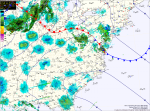
Current Surface Map
Warm and humid air continues to build into the region, setting the stage and allowing for scattered showers and thunderstorms to develop this afternoon. Skies are expected to clear this afternoon, allowing temperatures to warm to near 80 and enhancing the instability in the atmosphere.

It appears that there will be enough instability for some of these storms to become severe, with damaging winds and hail.
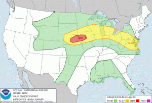
SPC Day 1 Outlook
Here is an excerpt from the Storm Prediction Center:

Scattered showers and storms this afternoon
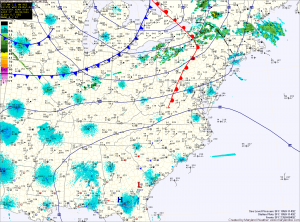
Current Surface Map
An area of low pressure moving through the Great Lakes will drag a cold front through the state this evening. Ahead of the front, strong southwesterly winds will send temperatures into the 70s and set the stage for scattered showers and thunderstorms.

There is a slight risk that these storms could become severe with large hail and damaging winds as the primary concern. Be sure to check the radar and be aware of any possible watches and warnings that may be issued this afternoon.

The showers and storms will be pushed eastward and off the coast by later this evening as the cold front moves through.