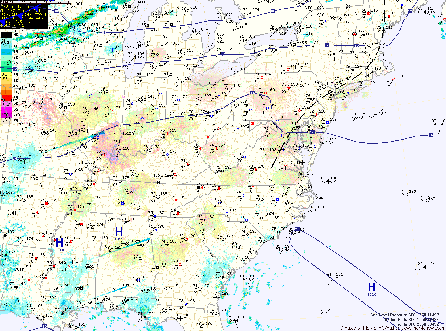
Current Surface MapAnother hot and humid day is on tap today. Highs will once again be in the mid to upper 90s with heat index values near 110. An Excessive Heat Warning is in effect for Washington and Baltimore, while a Heat Advisory is in effect for the surrounding counties in central Maryland.
There will also be scattered thunderstorms this afternoon. The storms will be capable of producing gusty winds, heavy rainfall and large hail.
A cold front will approach tomorrow, but will remain to our north resulting in another hot and humid day with afternoon and evening thunderstorms. Highs will be in the mid 90s. The storms could be strong to severe, with damaging winds, large hail and locally heavy rainfall.
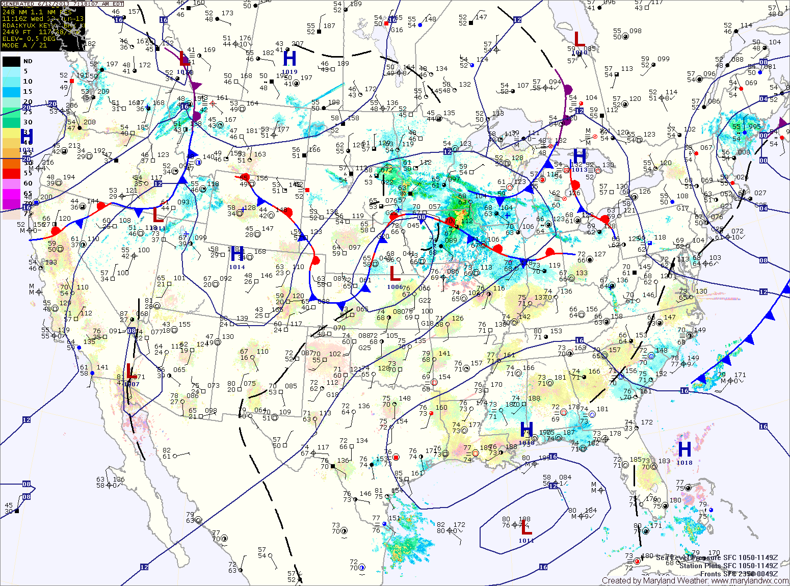
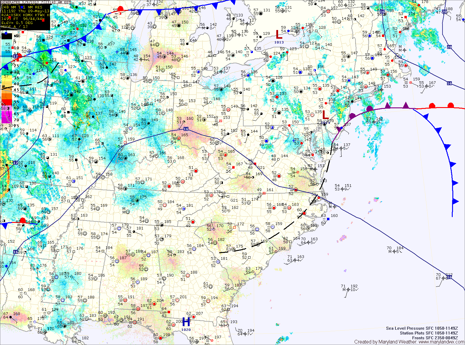
Current Surface MapAn area of low pressure moving into a very unstable atmosphere has touched off a line of thunderstorms this morning. The line is currently moving into central Maryland. A Severe Thunderstorm Watch is in effect for this line. Expect frequent lightning, very heavy rainfall, large hail and strong gusty winds with this line of storms.
Light rain will continue behind the line for a few hours. As the low moves to our north this afternoon, winds will turn southerly and the atmosphere will destabilize again. Another round of severe thunderstorms is expected this afternoon and evening across the area. These storms will be capable of producing large hail, damaging winds, heavy rainfall and tornadoes. It will be warm, humid and windy today, with highs in the upper 80s to low 90s and winds gusting to 35mph.
Current Surface MapA frontal boundary is stalling out to our south. As it does, an area of low pressure will ride along the front, bringing showers and thunderstorms to the area tonight and tomorrow.
Meanwhile, today will be partly sunny, warm and humid with an isolated shower or thunderstorm possible this afternoon. Highs will be in the upper 80s to around 90.
Thunderstorm activity will actually increase tonight as a piece of energy moves through the area. Some of these storms may become severe with damaging winds and heavy rainfall.
A thunderstorm complex over the midwest will move eastward tomorrow morning, bringing a chance of morning rain or thunderstorms to the area. Regardless of that system, as the low and cold front approach, all signs point to strong to severe thunderstorms developing over the area by afternoon. A wide-spread severe weather event is looking likely tomorrow afternoon, with damaging winds, large hail, heavy rainfall and isolated tornadoes possible across the entire state but especially along central and eastern Maryland. Highs will be in the upper 80s.
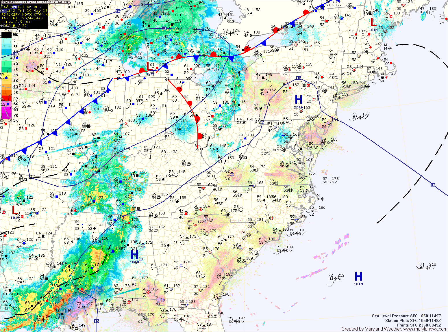
Current Surface MapHigh pressure will bring warm and humid conditions to the area as it builds in and then off the coast. Meanwhile, a cold front will approach from the west.
The combination of the two will kick off scattered showers and thunderstorms this afternoon and evening. Some of the storms may become severe with damaging winds, heavy rainfall and large hail, especially across western Maryland. Highs today will be in the low to mid 80s.
Thunderstorm activity will diminish tonight with the loss of daylight, but showers will remain possible through the overnight.
Current Surface MapDense fog will continue to lift this morning, leaving cloudy conditions. As we warm this afternoon, scattered showers and thunderstorms will develop again. Some of the storms could produce locally heavy rainfall. Highs today will push into the mid to upper 70s.
High pressure builds in tonight and into tomorrow, before the next weather maker begins to affect us tomorrow afternoon. A cold front to the west will provide forcing to help shower and thunderstorm development during the afternoon and evening. Some of the storms could become strong to severe with gusty winds and hail. Highs tomorrow will push into the 80s.
The shower and storm threat will continue Friday night and Saturday as the front continues to march into the area. The storms Saturday afternoon and evening could once again turn severe. Highs will be in the mid to upper 70s.
The current light rain and drizzle that is moving through the area will clear in the next few hours. This will allow partial clearing to occur, helping to destabilize the atmosphere. Thunderstorms will develop this afternoon over the mountains and move eastward into the evening.
Depending on how much clearing occurs, some of these storms could become severe with damaging winds, large hail and even an isolated tornado. Highs today will be in the mid 80s.
The cold front moves through tomorrow, bringing another round of showers and thunderstorms during the day. Highs will again be in the mid 80s.
Current Surface MapHigh pressure will control our weather today, bringing another mostly sunny day with temperatures in the upper 80s to near 90.
An area of low pressure will approach tomorrow and bring a cold front through the area on Wednesday. This will provide a focus for thunderstorm development tomorrow. Scattered thunderstorms are expected and some of these storms could become severe with damaging winds, large hail and even tornadoes. Highs will be in the upper 80s.
Current Surface MapAs high pressure moves off the coast today, warm humid air will continue to flow into the area.
The airmass will support the development of isolated showers and thunderstorms this afternoon. Highs will be in the mid 90s with heat index values around 100.
More of the same tomorrow, hot and humid with scattered afternoon thunderstorms. Highs will be in the low to mid 90s.
THE NWS STORM PREDICTION CENTER HAS ISSUED A SEVERE THUNDERSTORM WATCH EFFECTIVE THIS WEDNESDAY AFTERNOON AND EVENING FROM 1245 PM UNTIL 900 PM EDT. HAIL TO 1.5 INCHES IN DIAMETER...THUNDERSTORM WIND…
…HEAT ADVISORY REMAINS IN EFFECT FROM 11 AM THIS MORNING TO 9 PM EDT THIS EVENING…
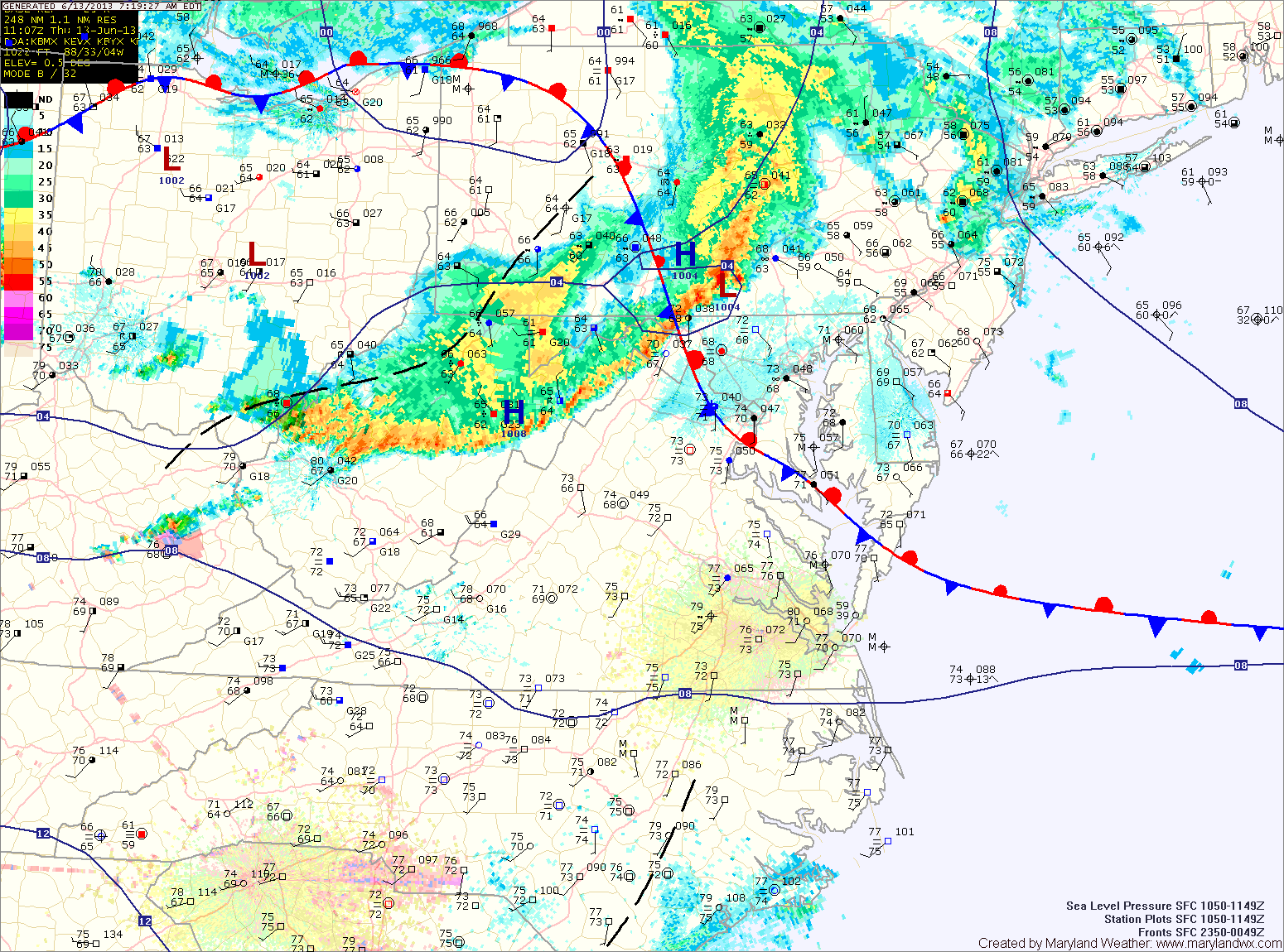
Current Surface MapA cold front remains to our north while high pressure over the southeast continues to keep the region in hot, humid air. Showers and thunderstorms are expected to develop this afternoon with some of the storms possibly becoming severe with damaging wind and large hail. Highs today will again be near 100 degrees, with heat index values topping 105.
The cold front will slowly move southward, continuing rain chances tonight and tomorrow but more importantly it will drop temperatures about 10 degrees. Highs tomorrow will be around 90. Additionally, showers and thunderstorms are likely again tomorrow as the front remains in the area.