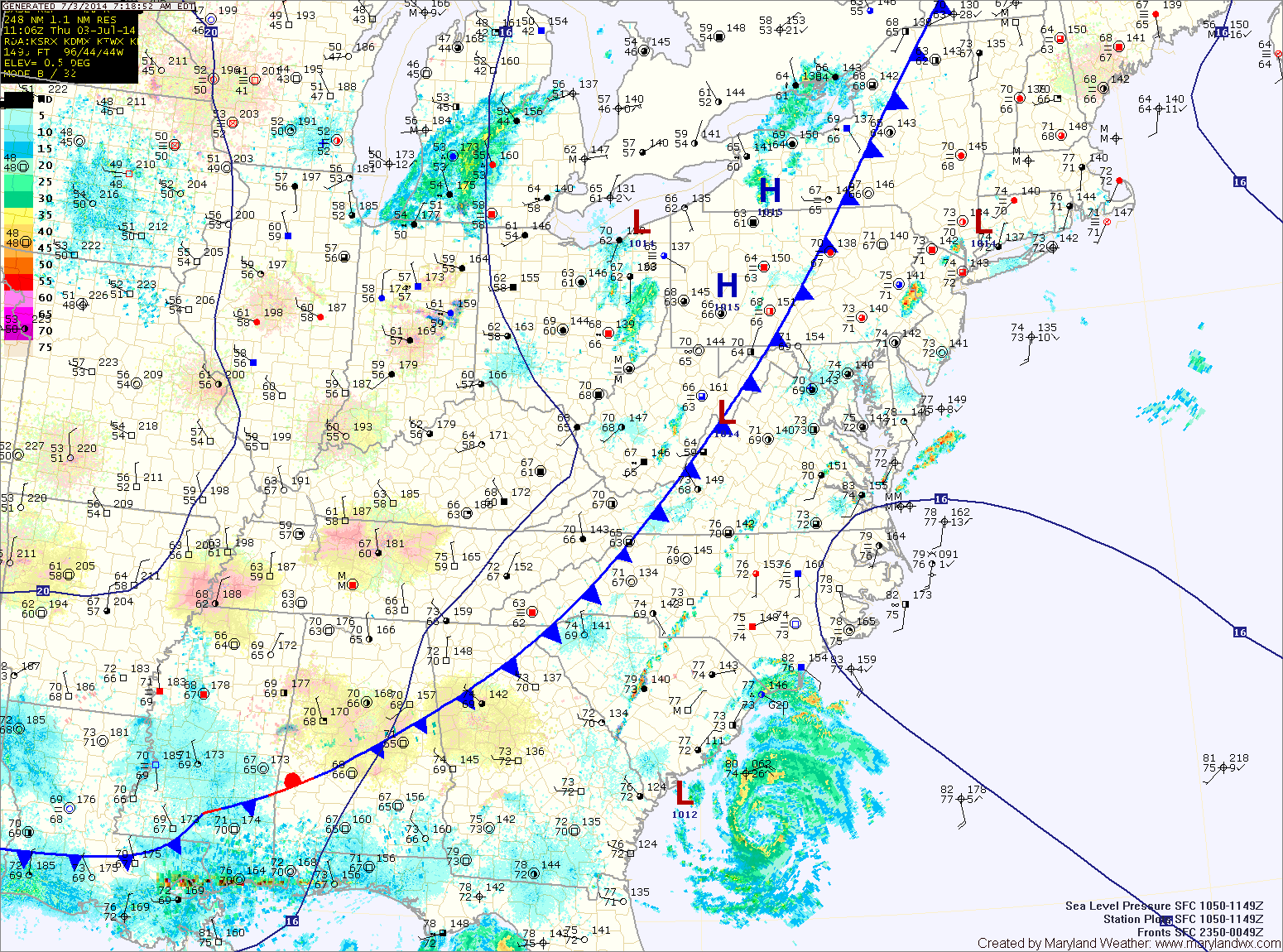
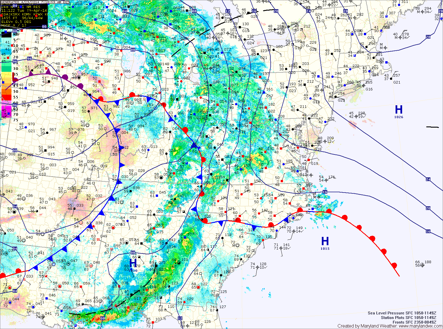
**A FLASH FLOOD WATCH has been issued for: Anne Arundel, Baltimore, Baltimore City, Carroll, Cecil, Frederick, Harford, Howard, Montgomery and Prince George's counties.** A cold front is moving into the…
A FLASH FLOOD WATCH is in effect for most of the state except far Western Maryland and the lower Eastern Shore.
Current Surface MapA cold front will move into the area today, touching off another round of showers and thunderstorms this afternoon through tonight. It will remain hot and humid with highs in the low 90s. This airmass will continue to support strong storms with gusty winds, large hail and very heavy rainfall. Localized flash flooding is possible in any storm.
The front will push through tomorrow morning, ending the rainfall and ushering in cooler and drier air for the holiday weekend. Expect mostly sunny skies by tomorrow afternoon, with highs in the low 80s.
The front will also steer Hurricane Arthur well east of the state. By Friday afternoon, the storm should be well off the Ocean City coast, accelerating away from the area.
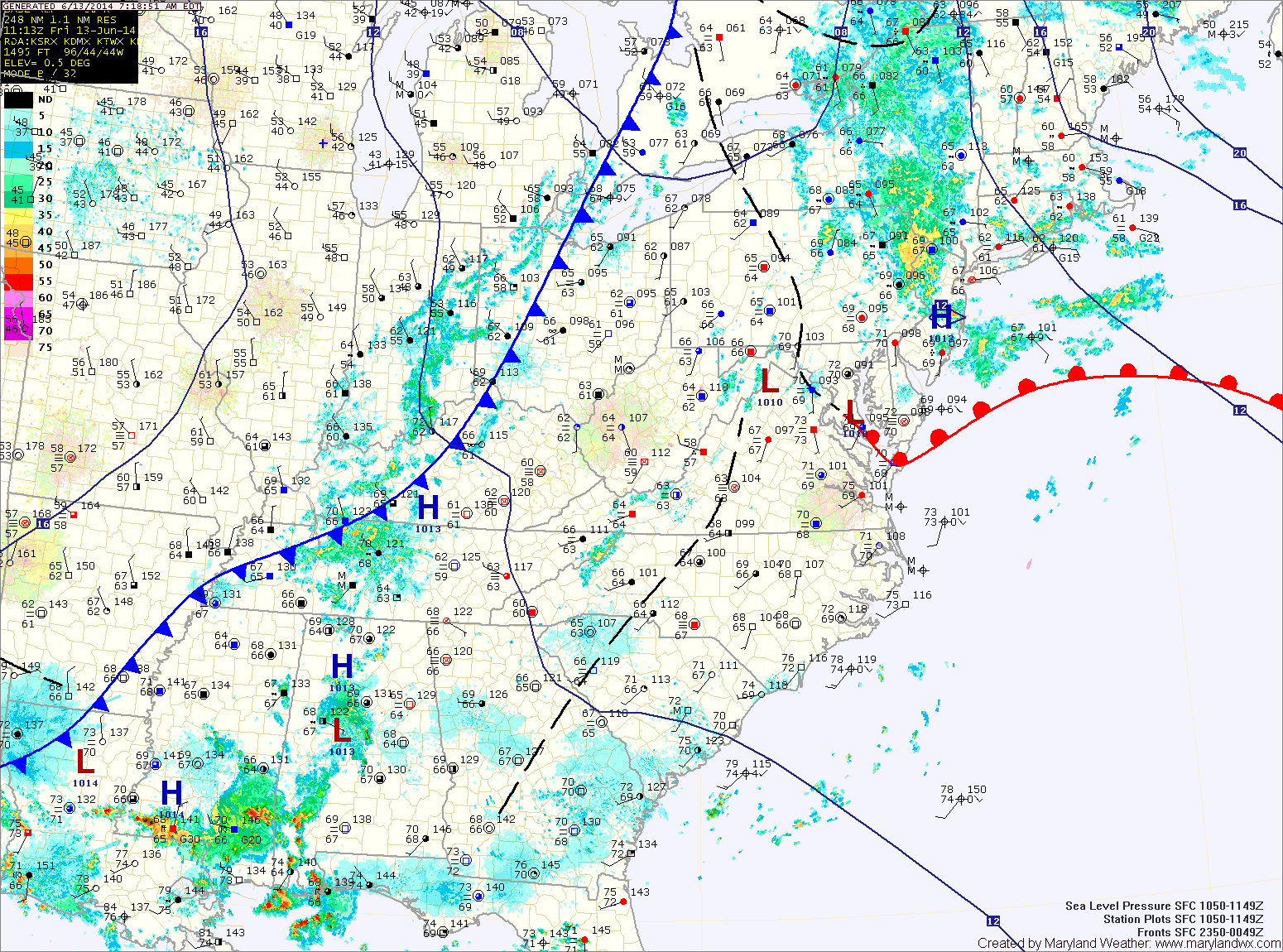
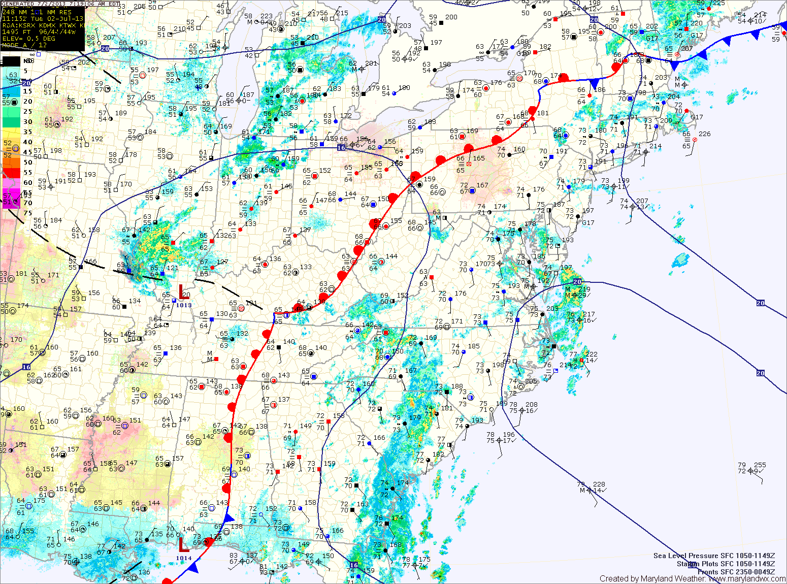
A FLASH FLOOD WATCH is in effect until 10pm tonight for most of central Maryland.
Current Surface MapA cold front to our west is poised to move through the state today and tonight, pushing the warm, humid air out and bringing in cooler and drier air. Before it does, expect another warm and humid day.
Showers and thunderstorms will be likely again today into tonight as the front moves through. Some of the storms could produce locally heavy rainfall and flash flooding. Highs will be in the mid 80s.
The front will cross the area tonight, bringing an end to the rainfall.
High pressure moves in tomorrow, providing sunny skies and drier air. Highs will be around 80.
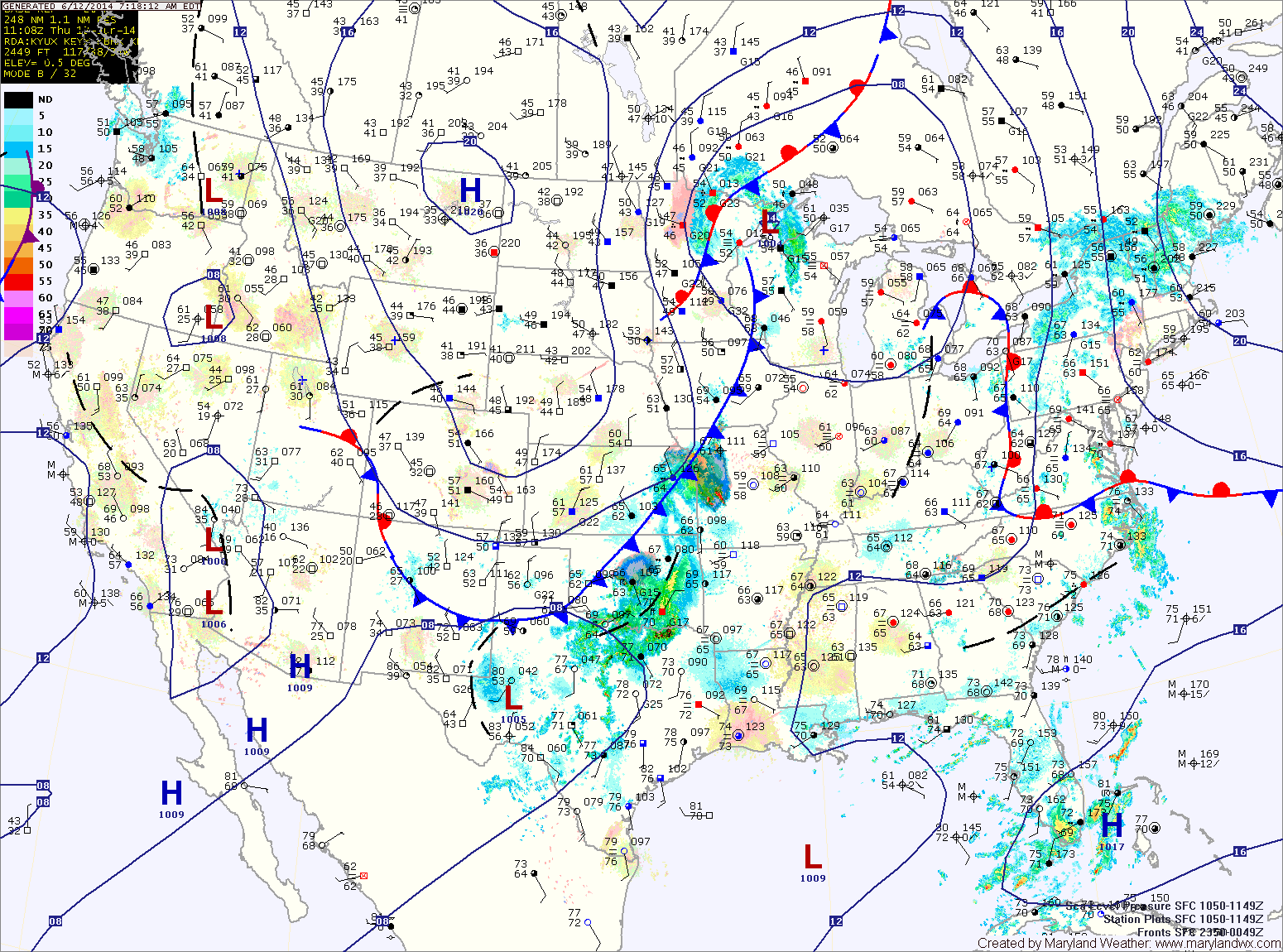
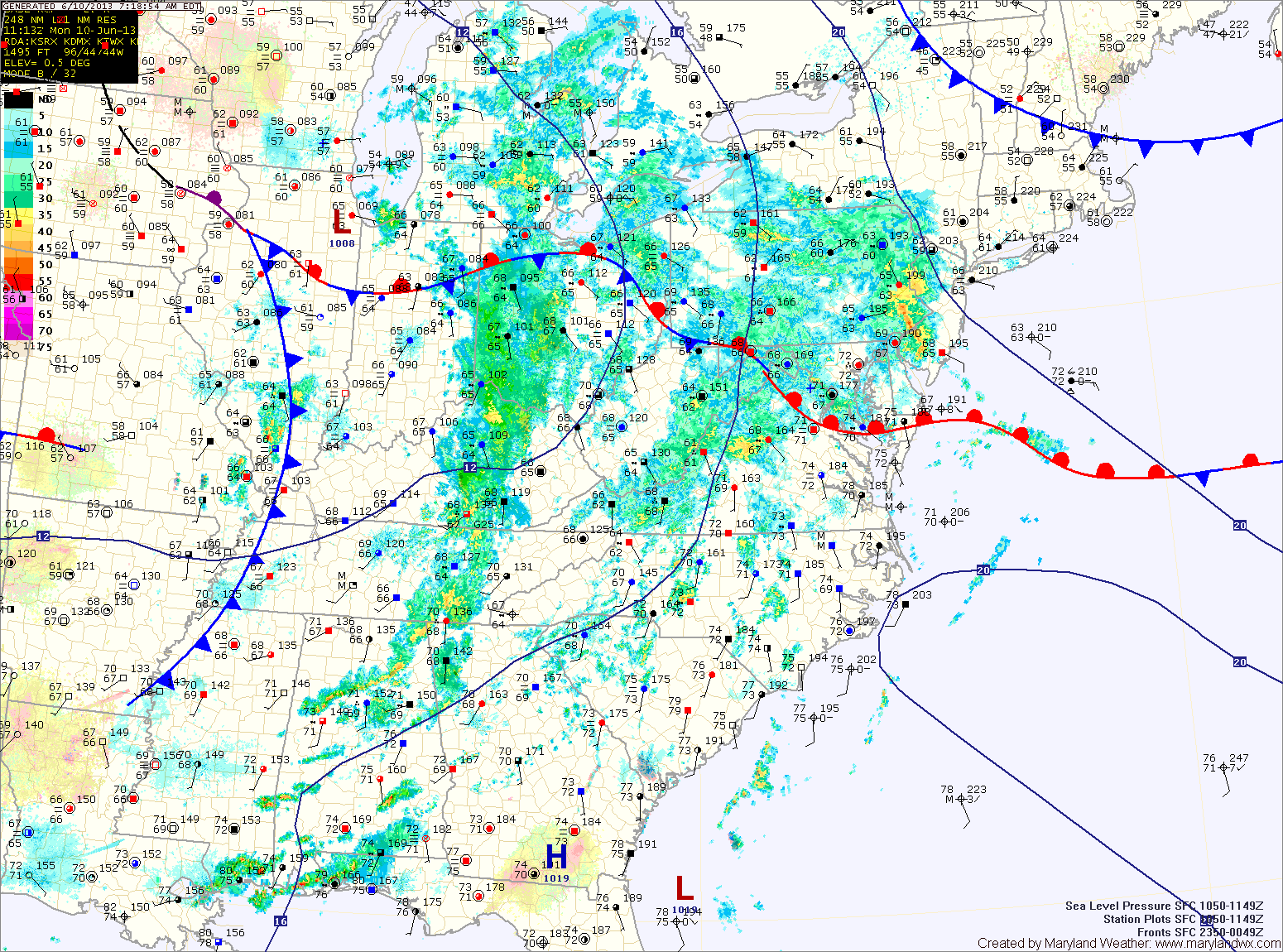
Current Surface MapA FLASH FLOOD WATCH is in effect for most of central and western Maryland.
With warm and humid air still in place, expect another round of showers and thunderstorms today. The storms will have ample moisture and localized flash flooding is possible this afternoon and evening. Highs will be in the low to mid 80s.
The storm threat will decrease tonight, but scattered showers and isolated storms are still possible through the overnight.
A cold front will approach tomorrow, firing up another round of showers and storms. Once again, these storms will be capable of producing locally heavy rainfall leading to flash flooding. Highs will be in the mid 80s.
Current Surface MapA FLASH FLOOD WATCH is in effect for counties west of the bay, excluding St. Mary’s and Calvert.
A cold front with ample moisture is slowly moving towards the region today. Ahead of the front, easterly flow has continued, resulting in fog and misty conditions.
As the front approaches, the flow should shift to a more southerly direction and intensify, scouring out the low level moisture. Expect this to occur this afternoon, resulting in breaks in the cloud cover and breezy conditions.
The front will be close enough late this afternoon to trigger scattered showers and thunderstorms before the more widespread rainfall moves in this evening. Highs today will be in the low to mid 70s.
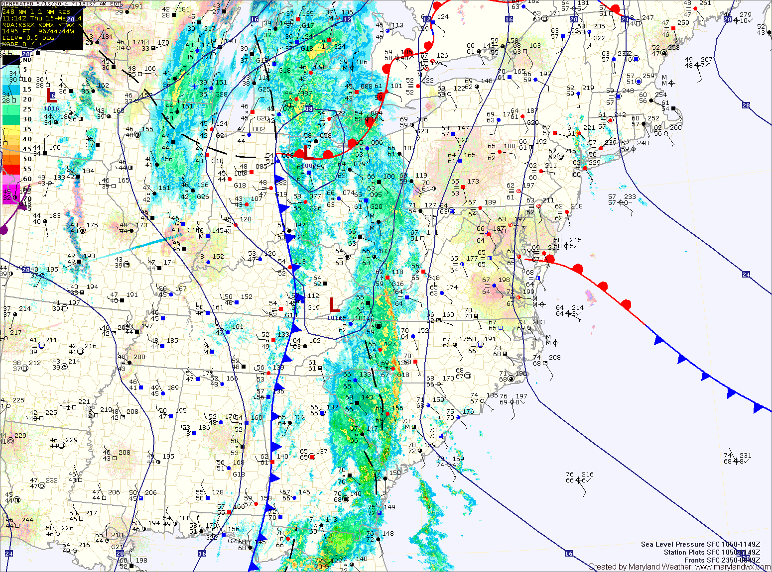
Current Surface MapA FLASH FLOOD WATCH is in effect this evening through tomorrow night for all counties west of the bay, except Garrett.
A large area of low pressure continues to slowly move through the middle of the country. The low has been responsible for the severe weather and tornadoes across the deep south and will spread another round of rainfall into our area today.
Rain is moving back into the state from west to east. Expect rain to overspread the entire state over the next few hours. The rain will continue through the day. It will also be breezy with highs in the low 50s.
Current Surface MapAs this blocking pattern continues, another day of showers and storms is on tap. The good news is, after today, rain chances will gradually decrease.
Scattered showers are moving through the area at this time and this will continue into the afternoon. Additionally, with the afternoon heating, thunderstorms will also be possible.
Any shower or storm will be capable of producing locally heavy rainfall and flash flooding. A Flash Flood Watch is in effect for all of central Maryland. Highs today will be low 80s.
Current Surface MapAs a warm front moves northward today and a cold front approaches from the west, several rounds of heavy rainfall will move through today. Additionally, thunderstorms are likely this afternoon, producing locally heavy rainfall and strong gusty winds.
A Flash Flood Watch is in effect for all of central Maryland, while a general Flood Watch is in effect for the Eastern Shore. Highs today will be in the mid 70s.
Rainfall will begin to taper off later tonight as the cold front moves through.
The front will clear the area tomorrow morning, but will stall out to our south. This will allow for a slight chance of an afternoon shower or thunderstorm. Highs will be in the low 80s.
Rain is moving in from the south and will overspread the area within the next few hours. The rain will be heavy at times this afternoon and evening. 2-3 inches…
The flash flood watch has been extended through this evening as more showers and storms work their way into the area. Moisture from the Gulf and the Atlantic continue to…