A strong cold front approaching from the west will deliver a dramatic temperature drop tomorrow as arctic air streams in on gusty northwest winds. Meanwhile, low pressure will be developing along the front and will bring additional moisture into the area. As a result, rain will move into the area later tonight, and then begin to change to snow from west to east.
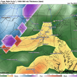
Here is this afternoon’s European model depiction of the storm from 1am through 7pm tomorrow:
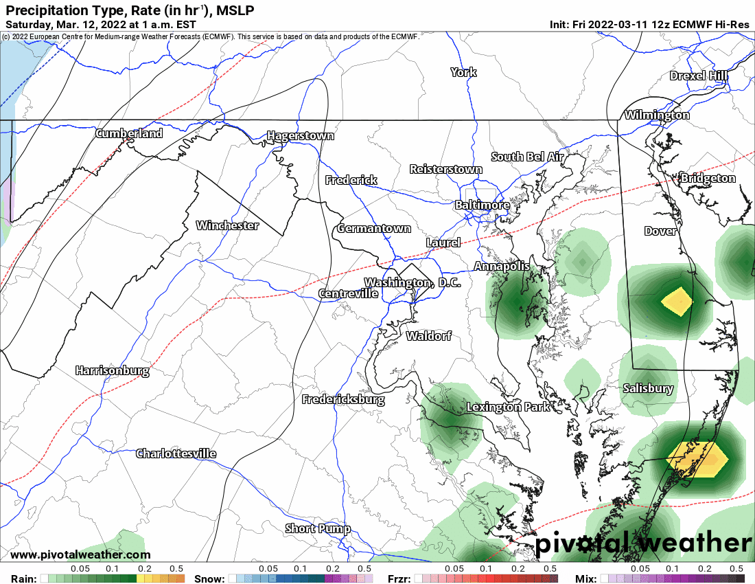
The rain/snow line will progress eastward during the early morning hours, and will likely reach the metro areas around 8am. Confidence has increased that most areas along and west of I-95 will see accumulating snow, with increasing amounts as you head west. Additionally, with wind gusts to near 50 mph, near blizzard conditions are possible in the far western Maryland.
There are a lot of factors that could limit the snowfall potential with this system, especially along and east of I-95: snow falling during the day vs. night, the mid-March sun angle, the timing of the arrival of the cold air, etc. but even in these areas, 1-2″ seems possible, especially on colder and grassy surfaces.
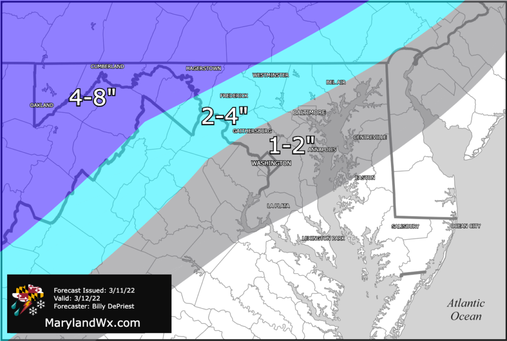
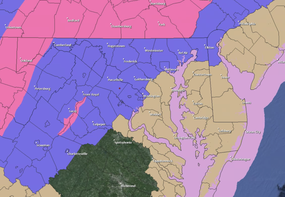
Winter Storm Warnings are in effect for Garrett and W. Allegany counties, and Winter Weather Advisories extend eastward to the I-95 corridor. In addition to the winter weather headlines, Wind Advisories for gusts to near 50 mph have been issued for the entire state, expiring 1am Sunday.
Regardless of the final snow totals, it will be a day to stay indoors, especially as the temperatures drop and winds pick up tomorrow afternoon and evening. Wind chills will range from the -10s in the mountains to single digits to 10s elsewhere. If you do have to venture out, be careful and be sure to layer up. Winter seems to be going out with a bang!