
As cold air settles in over the eastern US, a potent area of low pressure will approach from the south. The system will move into our area during the morning hours tomorrow, spreading snow from southwest to northeast.
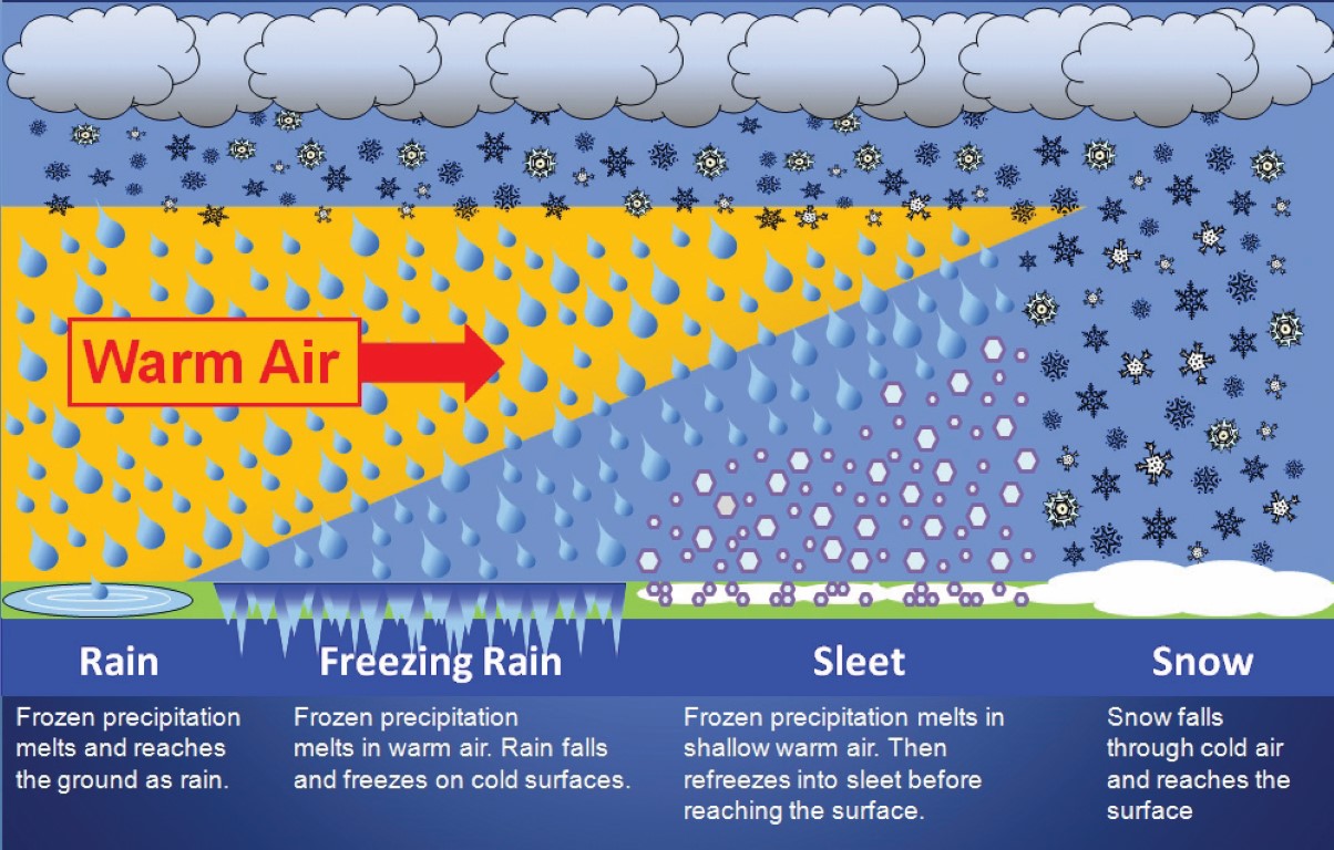
The snow will continue, moderate to heavy at times through the morning hours for most areas, as warmer air surges in aloft, with temperatures remaining near or below freezing at the surface. This will cause the snow to mix with and change over to sleet for a time, before the sleet changes over to freezing rain, with plain rain likely far south and east.
As is usually the case, the changeover will occur quicker in southern Maryland, and later north and west of I-95. Far western Maryland will likely stay mostly snow, but some sleet is possible there as well.
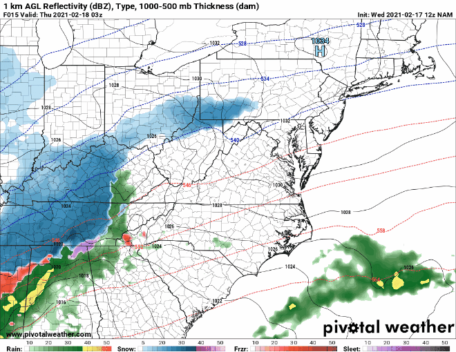
Model Output
Here is a quick view of the latest NAM output, showing the general timing of the system, and the transition from snow to wintry mix. Snow overspreads the area before sunrise tomorrow, and everything winds down during the evening hours.
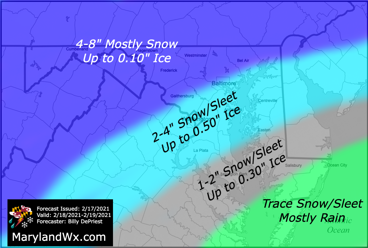
Snow, Sleet, Ice Forecast
Here is my current forecast for snow, sleet, and ice accumulations. This forecast is based on the overnight models, as well as this morning’s NAM model output. While the snow will likely cause moderate impacts, the real concern is the amount of ice accumulation that is possible along and south of I-95.
NWS Watches, Warnings, Advisories
At this time, Winter Storm Warnings (pink) and Winter Weather Advisories (purple) have been posted for most of the state west of the bay.

I will continue to monitor the latest trends and model data, and I will post an update this afternoon or evening if needed.