
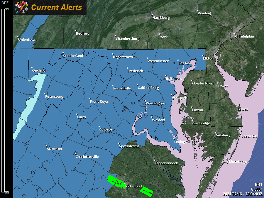
The National Weather Service has issued Winter Storm Watches for all areas west of the bay ahead of the next storm system that will bring wintry weather to our area late tomorrow night into Thursday.
The models continue to trend colder, and the threat of heavy snow along with ice accumulation is growing.
Here is the latest European model run, showing the possible evolution of the storm:
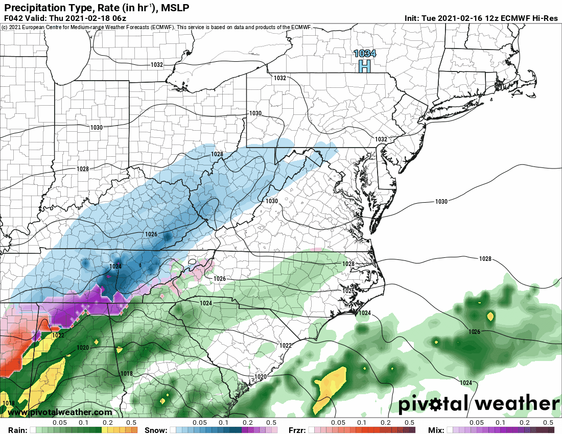
In this scenario, snow would overspread the state from SW to NE during the early Thursday morning hours, becoming heavy at times. Areas along and south and east of I-95 would mix or turn over to sleet and freezing rain, with plain rain along the coast. The storm continues into Thursday night and ends by Friday morning.
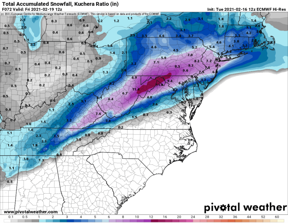
The result of this run is heavy snow, mainly north and west of I-95, with amounts tapering off to the south and east as mixing occurs:
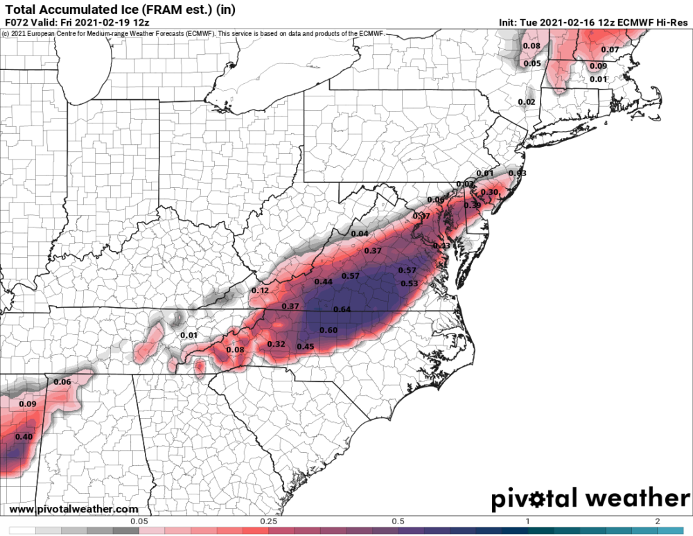
Ice accumulations would be impactful as well:
Please remember, this is not a forecast, and is just one model run used to illustrate general timing and the possible evolution of the system. I’ll have a full update tomorrow morning, along with my snowfall forecast.