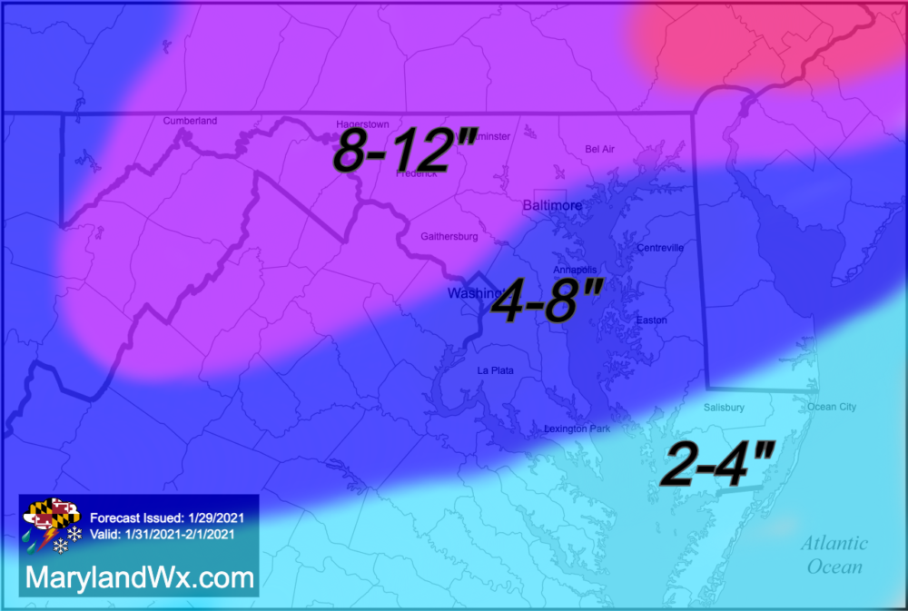
A complex storm system will bring a significant snowfall to our state Sunday into Monday. Low pressure will move into the Ohio Valley Sunday, and die out as new low pressure develops off the east coast. As a result, light snow will break out from SW to NE Sunday morning, and will continue, moderate to possibly heavy at times throughout the day, with several inches of accumulation by sunset. There will likely be a lull in the precipitation Sunday night, as the energy from the first low transfers to the coast. As the precipitation becomes lighter, it is likely that areas along and south and east of I-95 changeover to a wintry mix. This period of mixed precipitation should change back over to snow early Monday morning, as the coastal low intensifies and colder air is drawn back into our area.
This is where the forecast becomes tricky, as the amount of snow that we see in this “second half” is entirely dependent on the strength and location of the coastal low pressure system. Historically, the coastal low in these situations tends to develop too late and too far north for us to get any appreciable snowfall, but there are a few exceptions, and this could be one of them.

Right now, it looks like we will see a bit more snow, perhaps another 2″ or so from the coastal low before it pulls away later in the day on Monday. At this time, a storm total of 2-4″ on the lower Eastern Shore, 4-8″ across central Maryland and the Eastern Shore, and 8-12″ north and west of I-95 seems likely.
I’ll have a final forecast out tomorrow.
