
An area of low pressure will bring precipitation into our area this afternoon and tonight. At the onset, it will be warm enough for rain in most areas, but as the rain falls, it will cool the atmosphere enough to change the rain to a wintry mix by this evening.
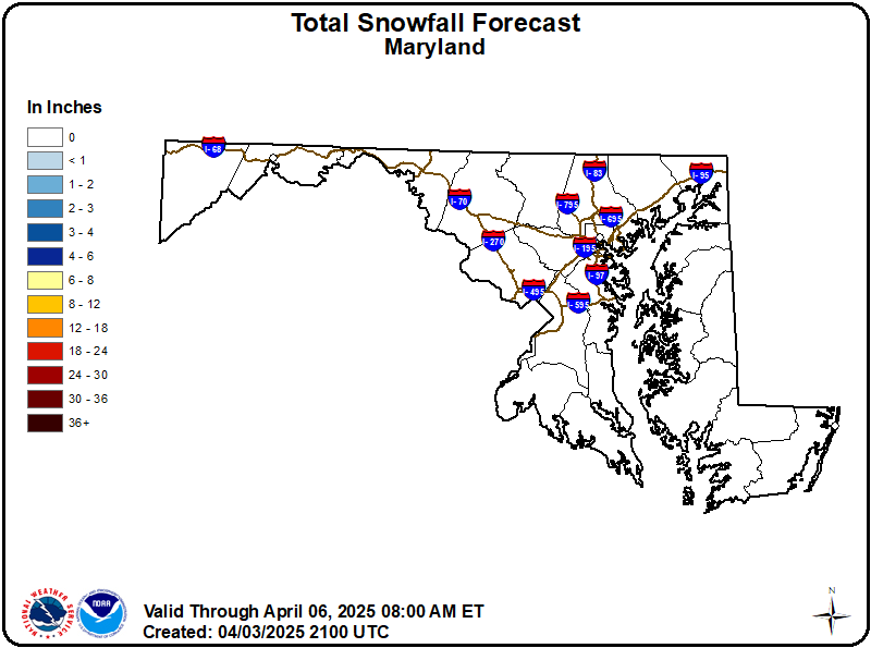
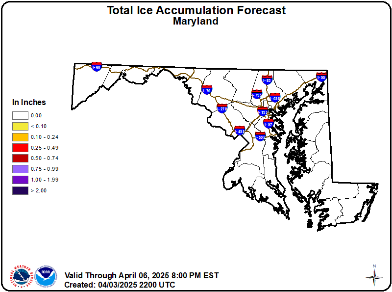
Areas north and west of I-95 face the greatest chance of impactful frozen precipitation. The National Weather Service has issued a Winter Weather Advisory from I-95 westward into Washington county, with 1-2 inches of snow/sleet, and up to .20″ of freezing rain expected. Farther west, a Winter Storm Warning is in effect for Garrett and Allegany counties, where 1-3″ of snow/sleet and up to .40″ of freezing rain accumulation is possible. For the metros and areas south and east, some snow/sleet/freezing rain is expected, but accumulations should be minimal.
Here are the snowfall and ice accumulation forecasts from the National Weather Service:
If you are out and about this evening or tonight, be careful and aware that snow and ice accumulations could impact your travel, especially north and west. As the system pulls away, the mix should wind down tomorrow morning and temperatures will rise into the upper 30s to low 40s.