
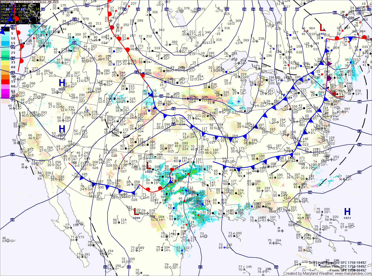
A WINTER STORM WATCH has been issued for all of Maryland. In effect tomorrow evening into Monday.
A complex area of low pressure will approach the area from the southwest tomorrow. The low will track off the coast to our south, spreading accumulating snow into the area.
Recent model trends have pushed the storm further south, putting the state on the northern edge of the precipitation. This means that a sharp cutoff of snowfall may occur over northern Maryland while the heaviest snowfall will be across the southern portions of the state, west of the bay.
The snow may begin as rain tomorrow evening before changing over as we head into tomorrow night. Snow will continue, moderate at times into early Monday morning before tapering during the morning hours.
There are several factors that will work against accumulation. The first is the marginal cold air. Temperatures will likely be in the low 30s for the majority of the storm. Another is the mid-March sun angle. The ground will absorb a lot of solar radiation and will be relatively warm. One more factor will be the warm air that is currently over the area. Highs today have reached the low to mid 60s in most places. All of these combined will work against snow totals.
The somewhat uncertain storm track combined with the above factors makes this forecast extremely tough.
Current Snowfall Forecast
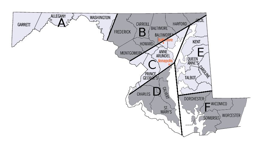
Zone A: 3-6″
Zone B: 1-3″
Zone C: 2-4″
Zone D: 3-5″
Zone E: 2-4″
Zone F: 1-3″
If a major change to the forecast is needed, an updated blog will be posted tonight or tomorrow morning.