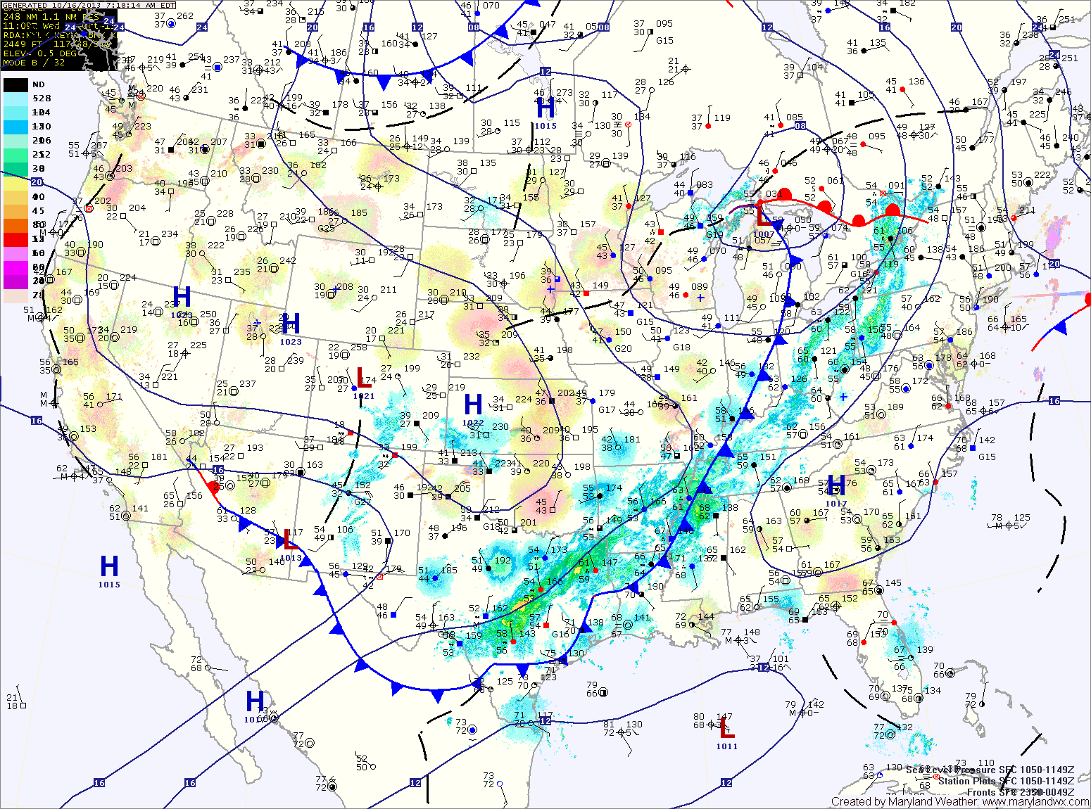
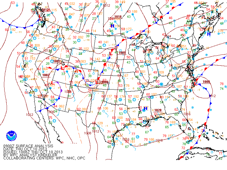
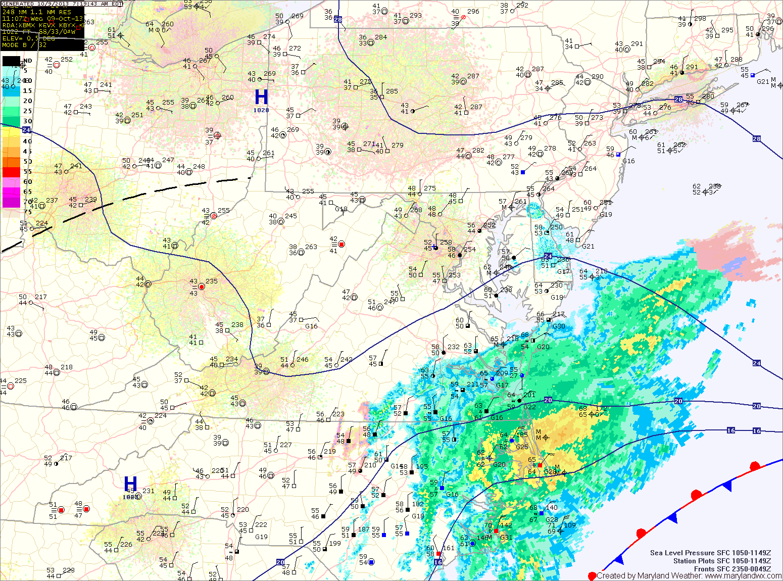
Cold Front Brings Showers Today

Current Surface Map
Current Surface Map
A cold front will approach today and move through tonight. As it does, expect scattered showers to affect the state this evening. Highs today will be in the low to mid 70s.

High pressure builds in tomorrow, leading to a sunny and cooler day. Highs will be in the mid to upper 60s.

Saturday will start out partly sunny, but a weak cold front will move through during the evening and will touch off another round of scattered showers during the late afternoon. Highs will be in the upper 60s.

Cloudy Today; Cold Front Crosses Tomorrow

Current Surface Map
Current Surface Map
A cold front to our west will keep extensive cloud cover over our area today. Highs will be around 70 degrees.

The front will continue to push eastward tonight and will be in the area tomorrow. Scattered showers will break out ahead of the front, affecting the area tomorrow evening. Highs will be in the low 70s.

The front will cross tomorrow night and cooler and drier air will move in to the region. Highs on Friday will be in the mid 60s with decreasing clouds.

Mostly Sunny Today; Cold Front Crosses Thursday Night

Current Surface Map
Current Surface Map
High pressure will bring mostly sunny skies today as it moves in from New England. Highs will be around 70 degrees.

Clouds will increase tomorrow as a cold front approaches from the west. Highs will be in the low 70s under partly sunny skies.

Thursday should remain mostly dry under partly sunny skies with a chance of showers developing Thursday night as the front passes through. Highs on Thursday will be in the low 70s.

The front will stall out to our south and east and an area of low pressure will form along it. This low will bring a chance of showers Friday. Highs on Friday will be in the mid to upper 60s.

Partly Sunny Today; Cold Front Crosses Wednesday Night

Current Surface Map
Current Surface Map
After bringing copious rainfall to the area, including 4.86″ here in Millersville, the drying trend will continue as the area of low pressure continues to weaken and move away. There will still be more clouds than sun, but it will be dry with highs in the upper 60s.

Clouds will decrease tomorrow with highs around 70 under mostly sunny skies.

Clouds will thicken again on Wednesday as a cold front approaches from the west. Highs will be in the low 70s.

The front will pass through Wednesday night bringing a chance of showers as it does.

Rain Today and Tonight; Drizzle through Weekend

Current Surface Map
Current Surface Map
***Flood Watches and Warnings are in effect for portions of the state. Please monitor our Alerts Page for the latest information.***

Coastal low pressure remains off the Delmarva coast this morning, continuing to push rainfall into our area. 2-3″ of rain has already fallen across the area, and another 1-2″ is possible today into tonight. Highs today will be in the low 60s.

Periods of rain will continue tonight and into tomorrow morning before tapering to drizzle as the low continues to weaken and slowly move away. Even as the low moves away, the region will remain in northeasterly flow, keeping the clouds and areas of drizzle around through Sunday. Highs both days will be in the low to mid 60s.

Rain Today and Tomorrow; Showers and Drizzle Through Weekend

Current Surface Map
Current Surface Map
Low pressure remains off the Carolina coast and it continues to push rainfall into our area. Nearly an inch of rain has fallen so far with another inch possible through tomorrow. Highs will remain in the upper 50s today.

Periods of rain will continue tomorrow into tomorrow night before finally tapering to drizzle. Highs will be in the low 60s.

Unfortunately, the low will stick around into the weekend, leading to drizzle on both Saturday and part of Sunday. The drizzle should end during the day on Sunday as the low moves away and weakens and high pressure builds in. Highs will be in the mid 60s each day.

Cloudy, Cool and Rainy through end of Week

Current Surface Map
Current Surface Map
What was once Tropical Storm Karen is moving slowly up the eastern seaboard. The low is currently centered off the Georgia coast, drifting northward. A swath of rain has pushed into the Delmarva and will continue to spread north and westward today. Expect rain to move into southern Maryland over the next few hours and into central Maryland by the afternoon. Highs today will be in the low 60s.

The rain will overspread the entire state tonight and become steady. The rain will continue tomorrow and highs will remain in the low 60s.

Expect the rain to begin to lighten as we move into tomorrow night and Friday. Although the rain will decrease in intensity, showers are expected to continue through Friday and into Friday night. Rainfall totals of 1-4″ are likely, with the highest amounts along the coast and lowest amounts in the mountains.

Becoming Sunny Today; More Rain on the Way

Current Surface Map
Current Surface Map
High pressure continues to build into the region today, following yesterday’s frontal passage. Highs today will reach the upper 60s under decreasing clouds.

Clouds will increase again tomorrow as an area of low pressure that was originally Tropical Storm Karen moves up the east coast. Rain from this system will move into the area tomorrow night. Highs tomorrow will be in the mid 60s.

The slow moving low pressure will bring more rain to the area on Thursday. The rain could be heavy at times. Highs will be in the mid 60s.

The rain will likely linger into Friday before the low begins to move away. Highs will again be in the mid 60s.

Showers and Thunderstorms Today

Current Surface Map
Current Surface Map
A strong cold front with ample tropical moisture is moving into the region. A band of showers and thunderstorms has pushed into the western portion of the state and will continue a steady march to the east.

Some of the storms may become severe this afternoon, with damaging wind being the main threat. An isolated tornado cannot be ruled out. Rainfall totals of over an inch are possible from this system. Highs will be in the mid 70s.

The rain will taper off this evening, into tonight. High pressure builds in tomorrow bringing sunny skies and highs in the upper 60s.

Partly Sunny and Warm Today

Current Surface Map
Current Surface Map
Today will feature more clouds than sun, especially this afternoon. It will continue to be warm, with highs in the mid to upper 80s.

Tomorrow will be mostly sunny with highs in the upper 80s.

High pressure will hang on through Sunday, providing another dry day, although clouds will increase through the day as a cold front approaches from the west. It will continue to be warm, with highs in the mid to upper 80s.