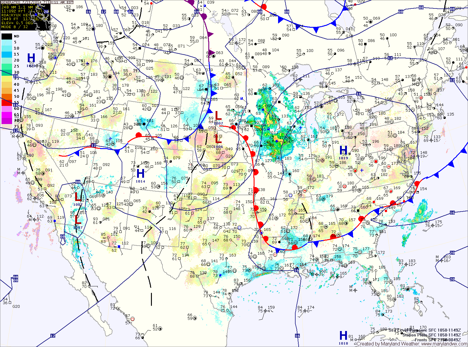
Severe Storms Possible this Afternoon
Showers and thunderstorms are likely this afternoon across the state. Some of the storms could become severe, with damaging winds and large hail as the primary threats. The greatest threat…

Everything you need to know about the weather in Maryland
The high will slide off of the coast tonight into tomorrow. This will allow warmer, more humid air to flow back into the area. Expect highs to be in the upper 80s to around 90 under mostly sunny skies.
A disturbance will move into the area Saturday night and Sunday, bringing a chance of showers and thunderstorms. Some of the storms could be strong to severe on Sunday with damaging winds being the most likely threat. The storms will also be capable of producing heavy rainfall, leading to localized flash flooding. Highs will be in the mid to upper 80s.
The cold front crosses tonight into tomorrow morning bringing an end to the rainfall. Cooler and drier air will filter in tomorrow, leading to mostly sunny skies by the afternoon. Highs will be in the low 80s with low humidity.
High pressure will remain overhead Thursday, leading to another pleasant day. Highs will be in the low to mid 80s.
The main threat with these storms will be very heavy rainfall, damaging winds and large hail. Highs will be in the upper 80s.
The front will press south of the state tonight, ending the storm threat.
The front should remain south of the state tomorrow allowing northwest flow to bring in cooler and drier air. Expect partly sunny skies and highs in the low to mid 80s.
We will remain in warm humid air tonight and tomorrow, keeping the threat of rain in the forecast. Additionally, another round of thunderstorms is likely tomorrow afternoon and evening. Highs will be in the low to mid 80s.
A cold front will approach on Friday, setting the stage for yet another round of showers and thunderstorms Friday afternoon and evening. The front will clear the area Friday night into Saturday morning, setting the stage for a drier weekend.
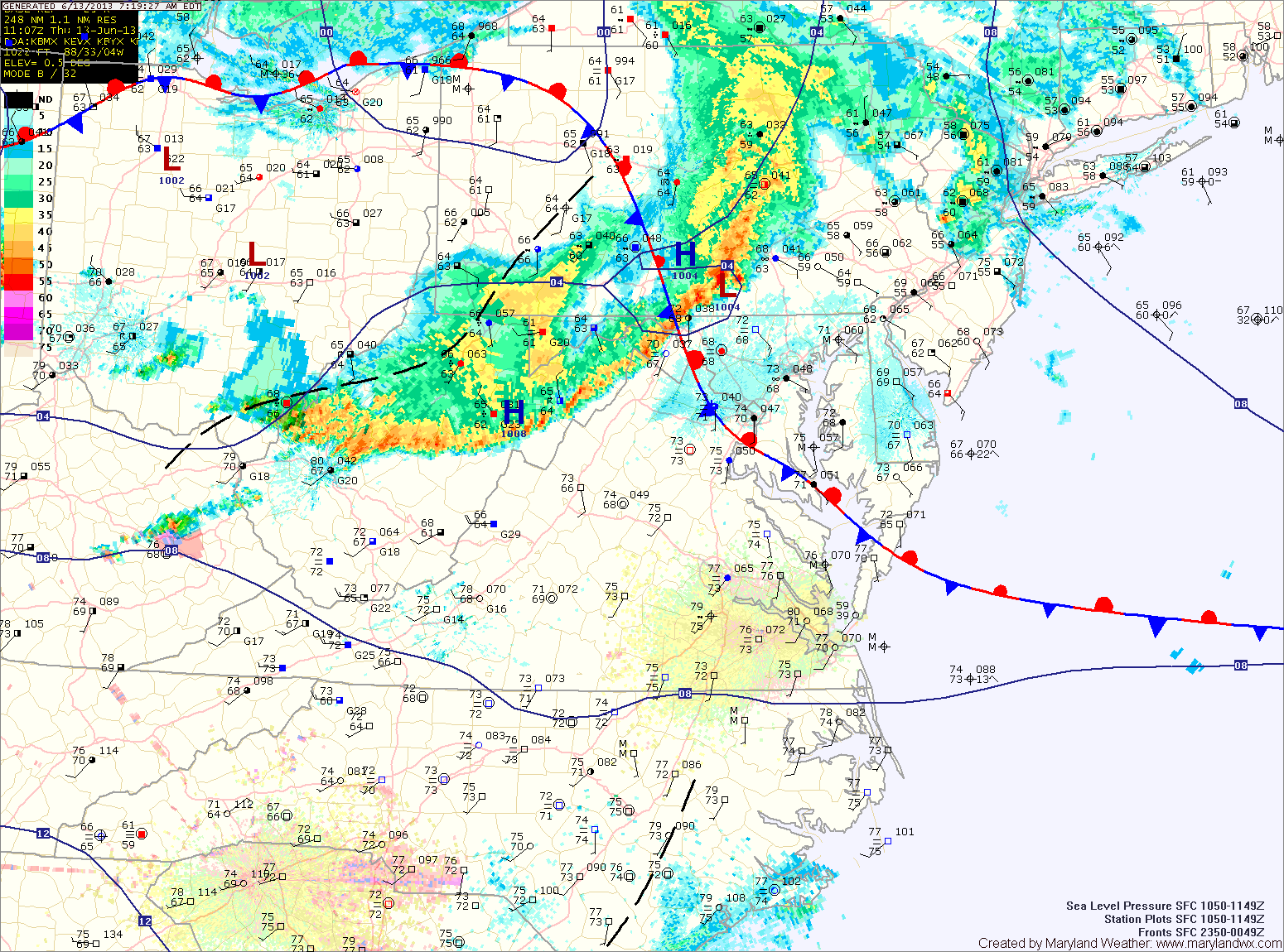
Light rain will continue behind the line for a few hours. As the low moves to our north this afternoon, winds will turn southerly and the atmosphere will destabilize again. Another round of severe thunderstorms is expected this afternoon and evening across the area. These storms will be capable of producing large hail, damaging winds, heavy rainfall and tornadoes. It will be warm, humid and windy today, with highs in the upper 80s to low 90s and winds gusting to 35mph.
Meanwhile, today will be partly sunny, warm and humid with an isolated shower or thunderstorm possible this afternoon. Highs will be in the upper 80s to around 90.
Thunderstorm activity will actually increase tonight as a piece of energy moves through the area. Some of these storms may become severe with damaging winds and heavy rainfall.
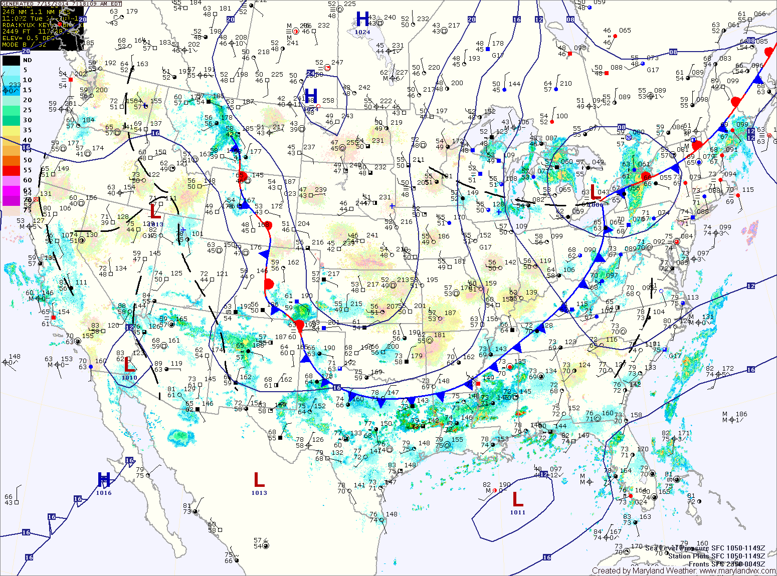
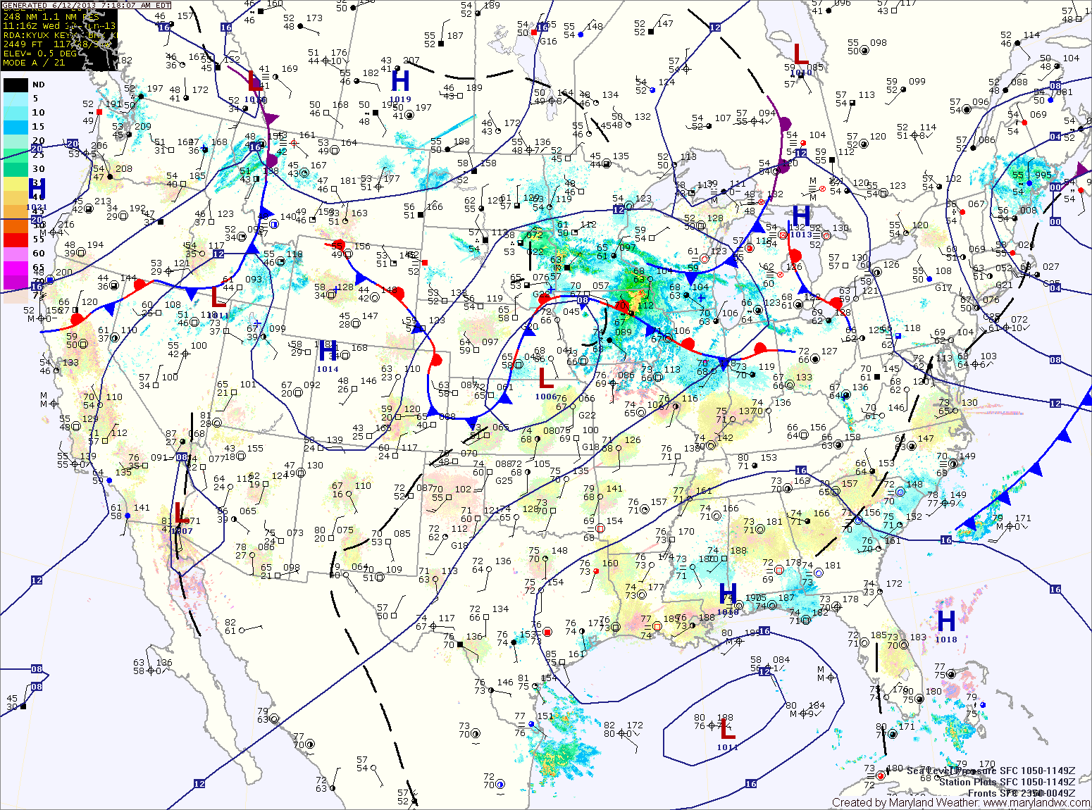
A thunderstorm complex over the midwest will move eastward tomorrow morning, bringing a chance of morning rain or thunderstorms to the area. Regardless of that system, as the low and cold front approach, all signs point to strong to severe thunderstorms developing over the area by afternoon. A wide-spread severe weather event is looking likely tomorrow afternoon, with damaging winds, large hail, heavy rainfall and isolated tornadoes possible across the entire state but especially along central and eastern Maryland. Highs will be in the upper 80s.