
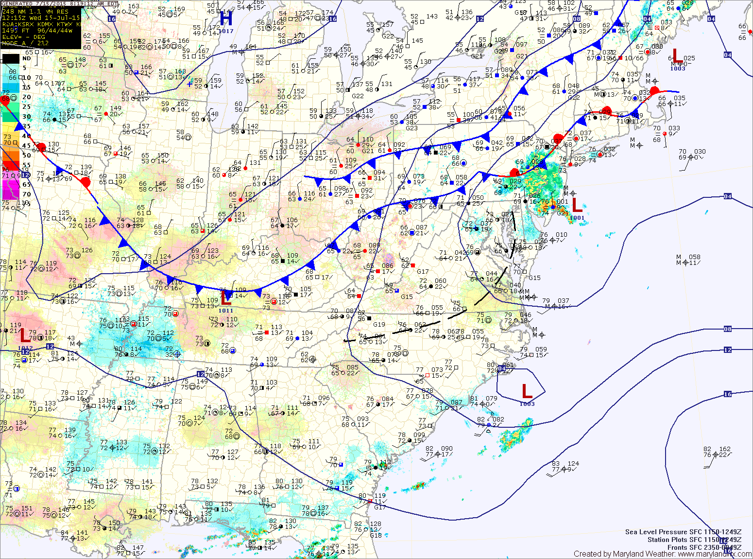
TODAY: Counter clockwise circulation around a departing area of low pressure will rotate showers and possibly a thunderstorm into our state today, moving from northwest to southeast. The showers and storms are expected to become more numerous this afternoon before dissipating this evening. Highs will be in the mid 80s.
THURSDAY: With high pressure building in, expect mostly sunny skies and highs in the low 80s.
FRIDAY: Another day under high pressure will lead to mostly sunny skies and highs in the low to mid 80s.
SATURDAY: The high pressure center shifts offshore allowing southerly flow to develop. Temperatures and moisture will increase allowing isolated afternoon showers and thunderstorms to develop. It will be warmer, with highs around 90°.
SUNDAY: Much like Saturday, expect warm and humid conditions with isolated afternoon and evening showers and thunderstorms. Highs will be in the low 90s.
OUTLOOK: Hot and humid conditions are likely to continue into next week. Highs will be in the low 90s Monday through Wednesday with a chance of showers and storms each day.
Stay up to date with storm information on your favorite social media site!
Follow me on Twitter, Facebook and Google+!