
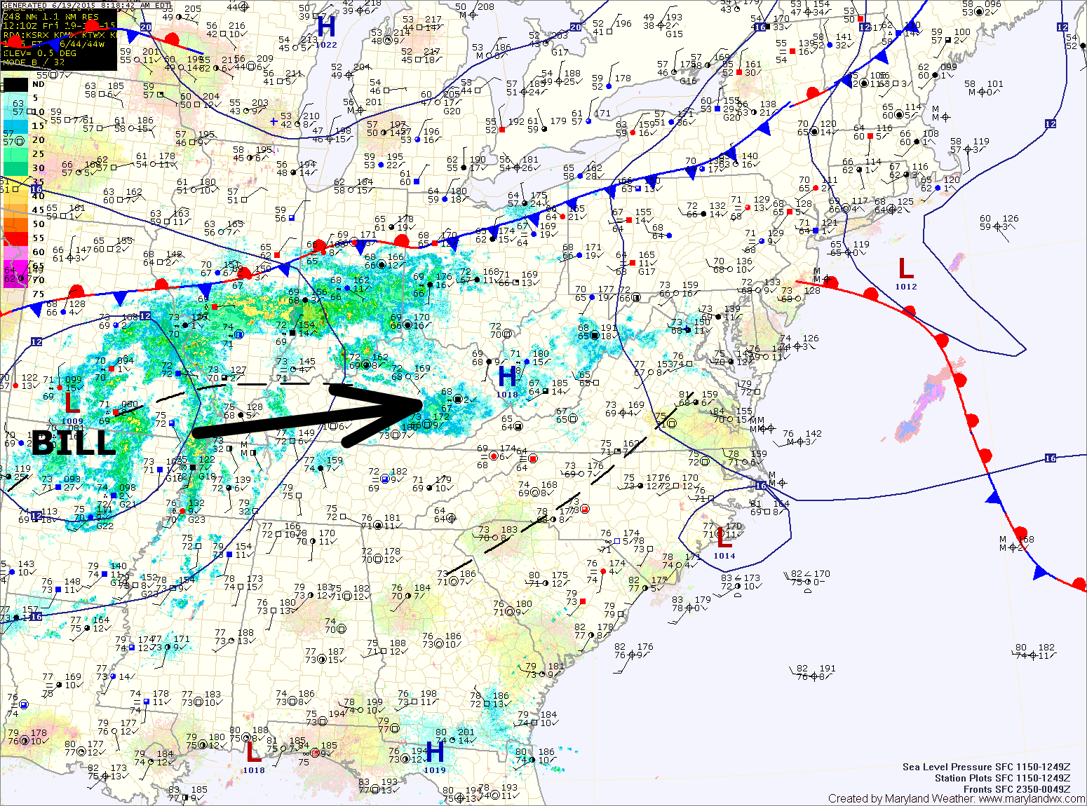
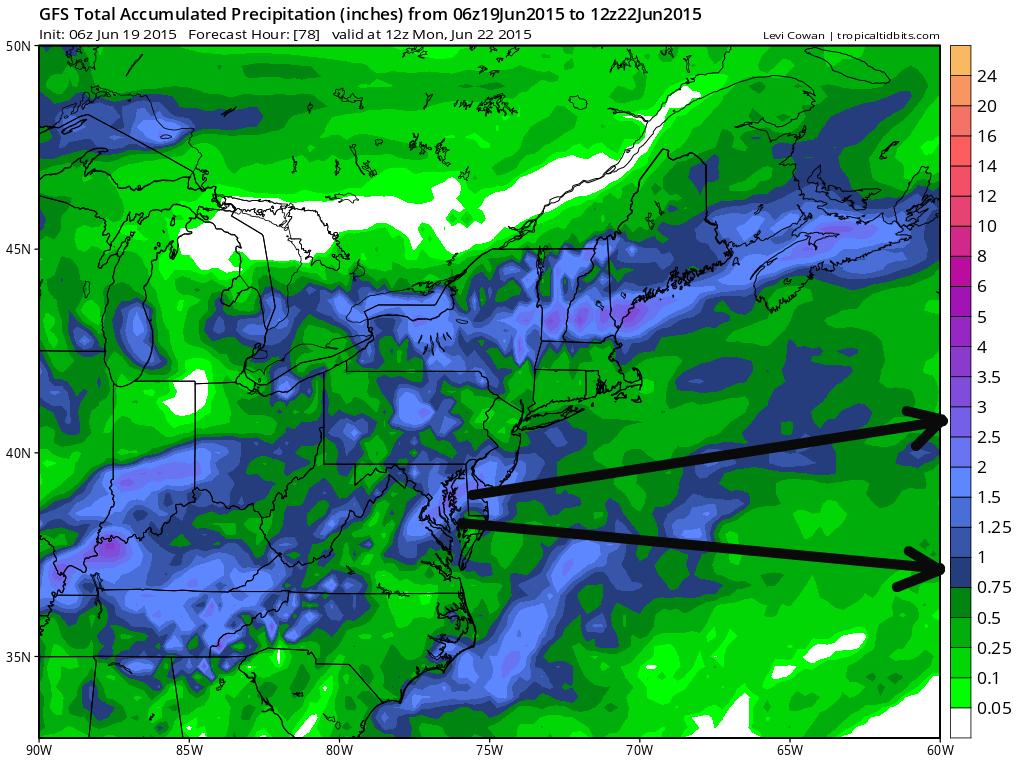
A weak front will slide into the area today, moving south of the state tonight. The remnants of Bill will pass through tomorrow night into Sunday, followed by another front Sunday night.
SATURDAY: Expect increasing clouds during the morning and afternoon, with scattered showers and storms developing during the afternoon hours. Highs will be in the low to mid 80s.
Showers and storms will increase in coverage during the evening hours as the remnants of Bill move in.
Rain will continue Saturday night, heavy at times, especially across central and southern parts of the state.
A cold front will be approaching from the west which will support isolated showers and thunderstorm activity during the afternoon and evening hours. Highs will be in the mid to upper 80s.
MONDAY: The front will likely stall out near or just to our south by Monday. Areas near the front may see afternoon storms, but most areas will remain dry. Highs will be around 90°.
OUTLOOK: The front will remain stalled to our south through midweek. Isolated storms will be possible Tuesday and Wednesday, with highs in the mid to upper 80s both days.
Stay up to date with storm information on your favorite social media site!
Follow me on Twitter, Facebook and Google+!