Current Surface MapHigh pressure will provide a mostly sunny day today with highs in the mid to upper 30s.
The high will move off the coast later today as an area of low pressure approaches from the southwest. The low will spread precipitation into the area tomorrow morning likely in the form of snow.
The snow will change to sleet during the afternoon and then eventually to rain by the evening along and east of I-95. This area may see up to an inch of snow before changing over.
URGENT - WINTER WEATHER MESSAGE NATIONAL WEATHER SERVICE BALTIMORE MD/WASHINGTON DC 1009 AM EST MON DEC 9 2013 WASHINGTON-FREDERICK MD-CARROLL-NORTHERN BALTIMORE-HARFORD-MONTGOMERY-HOWARD-SOUTHERN BALTIMORE-PRINCE GEORGES-ANNE ARUNDEL INCLUDING THE CITIES OF...HAGERSTOWN...FREDERICK... WESTMINSTER...GAITHERSBURG...COLUMBIA...BALTIMORE...ANNAPOLIS... ..WINTER…
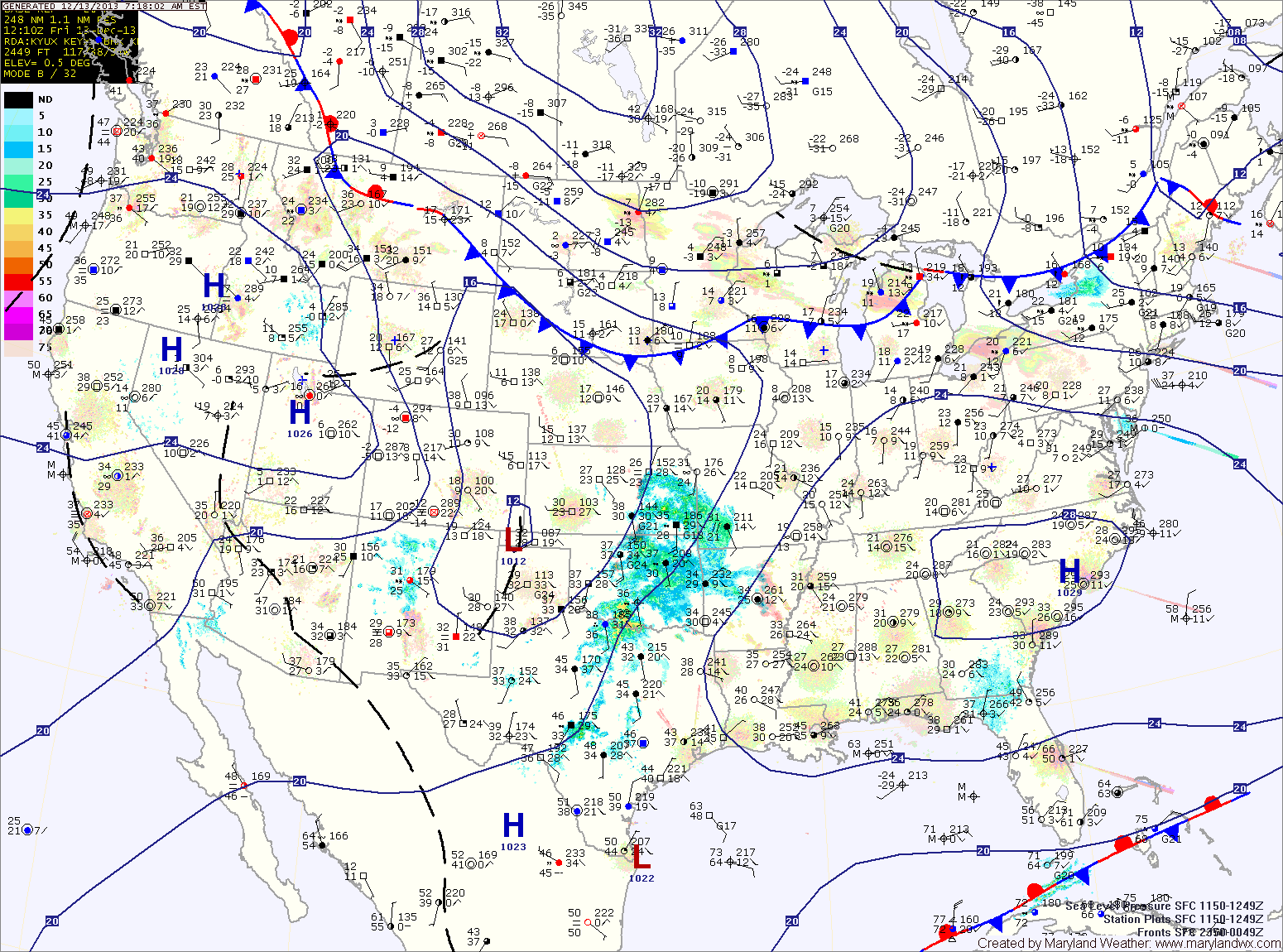
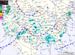
Current Surface MapThe biggest snowstorm in over 2 years will affect the area tonight and tomorrow. Today will feature increasing clouds with highs in the low to mid 40s.
Currently, a Winter Storm Warning is in effect for Allegany, Frederick, Garrett and Washington counties. A Winter Storm Watch remains in effect for the rest of the state west of the Bay.
Precipitation will overspread the state from west to east this afternoon and evening. In the mountains, it will start as snow, while further east, rain will develop and slowly transition to snow during the overnight.
By tomorrow morning, all areas west of the Bay will have transitioned to snow. Areas around and east of I-95 may mix with rain at times tomorrow morning, but the snow will continue, heavy at times through the day and into tomorrow night. Lower southern Maryland and the Eastern Shore will see more rain and have more mixing, cutting down storm totals. By tomorrow night, even these areas will see a period of all snow before it begins to taper off.
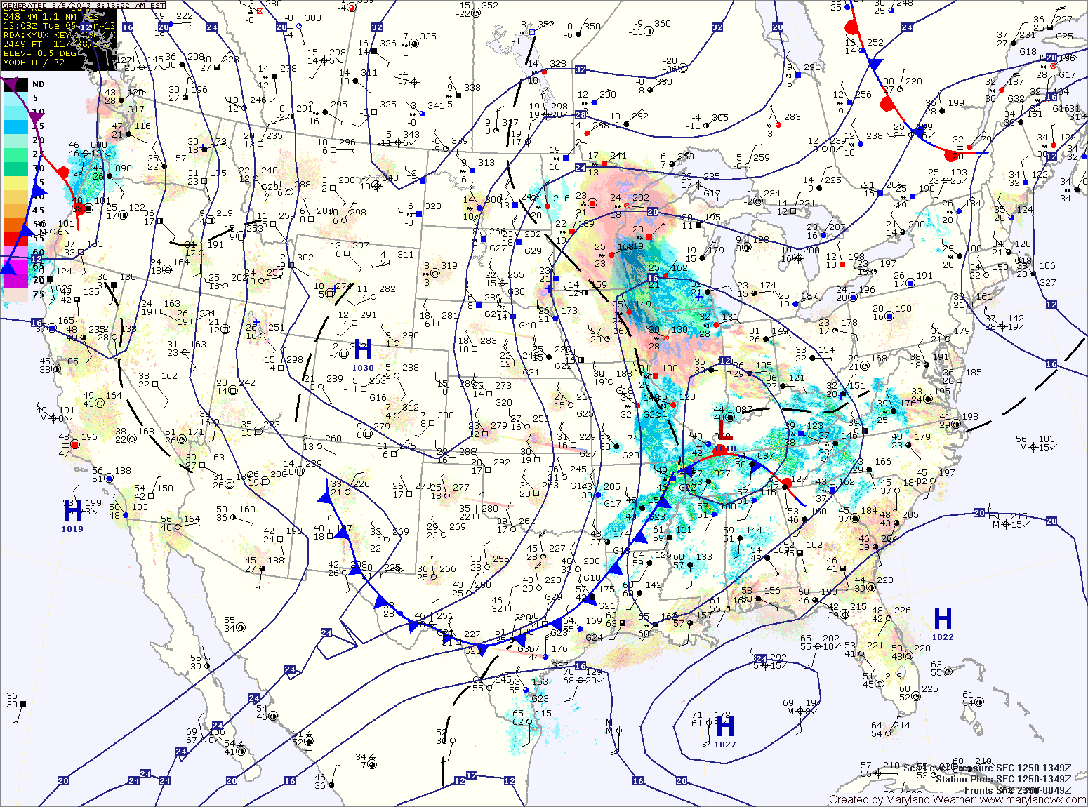
Current Surface MapHigh pressure will build into the area today, providing mostly sunny skies. Highs today will be in the low 40s.
Clouds will increase tomorrow, ahead of an area of low pressure that will move towards our area. Highs tomorrow will be in the low to mid 40s.
Expect light rain or light rain and snow to develop Tuesday evening. As the storm moves to our south, it will intensify and drag colder air into the area. This will change the rain over to snow late Tuesday night. Snow will continue through the day on Wednesday, tapering off Wednesday evening.
The marginal temperatures, combined with a March sun angle will work against accumulations, however with heavy snowfall rates, there is still a potential for a significant amount of accumulation of snow from this storm.
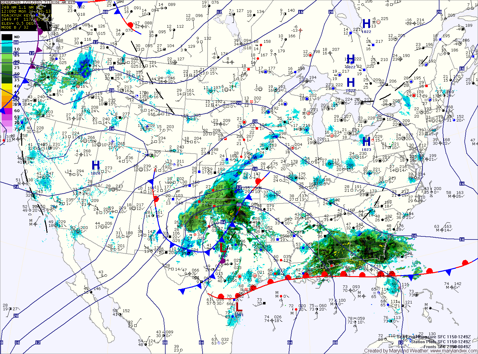
Current Surface MapHigh pressure will result in sunny skies today, with highs in the mid to upper 40s.
An area of low pressure will approach from the southwest tomorrow, spreading rain across the area. In far Western Maryland, it will be cold enough at the surface for a significant ice accumulation.
A Winter Storm Watch is in effect for Garrett and Allegany counties for up to a quarter inch of ice accumulation.
Elsewhere, the rainfall may begin as a brief period of sleet before quickly changing to plain rain. Highs tomorrow will be in the low to mid 40s.
The rainfall will continue into tomorrow night before tapering off. Rainfall totals of a half to three quarters of an inch are possible.
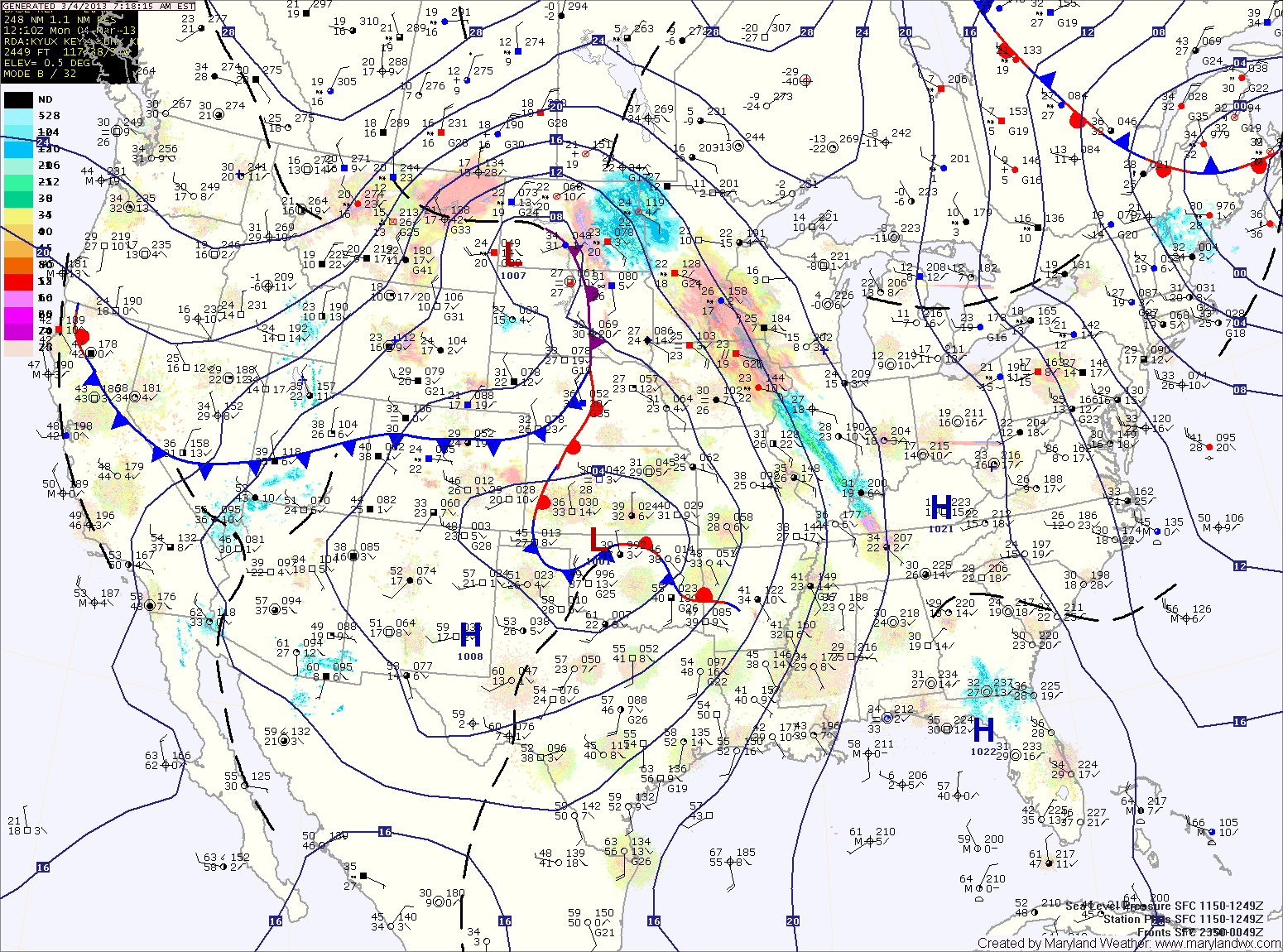
Models have come into agreement in bringing an area of low pressure towards our area tomorrow into tomorrow night. The low will pass by to our south, allowing colder air…
Current Surface MapHigh pressure will control the weather today, providing sunny skies. It will be breezy, with highs in the mid 50s.
A strong storm system that will bring heavy snow to the midwest will begin to spread clouds into our area tonight. The clouds will thicken tomorrow as the storm brings a strong cold front through the region.
Rain will develop out ahead of the front and will spread into the area during the late afternoon. Highs will be in the mid to upper 40s.
The rain will continue tomorrow night and into Friday morning. In the mountains of far Western Maryland, it will be cold enough for snow. Winter Storm Watches have been issued for Garrett and Allegany counties where near blizzard conditions are expected into Saturday.
This blog post will be updated throughout the day today as needed with updates on the forecast and progress of Hurricane Sandy. Please check this post periodically for updates. I…
WWUS41 KLWX 211424 WSWLWX URGENT - WINTER WEATHER MESSAGE NATIONAL WEATHER SERVICE BALTIMORE MD/WASHINGTON DC 924 AM EST MON FEB 21 2011 MDZ004>007-212230- /O.EXA.KLWX.WS.A.0004.110222T0200Z-110222T1200Z/ FREDERICK MD-CARROLL-NORTHERN BALTIMORE-HARFORD- INCLUDING THE CITIES…
I disagree a bit with the National Weather Service forecast for this storm. I do not think we will see Winter Storm Watch level snows (5+ inches) in the DC/Baltimore…