Skip to content
Maryland Weather

Everything you need to know about the weather in Maryland

  • Home
  • Blog Posts
    • Latest Posts
    • Archives
  • Forecasts
    • Local Forecasts
    • Forecast Discussion
  • Station Data
    • Current Data
  • Current Alerts
  • Radar Data
  • Maps & Satellite
    • WPC Maps
    • Satellite
  • Tropical
  • About
  • Subscribe!

windy

Post-Storm Update and Snowfall Totals

Current Watches, Warnings and Advisories issued by the National Weather Service: --- A *WIND CHILL WARNING* is in effect for: Allegany, and Garrett counties. --- --- A *WIND CHILL ADVISORY*…
Read More
Posted by By Billy DePriest Friday, January 5, 2018Posted inAlert, News

Update: Powerful Storm System to Bring Snow, Wind, and more Cold Air

This is an update to the original post, which can be found here. The storm remains on track to begin affecting our state this evening and lasting into tomorrow. Snowfall…
Read More
Posted by By Billy DePriest Wednesday, January 3, 2018Posted inAlert, Forecast, Update

Cold Air On the Way; Slight Chance of Light Snow Friday?

The much anticipated strong cold front that will flip the weather pattern is on our door step today and will pass through tonight. Showers are entering western Maryland this morning…
Read More
Posted by By Billy DePriest Tuesday, December 5, 2017Posted inForecast

Showers Today, Drizzle Tomorrow, Heavier Rain Sunday & Monday

A storm system is pushing areas of showers into our area this morning. Showers will continue through the day as highs reach the mid 40s. Clouds and drizzle will continue…
Read More
Posted by By Billy DePriest Friday, January 20, 2017Posted inForecast

Light Snow Likely Tomorrow Night; Less Likely this Weekend

A cold front will pass through the state today, ushering in colder air on gusty northwest winds. Before it does, highs will top out in the low 50s but wind…
Read More
Posted by By Billy DePriest Wednesday, January 4, 2017Posted inForecast

Bitterly Cold Air Sets Stage for Frozen Precip Saturday

An arctic front is poised to deliver bitterly cold air to our area Thursday and Friday. The cold air will stick around into the first part of the weekend as…
Read More
Posted by By Billy DePriest Tuesday, December 13, 2016Posted inForecast

Unseasonably Warm Today; Fall Returns this Weekend

With high pressure moving off of the east coast, southerly flow will usher warmer air into our region. Highs today will be in the mid to upper 60s. Major changes…
Read More
Posted by By Billy DePriest Friday, November 18, 2016Posted inForecast
Cold Front Will End Stretch of Warm Weather

Cold Front Will End Stretch of Warm Weather

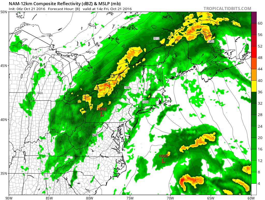
A cold front is moving into the region today, spreading showers across the state as it does. The front will push into western portions of the state this morning, reaching…
Read More
Posted by By Billy DePriest Friday, October 21, 2016Posted inForecast

Pleasant Today; Hermine Impacts the Weekend

High pressure will create a very pleasant day in our area today. Highs will be right around 80 with low humidity and plenty of sunshine. Hurricane Hermine came ashore last…
Read More
Posted by By Billy DePriest Friday, September 2, 2016Posted inAlert, Forecast

More Cold Air on the Way; Rain/Snow Showers Likely Tomorrow

Summary: Low pressure will push through tonight into tomorrow. Cold high pressure builds in Sunday followed by a cold front on Monday. An area of low pressure will move into…
Read More
Posted by By Billy DePriest Friday, April 8, 2016Posted inAlert, Forecast

Posts pagination

Previous page 1 2 3 4 … 14 Next page
Current Conditions
Current Air Quality Index
Current Radar
Current Satellite
CPC 8-14 Day Temperature Outlook
CPC 8-14 Day Precipitation Outlook
CPC 1 Month Temperature Outlook
CPC 1 Month Precipitation Outlook
Email Subscription
Get the latest blogs emailed to you!


Instagram

maryland_wx

B.S. Meteorology @valparaiso_university | Skywarn Spotter | Providing weather info including forecasts and alerts for the state of Maryland.

🌬 As cold high pressure continues to settle ove 🌬 As cold high pressure continues to settle over the area, Frost and Freeze alerts have been issued for most of the state.

⚠️ A Freeze Warning is in effect for: Baltimore, Carroll, Frederick, and Harford counties...
* IMPACTS...Frost and freeze conditions will kill crops, other sensitive vegetation and possibly damage unprotected outdoor plumbing.

⚠️ A Frost Advisory is in effect for: Anne Arundel, Caroline, Cecil, Charles, Howard, Kent, Montgomery, Prince Georges, Queen Anne's, and Washington counties...
* IMPACTS...Frost could kill sensitive outdoor vegetation if left uncovered.

See https://www.marylandwx.com/alerts/ for more details.
Rainfall associated with Hurricane Ian has entered Rainfall associated with Hurricane Ian has entered southern portions of the state and will continue to move northward this evening. 

Expect periods of moderate to heavy rainfall tonight into early tomorrow morning before tapering to lighter showers through the day. Steadier rainfall may develop again on Sunday, lasting into Sunday evening as the remnant low spins off the coast.

Rainfall totals of 1-2" are likely by Monday morning.
A strong cold front will bring big changes to our A strong cold front will bring big changes to our weather, just in time for the autumnal equinox! The front will cross today with some showers. Behind it, gusty NW winds will bring in much cooler air. Lows tonight and tomorrow night will fall into the 40s for most areas. Highs tomorrow will only reach the mid 60s. Welcome to fall!
Follow on Instagram
Facebook
Cover for Maryland Weather
10,725
Maryland Weather

Maryland Weather

Weather conditions, forecasts, watches and warnings from the National Weather Service and other weather updates for the state of Maryland.

Operated by Billy DePriest


Affiliations
USA Weather Finder
Copyright 2025 — Maryland Weather. All rights reserved.
Scroll to Top