Isolated showers and storms this afternoon
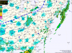
Current Surface Map
A cold front will move through the state tonight bringing with cooler and drier air with it but before it does, we will have one more day of warm and humid conditions.

The moist airmass will also allow another round of showers and thunderstorms to develop this afternoon. Today’s activity will be more isolated and will be more confined to areas along the bay. Some of these storms may become severe, with large hail and damaging wind being the primary threats. Highs today will push into the low to mid 80s.

Another tricky temperature day

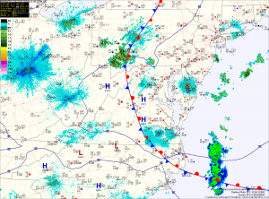
Current Surface Map
Just like yesterday, a stationary front remains draped across the state. Yesterday, we saw temperatures in the upper 50s in northeast Maryland and upper 80s across the Potomac in central Virginia. There is a bit more confidence that the front will move to the northeast today. This should push temperatures into the 80s in most spots along and west of I-95, while areas to the east rise into the 70s.

Also like yesterday, thunderstorms are expected to form over the mountains and move eastward, reaching the metro area by late afternoon. The primary threat from these storms will be strong winds and large hail.