Cloudy, Cool and Rainy through end of Week
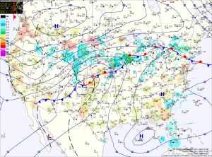
Current Surface Map
Current Surface Map
What was once Tropical Storm Karen is moving slowly up the eastern seaboard. The low is currently centered off the Georgia coast, drifting northward. A swath of rain has pushed into the Delmarva and will continue to spread north and westward today. Expect rain to move into southern Maryland over the next few hours and into central Maryland by the afternoon. Highs today will be in the low 60s.

The rain will overspread the entire state tonight and become steady. The rain will continue tomorrow and highs will remain in the low 60s.

Expect the rain to begin to lighten as we move into tomorrow night and Friday. Although the rain will decrease in intensity, showers are expected to continue through Friday and into Friday night. Rainfall totals of 1-4″ are likely, with the highest amounts along the coast and lowest amounts in the mountains.

Becoming Sunny Today; More Rain on the Way

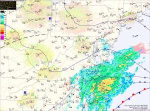
Current Surface Map
Current Surface Map
High pressure continues to build into the region today, following yesterday’s frontal passage. Highs today will reach the upper 60s under decreasing clouds.

Clouds will increase again tomorrow as an area of low pressure that was originally Tropical Storm Karen moves up the east coast. Rain from this system will move into the area tomorrow night. Highs tomorrow will be in the mid 60s.

The slow moving low pressure will bring more rain to the area on Thursday. The rain could be heavy at times. Highs will be in the mid 60s.

The rain will likely linger into Friday before the low begins to move away. Highs will again be in the mid 60s.

Partly Sunny and Warm Today

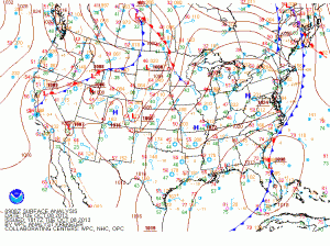
Current Surface Map
Current Surface Map
Today will feature more clouds than sun, especially this afternoon. It will continue to be warm, with highs in the mid to upper 80s.

Tomorrow will be mostly sunny with highs in the upper 80s.

High pressure will hang on through Sunday, providing another dry day, although clouds will increase through the day as a cold front approaches from the west. It will continue to be warm, with highs in the mid to upper 80s.