Continued Windy; Red Flag Warning in Effect
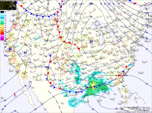
Current Surface Map
Current Surface Map
As cold Canadian high pressure moves into the region, winds will continue to gust to near 30mph. These winds, combined with very low humidity values will help spread any uncontrolled fires. Highs today will only reach the upper 40s to low 50s.

High pressure moves overhead tomorrow, calming winds and continuing the sunshine. The high will move off the coast during the afternoon and high clouds will begin moving in, ahead of low pressure to the south. Highs will be in the low to mid 50s.

Low pressure will move along the southeast coast then up and off the Carolina coast. Rain will move in overnight Thursday and continue through Friday morning. As the low moves away Friday afternoon, the rain will taper off and end during the late afternoon. Highs Friday will be in the mid to upper 50s.

Mostly Sunny and breezy again today

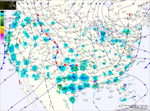
Current Surface Map
As an area of low pressure continues to build over eastern Canada, dry and windy conditions will continue across the area. Expect highs today to be in the upper 60s with wind gusts to near 30 mph this afternoon. As a result of the continued dry and windy conditions, a Red Flag Warning remains in effect for the state. A Red Flag Warning means that the combination of strong winds, low humidity and warm temperatures will create “explosive fire growth potential.”

The low begins to move south towards our area tonight, it will help drag cooler air into the area. Lows tonight will drop to near 40 in the cities and to near freezing north and west.