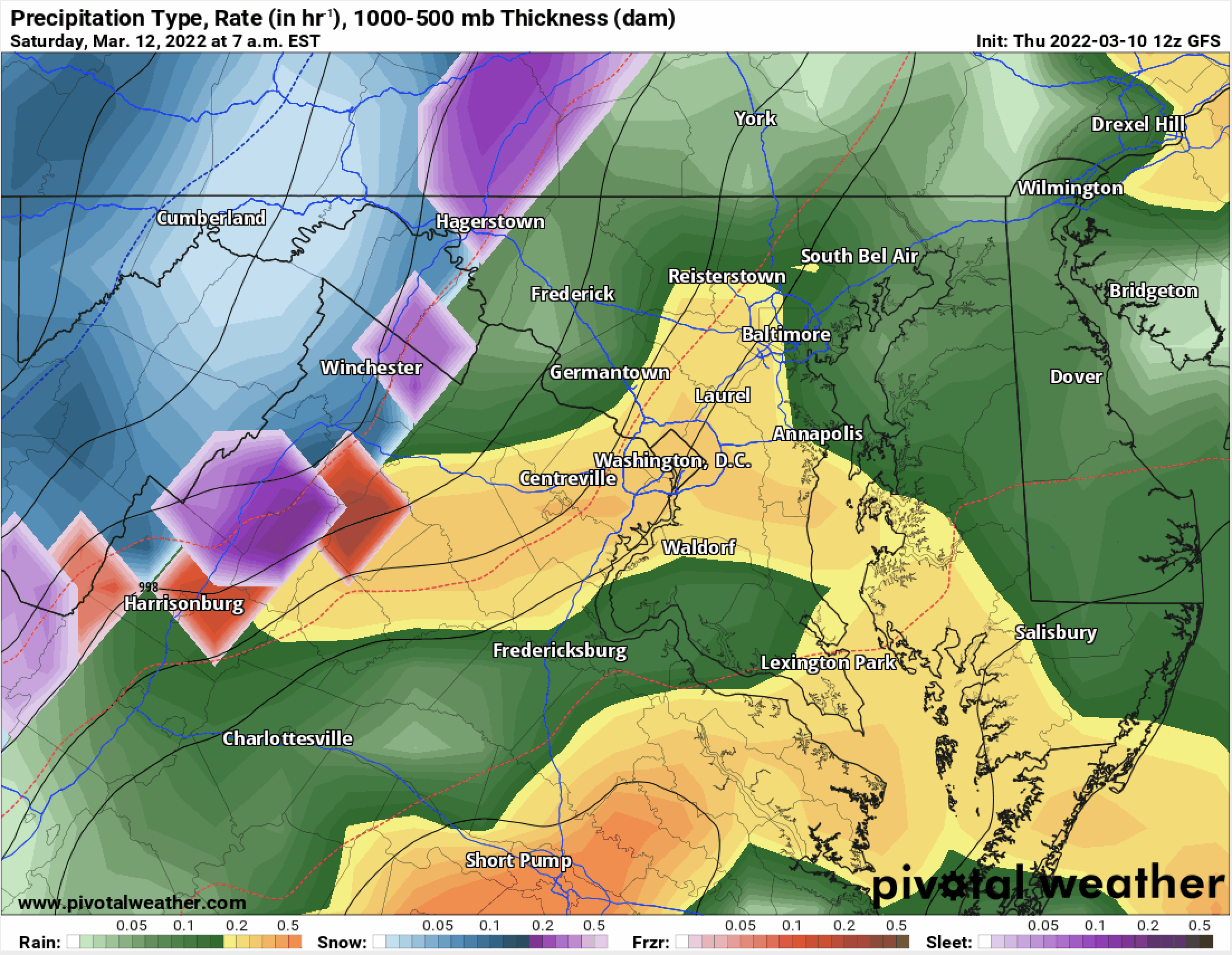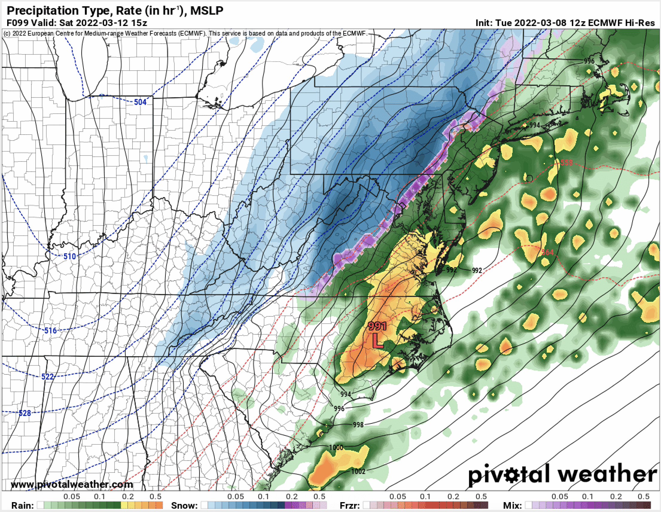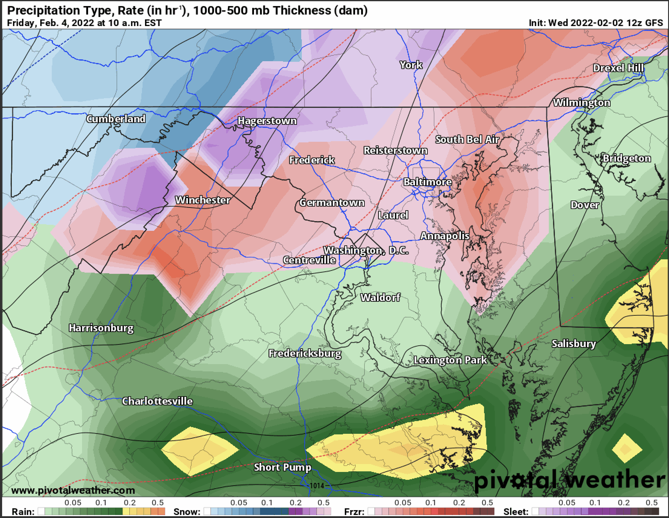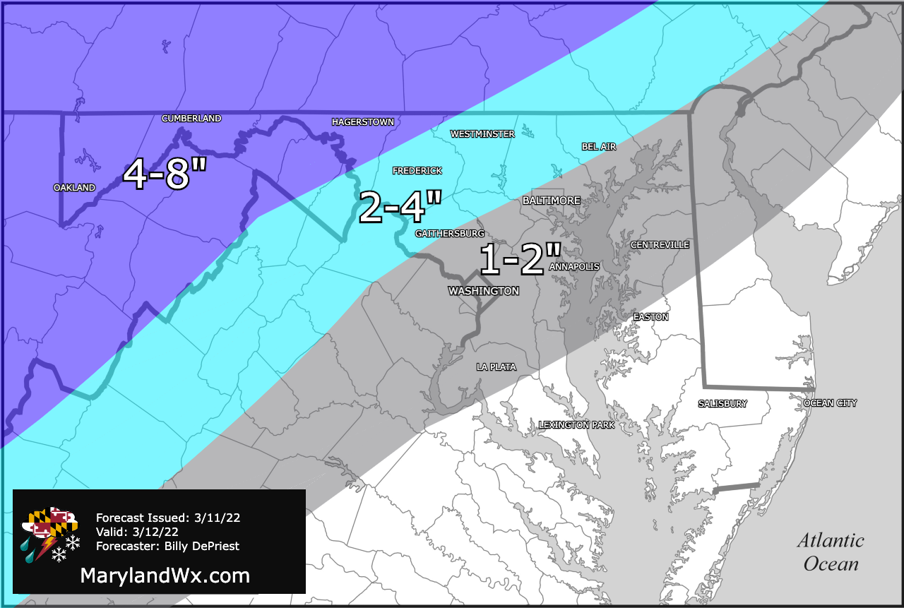
Potent cold front and low pressure to bring rain, snow, and very strong winds tomorrow
A strong cold front approaching from the west will deliver a dramatic temperature drop tomorrow as arctic air streams in on gusty northwest winds. Meanwhile, low pressure will be developing…