A Winter Weather Advisory remains in effect for: Allegany, Anne Arundel, Calvert, Caroline, Charles, Frederick, Garrett, Howard, Montgomery, Prince George's, Queen Anne's, St. Mary's, Talbot and Washington counties A Winter…
A weak cold front is passing through the state at this time, touching off light snow showers and flurries as it passes through. The front will move through this morning…
A storm system to our west continues to move towards the northeast. All areas are now seeing freezing rain or plain rain depending on location. Generally, areas to the south and east of Baltimore and Washington are climbing above freezing at this time while north and west remain below freezing and will remain below freezing for a few more hours.
It is in these areas that the Winter Storm Warning is in effect. Up to 1/3 inch of ice can be expected before the rain tapers off this afternoon.
The rain/freezing rain should end by early afternoon for all areas as the storm continues to move away from the area. Highs today will climb to around 40 degrees.
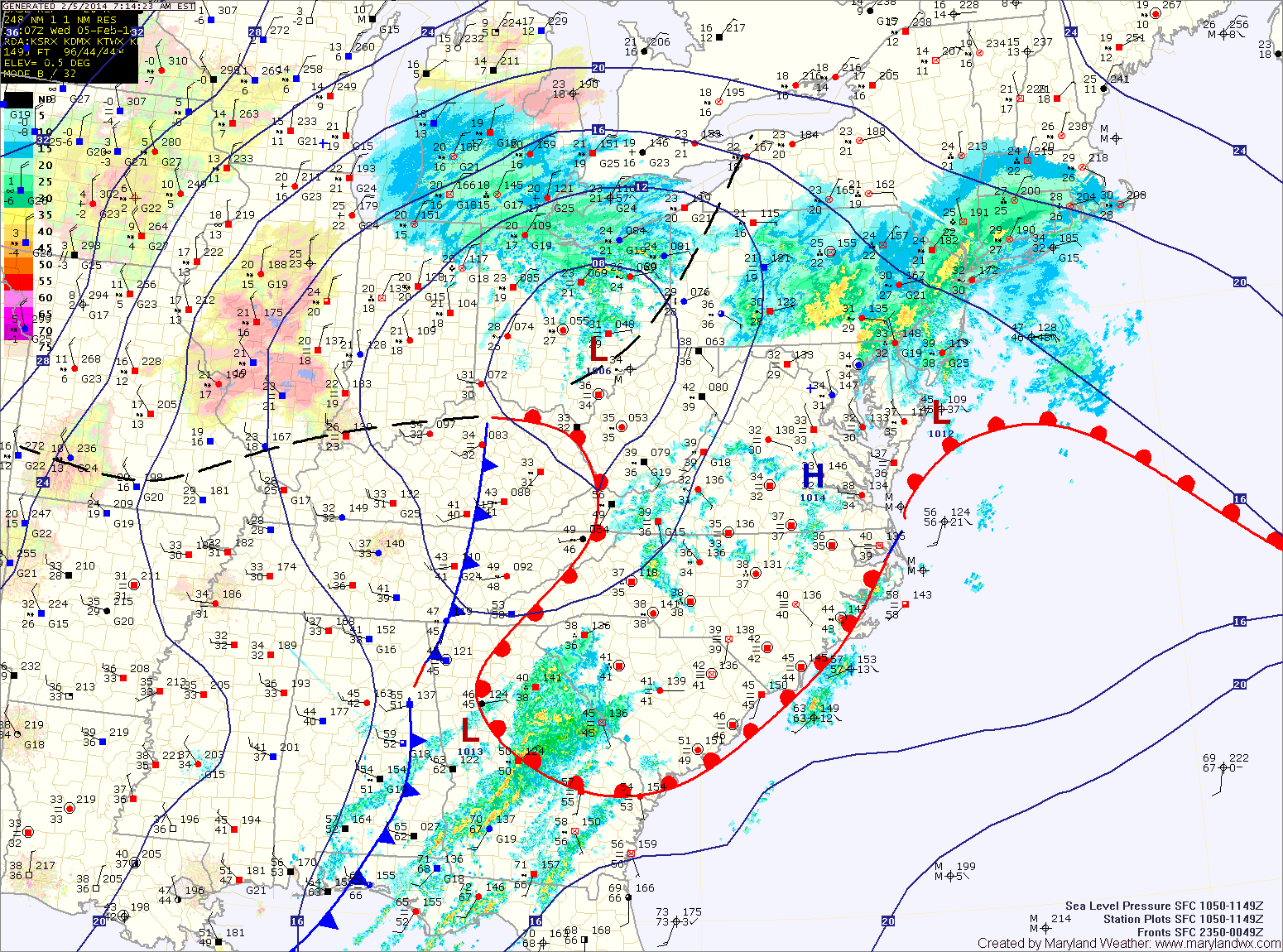
Current Surface MapThe next in a series of storms will approach today. This storm will pass by to our west, putting us on the warm side of the system. As the storm moves in and warmer air moves in aloft, cold air will be trapped at the surface east of the mountains. This will result in a wintry mix of precipitation tonight into tomorrow.
Along northern and western Maryland, a Winter Storm Warning has been issued. Expect snow to develop this evening, changing to sleet and then freezing rain. The freezing rain will likely last through the morning before temperatures warm above freezing tomorrow afternoon. Several inches of snow and sleet may fall, followed by up to 1/3 inch of ice from freezing rain.
Further south, into central Maryland, a Freezing Rain Advisory has been issued. Expect snow and sleet to develop this evening and change to freezing rain later tonight. Up to 1/10 inch of ice is possible before temperatures rise above freezing tomorrow morning, changing the freezing rain to plain rain.
Southern Maryland and the lower eastern shore will quickly rise above freezing and see mostly rain.
Today will see increasing clouds as another cold front moves through the region tonight. The front will have a little moisture with it, and will produce scattered flurries overnight as it crosses the state.
The main weather story is the storm system that will begin to affect the area tomorrow night.
Expect light snow and sleet to continue to develop over the area tonight, transitioning to freezing drizzle. The freezing drizzle will continue, off and on into Tuesday morning, before possibly…