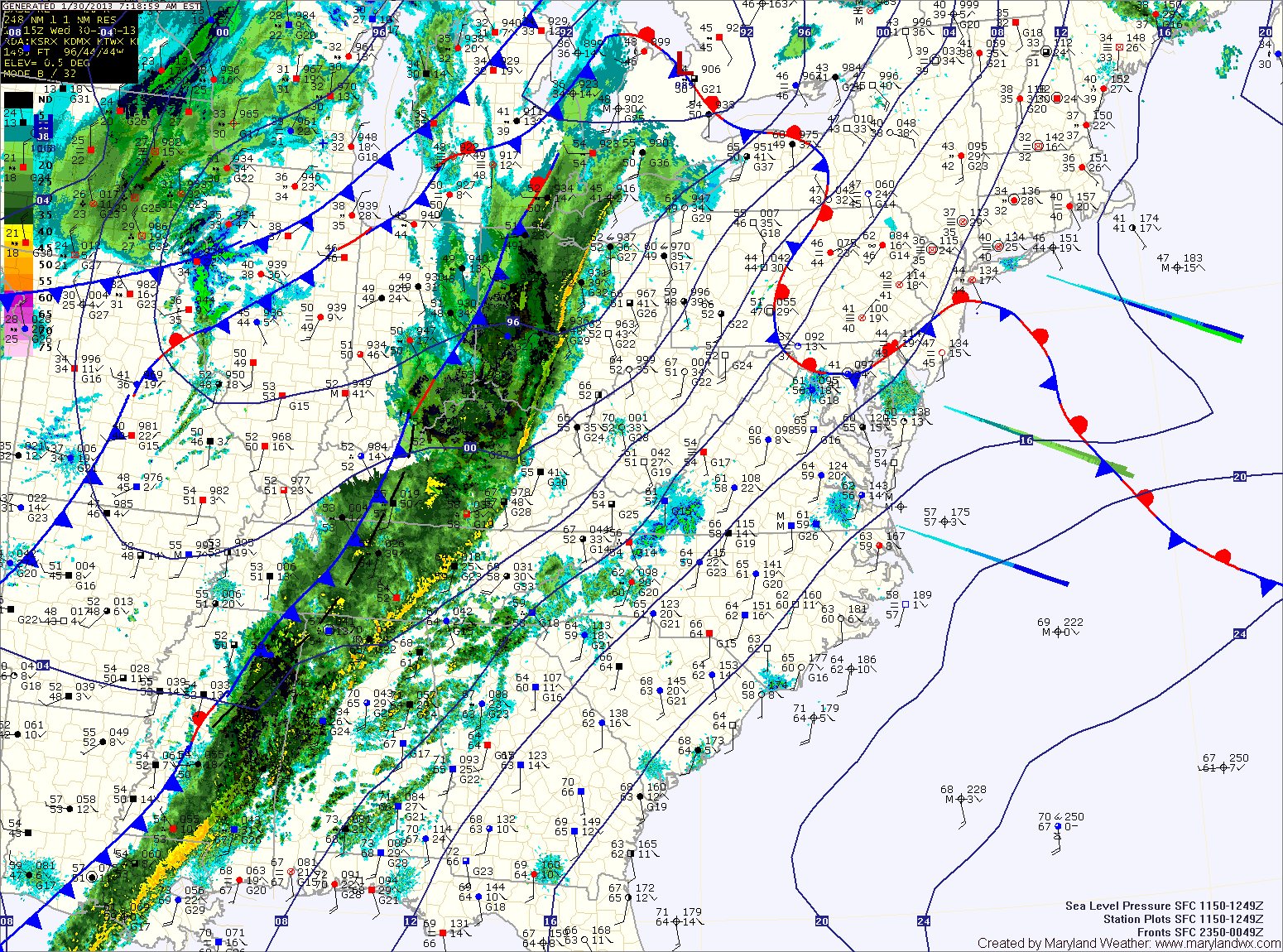
Showers likely into the afternoon; Continued warmth through Friday

Current Surface Map
Current Surface Map
A Freezing Rain Advisory is in effect until 10am for areas north and west of I-95.


A weak cold front is spreading showers through the state this morning. Some areas, especially north and west of I-95 are below freezing, causing icy spots. Temperatures everywhere will rise above freezing this morning, reaching the upper 40s to around 50. Showers will likely continue off and on into the afternoon before clearing out this evening.

High pressure builds in tonight and slides off the coast tomorrow. As a result, expect partly sunny skies and highs around 50.

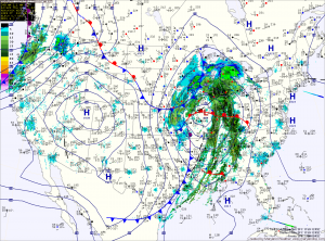
A stronger cold front will approach Thursday night, spreading showers into the area by Friday morning. Some of the showers may contain locally gusty winds as well. The showers will continue Friday morning and into the afternoon. The front will likely push through during the afternoon hours, bringing an end to the rain. Highs will be in the upper 50s to around 60.

Foggy Start, Warm Afternoon; Rain Late Tonight

Current Surface Map
Current Surface Map
Areas of fog will give way to partly sunny skies this afternoon. Southerly winds will increase through the day as a cold front approaches from the west. Highs today will be in the low 70s.

The front will spread rain showers and isolated thunderstorms into the area late tonight. Some of the showers and storms may produce locally gusty winds.

The front will continue to push showers and isolated storms through the area tomorrow The front will slow and may even stall along the bay Friday afternoon and evening. This will allow shower chances to persist into tomorrow night. Highs will be around 70 degrees.

Scattered Showers this Morning; Partly Sunny this Afternoon

Current Surface Map
Current Surface Map
Areas of light rain are moving through the state this morning while a warm front remains to our south. The front will lift northward this afternoon, bringing an end to the rainfall. Highs today will be in the low to mid 60s.

Tomorrow will see generally cloudy skies. Southerly flow ahead of an approaching cold front will increase winds through the day, with gusts near 25 mph by tomorrow night. Highs will be around 70 degrees.

The front will spread rainfall into the area late tomorrow night or early Friday morning. Winds will continue to gust to near 25 mph through the day on Friday. Additionally, an isolated thunderstorm is possible Friday with localized strong gusty winds. Highs on Friday will be in the low 70s.

Morning Fog; Afternoon Thunderstorms

Current Surface Map
Current Surface Map
Dense fog will continue to lift this morning, leaving cloudy conditions. As we warm this afternoon, scattered showers and thunderstorms will develop again. Some of the storms could produce locally heavy rainfall. Highs today will push into the mid to upper 70s.

High pressure builds in tonight and into tomorrow, before the next weather maker begins to affect us tomorrow afternoon. A cold front to the west will provide forcing to help shower and thunderstorm development during the afternoon and evening. Some of the storms could become strong to severe with gusty winds and hail. Highs tomorrow will push into the 80s.

The shower and storm threat will continue Friday night and Saturday as the front continues to march into the area. The storms Saturday afternoon and evening could once again turn severe. Highs will be in the mid to upper 70s.

Cold Front to Bring Showers and Storms Today

Current Surface Map
Current Surface Map
A cold front currently pushing through Ohio and will approach and cross the state this afternoon and evening. Widespread showers and thunderstorms are accompanying the front and will move into the area during the afternoon hours.

Ahead of the front, it will be warm and windy with southwest winds gusting to near 35mph. Highs today will push into the upper 70s to low 80s.

Showers and storms will move in from west to east during the late afternoon and evening, bringing locally heavy rainfall and strong, gusty winds. Flash flooding will be possible this afternoon and evening.

Cold Front to Bring Heavy Rain Tonight

Current Surface Map
Current Surface Map
A cold front will approach from the west today. Ahead of the front, temperatures will climb this afternoon into the upper 60s to near 70. Winds will also increase this afternoon, gusting to near 30mph.

Showers will develop later this afternoon, becoming more widespread this evening. Additionally, thunderstorms will be possible tonight.

Some of the storms may become severe with strong gusty winds. Rainfall totals of 1-2 inches are likely before the front clears the area early tomorrow morning.

Colder air will stream into the area tomorrow on gusty northwest winds. Highs will top out in the mid 40s.

Partly Sunny, Warmer Today; Rainy Tomorrow

Current Surface Map
Current Surface Map
A warm front will slowly push north through the area today. As it does, temperatures will rise into the low low to mid 50s by this afternoon.

A cold front will approach tonight and tomorrow. Ahead of the front, temperatures will climb into the 60s with strong southerly flow. Showers will also develop tomorrow morning and will increase in coverage and intensity as the front moves closer tomorrow afternoon and evening.

Periods of heavy rain and even thunderstorms are possible into tomorrow night. Rain totals of over an inch are expected and strong gusty winds are possible within the showers and storms.

The front will clear the area late tomorrow night, followed by gusty northwest winds and colder temperatures on Thursday. Highs Thursday will top out in the mid 40s.

Strong Cold Front Brings Rain and Wind

Current Surface Map
Current Surface Map
An intense area of low pressure continues to strengthen over the midwest while it drags a cold front across the country. The front will approach the area this afternoon spreading rain into the area by sunset.

The rain will be heavy at times, accompanied with strong gusty winds. A thunderstorm is possible during the overnight as well.

Winter begins at 6:12 tomorrow morning and the front will be pushing through around that time. Expect wind gusts to near 40mph tomorrow, as temperatures fall from the low 40s into the 30s during the day.

Mostly Cloudy Today; Cold Front Passes Tomorrow

Current Surface Map
High pressure will push off the New England coast as a cold front approaches from the west today. After a foggy start, expect mostly cloudy skies today with highs in the mid 60s.

The cold front will move close enough tonight to bring showers to the area after dark.

Some of the showers may produce brief gusty winds and heavy downpours.

The showers will continue into tomorrow morning as the front clears by afternoon. Highs will be in the low 50s.

Mostly Sunny Today; Cold Frontal Passage Tomorrow

Current Surface Map
The weather today will remain under control of high pressure. Expect a pleasant day after a chilly start under mostly sunny skies. Highs will be in the upper 60s.

A strong area of low pressure will move into the Great Lakes region tomorrow and swing a cold front through the state tomorrow night. Expect a line of showers and thunderstorms to develop and move through tomorrow night. Strong, gusty winds will be possible within the showers and thunderstorms. Highs ahead of the front tomorrow will be in the low to mid 70s.

Behind the front, high pressure builds in Friday. Clouds will decrease through the day and high temperatures will be around 70 degrees.