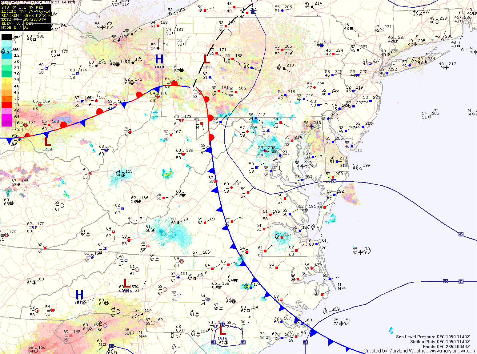
Several More Chances of Rain This Week
Continued easterly flow around high pressure to our north and low pressure to our southeast has caused fog to develop this morning. The fog will lift this morning but we…

Areas of fog will develop tonight as the easterly flow continues.
As we head into tomorrow, high pressure will begin to build in from the northwest. This will scour out the moisture and turn the flow to a more northerly direction. As a result, expect morning clouds to break allowing some afternoon sunshine. There is a slight chance of a shower during the late afternoon, but most areas will remain dry. Highs will be in the low to mid 70s.

Another round of fog/drizzle is expected tonight as Atlantic moisture moves back in.
Tomorrow will be similar to today, starting off with fog and drizzle but warming up into the low to mid 80s. There is a slight chance of thunderstorms during the late afternoon and evening hours.
A cold front will approach on Saturday, spreading scattered showers and thunderstorms into the region. Highs will be in the upper 70s to low 80s.
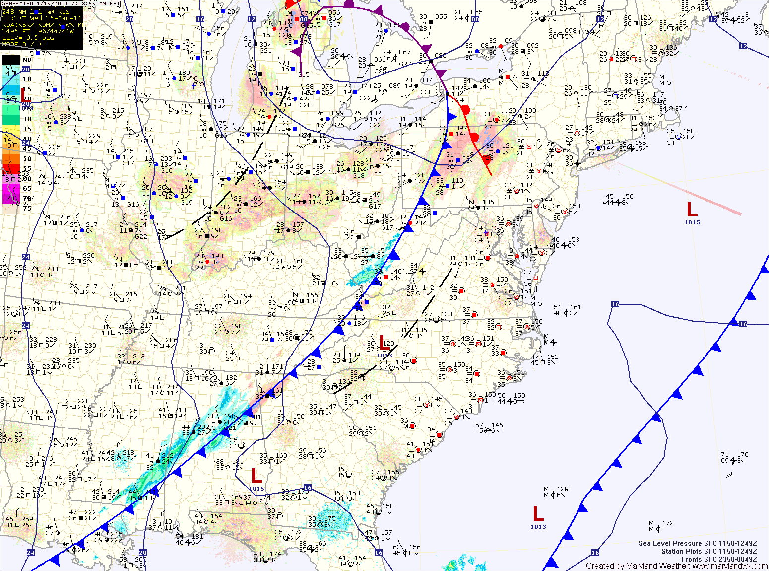
A weak cold front will cross the area tonight as low pressure develops off shore. In between the two, an area of light snow will likely develop. This area will likely be focused across Virginia, but flurries or light snow showers are possible across the state during the overnight hours into tomorrow morning. Little to no accumulation is expected.
Tomorrow will feature clearing skies with highs around 40.
High pressure will continue to build in tomorrow. As a result, expect a mix of clouds and highs in the mid 80s.
The high pressure will move to our south and off the coast by Saturday. As it does, southerly flow around the high will pump warmer air and higher humidity into the area. This will provide a slight chance of an isolated shower or thunderstorm during the afternoon hours. Highs on Saturday will be in the upper 80s to near 90.
Behind the front, winds will remain gusty and temperatures will be about 10 degrees cooler. Highs tomorrow will be around 50 degrees under mostly sunny skies.
More of the same on Wednesday as high pressure builds in. Mostly sunny skies, windy and highs in the low to mid 50s.

Expect more sunshine tomorrow as temperatures push to near 80 ahead of an area of low pressure that is moving into the Ohio Valley. As the low approaches Friday night, expect showers to develop across the area.

As a storm system approaches, more warmth and moisture will be drawn northward and into the area, pushing Friday’s highs to near 80.
Rain chances increase Friday night and scattered showers and thunderstorms are likely Saturday.

The area of high pressure that has been anchored off the Carolina coast will continue to dominate our weather. Expect the marine layer to move back into the area tonight, bringing more foggy conditions for tomorrow morning.