Summary: Low pressure will affect our area today through tomorrow morning. High pressure builds in late tomorrow into Wednesday. A cold front slides through late Wednesday into Thursday. High pressure…
High pressure will remain to our north today while a disturbance moves through from the west. High pressure will remain in place for the rest of the week. TODAY: High…
The stationary front that was to our north yesterday has pushed southward as a cold front ushering in colder marine air off of the Atlantic. At the same time, several…
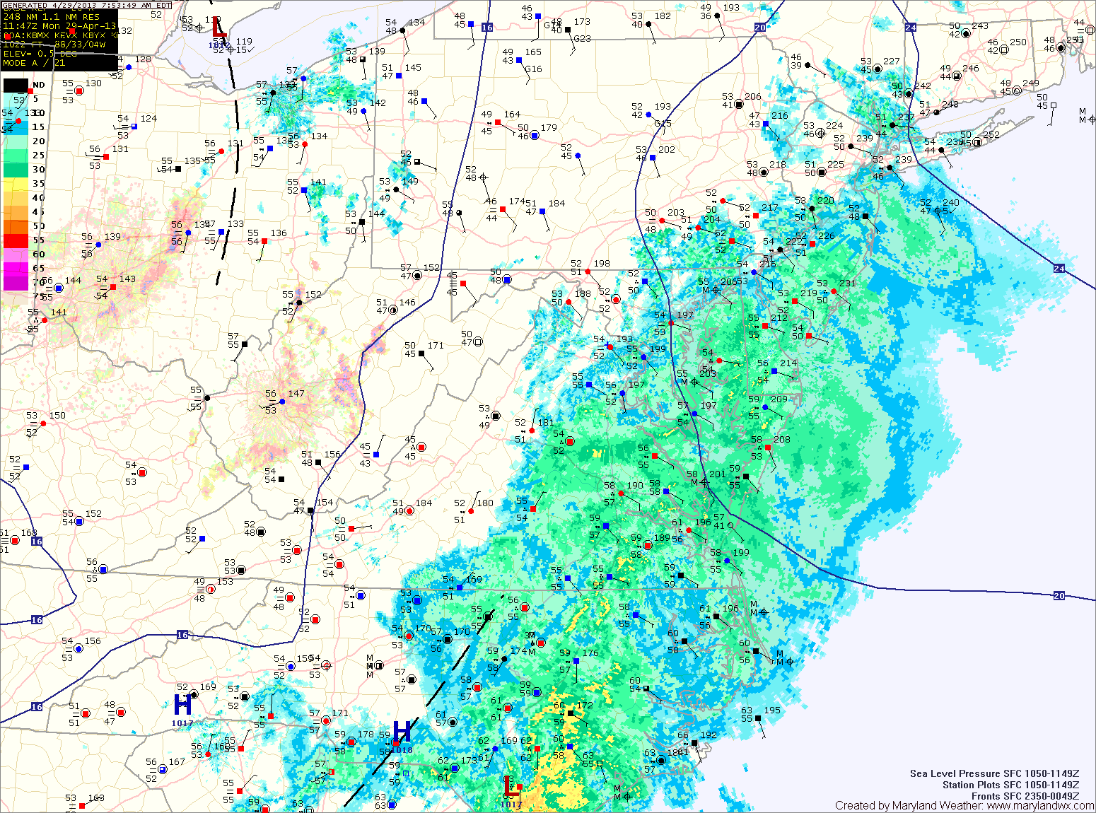
Current Surface MapEasterly flow combined with low pressure has resulted in a cool and damp day with light rain likely through the day and night.
The rain is mainly along and east of I-95 at this time, but will work its way westward during the day. Highs will struggle into the upper 50s.
Onshore flow with damp conditions and light rain chances will persist tomorrow and Wednesday.
The rainfall is expected to be lighter than today, but will still be in the forecast into Wednesday night. Highs both days will be in the low to mid 60s.
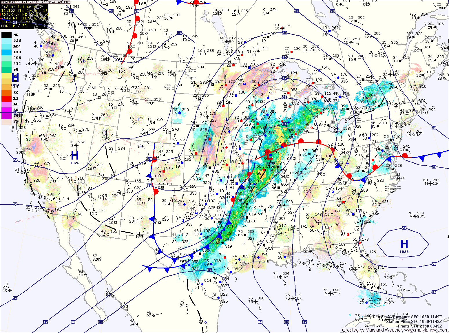
Current Surface MapA stationary boundary across Virginia this morning will push northward today as a warm front. Before it does, moist marine air is supporting scattered showers over the state.
The front will clear the state during the afternoon, allowing southerly flow to develop and clear out the showers. Highs this afternoon will top out around 70 degrees under partly sunny skies.
A cold front currently across the midwest will move towards the area tomorrow. The front will cross the state tomorrow evening, but before it does, it will spread numerous showers and thunderstorms through. Some of the storms may produce gusty winds and locally heavy rainfall. High temperatures tomorrow will be in the mid to upper 70s.