Showers and thunderstorms likely today
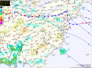
Current Surface Map
Current Surface Map
A back door cold front will move into the area this afternoon. As it does, showers and thunderstorms will develop this afternoon. Some of the storms may produce damaging winds and large hail. Highs will reach the low to mid 80s.

The front will push through tonight, bringing an end to the thunderstorm threat. However, showers are likely to continue through the night and into tomorrow. As easterly flow develops, the showers will diminish but low clouds and areas of drizzle will remain through most of the day. Highs will only be in the mid 60s.

Skies will try to clear on Friday as high pressure builds in and the flow becomes more westerly. Temperatures will rebound and highs will reach the mid 70s.

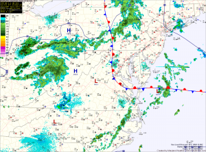
Foggy start, showers and storms possible this afternoon

Current Surface Map
A back door cold front has moved through central Maryland and has stalled out just west of Washington, DC. This has allowed cooler, moist marine air to move into central and eastern Maryland.

Expect the front to be pushed back to the east as an upper level disturbance moves through this afternoon, bringing with it a chance of showers and thunderstorms. Some of these showers and storms could produce locally heavy rain and gusty winds. Highs today will top out in the upper 60s to around 70 under partly sunny skies.