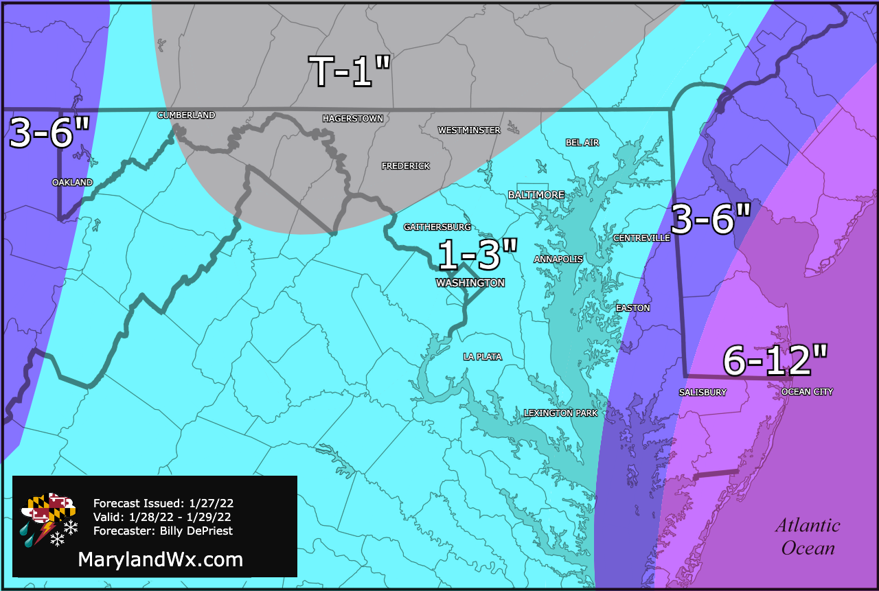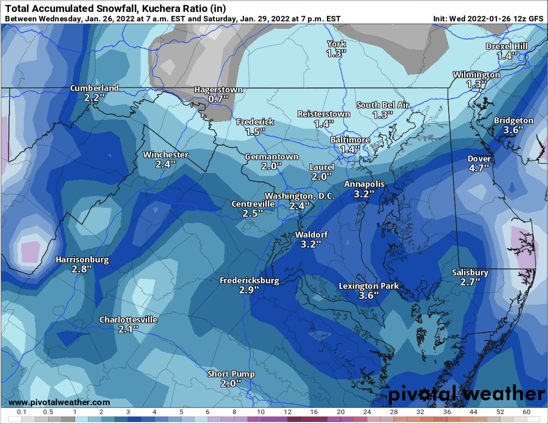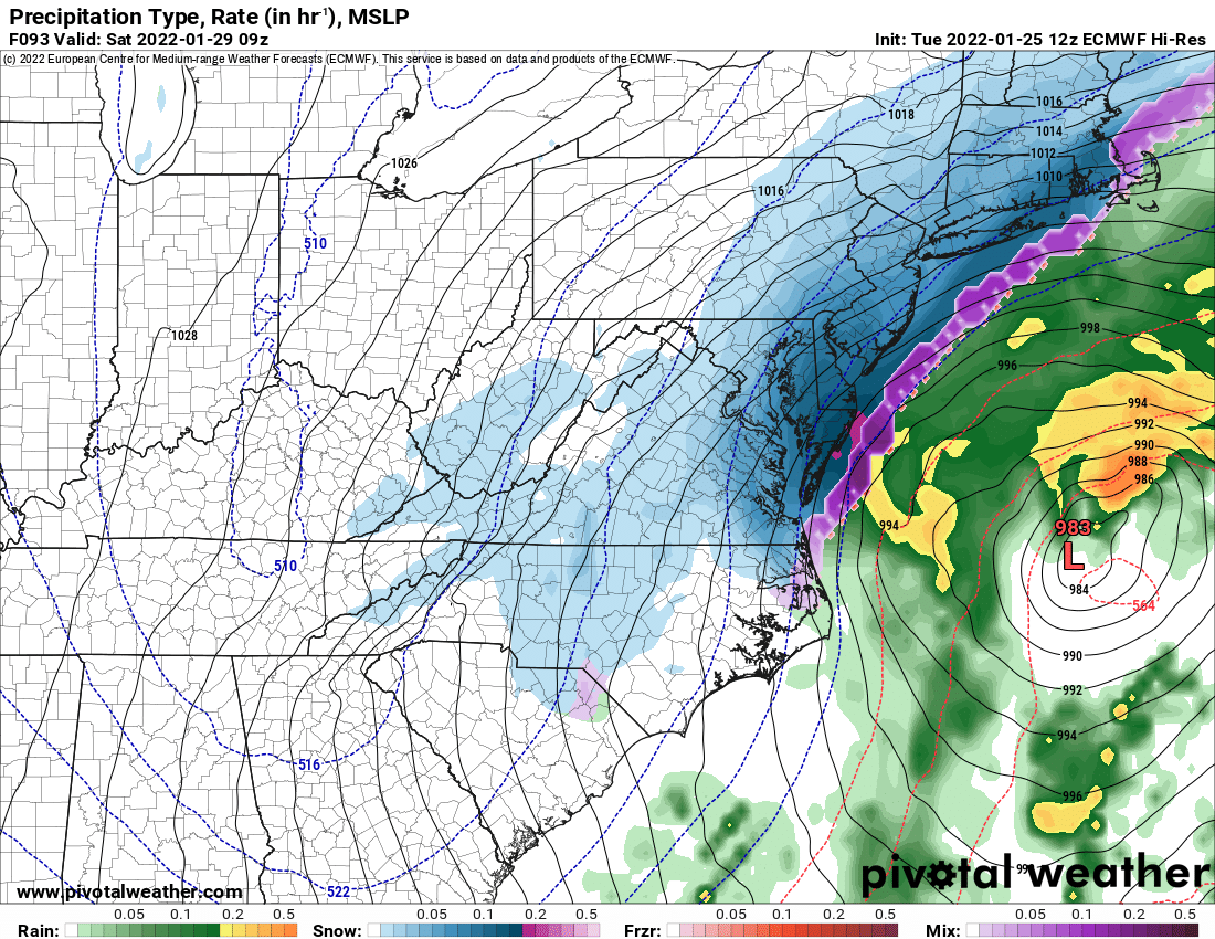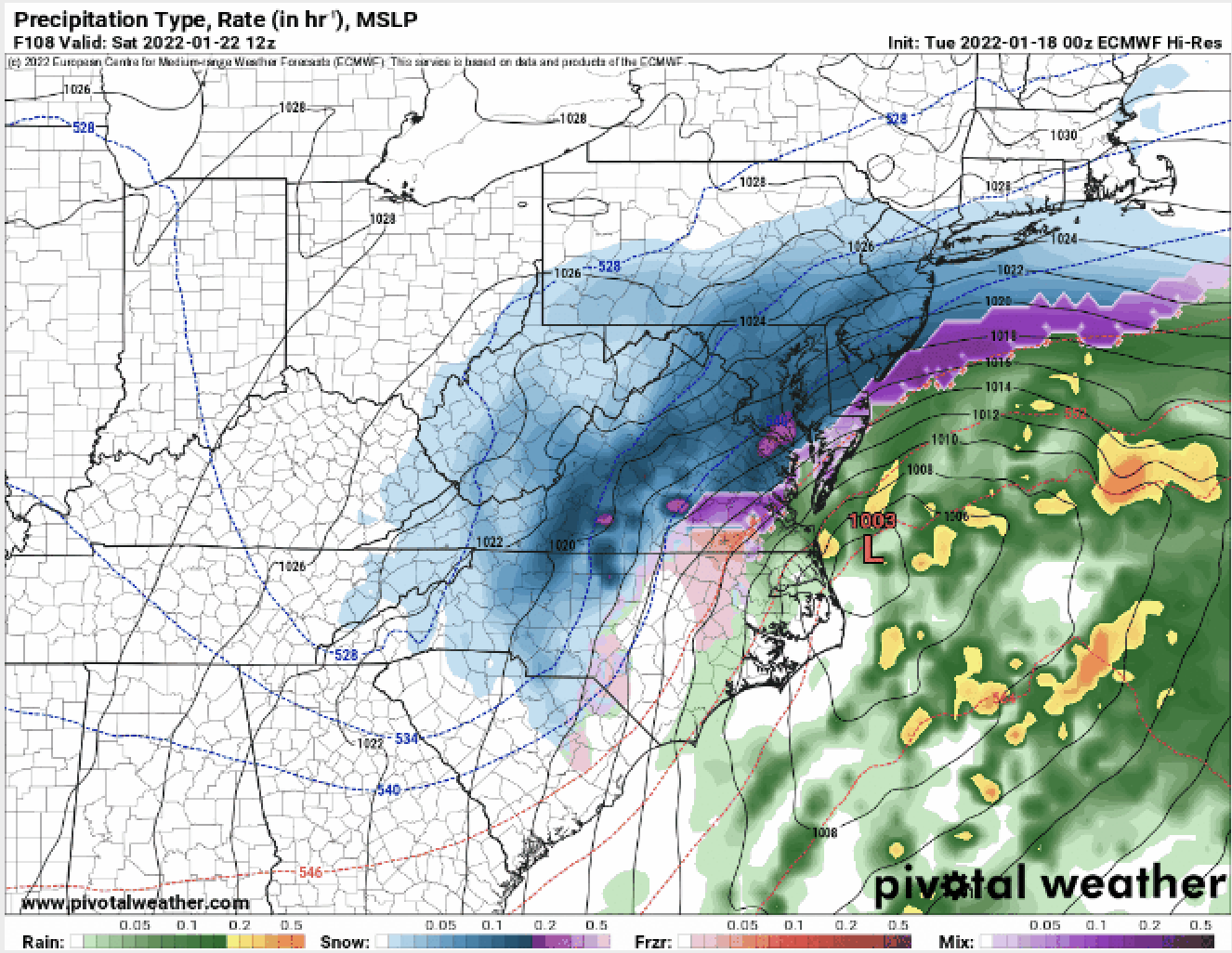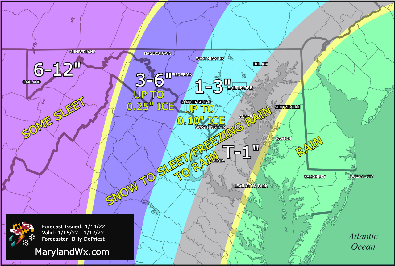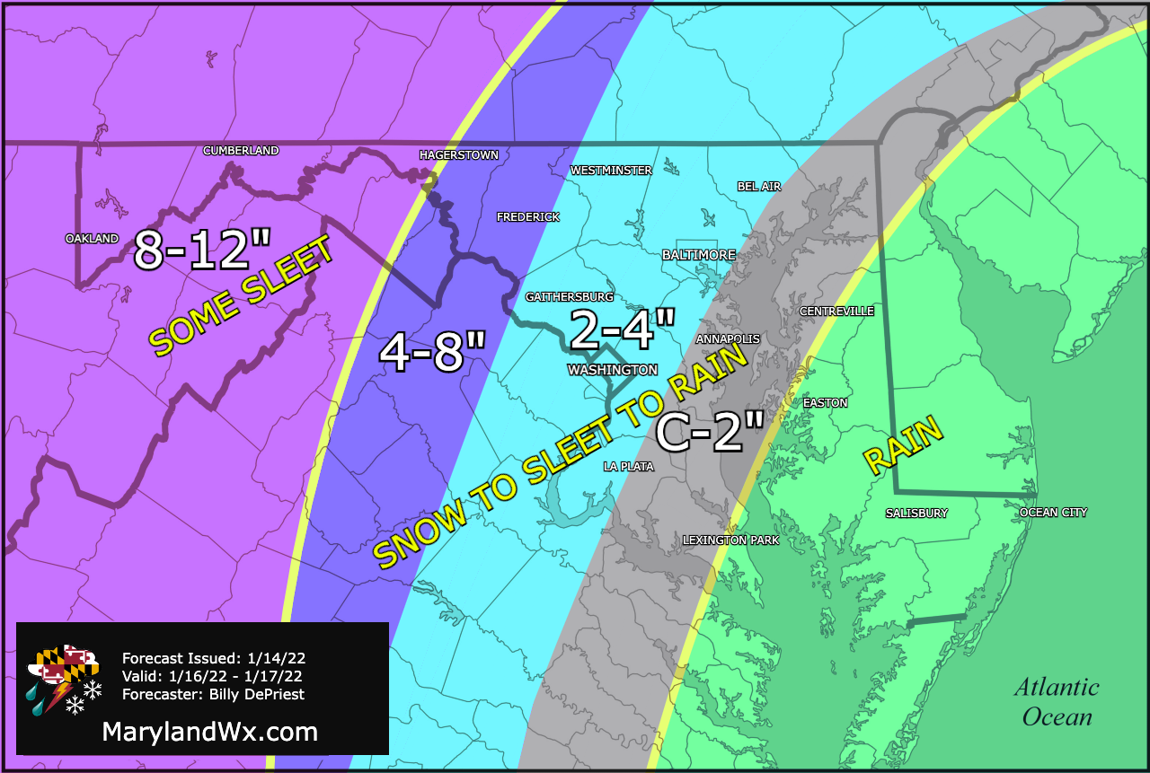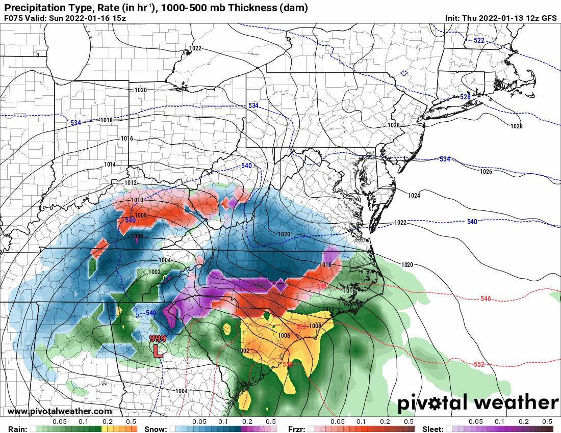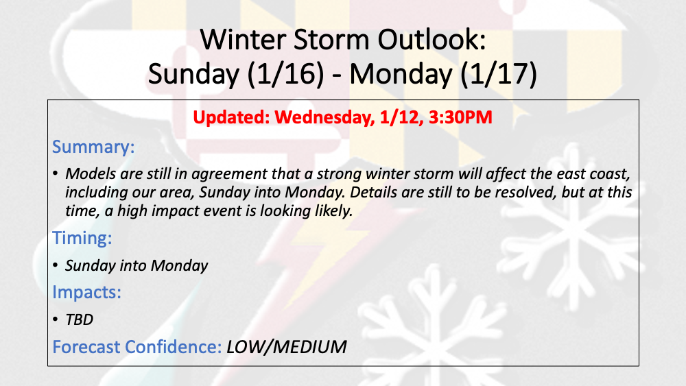
Friday AM Update: Slight snowfall adjustment; Blizzard Warnings along the coast
Summary Slight westward adjustment to the storm track has pushed slightly higher snow totals westward Winter Storm Warnings in effect on Eastern Shore. Blizzard Warning issued for Worcester county -…