
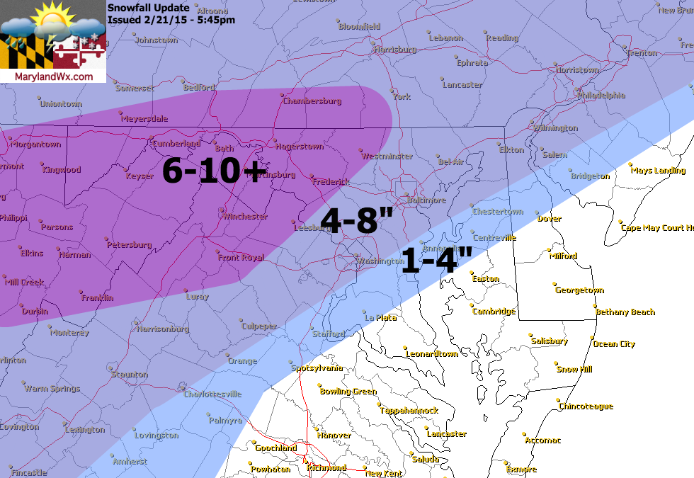
We are well into the storm and it is behaving about as expected except the front end snow is over performing a bit.
Totals look like they will be a few inches above my forecast, especially along and east of I-95. Across southern Maryland and the lower eastern shore, the transition to a wintry mix is well underway and snow totals there are averaging around 1″.
For those areas along and north and west of I-95, take my forecast map and add about 2″ to each range and that is about what we are seeing, with some areas west of Frederick seeing totals near 1 foot.
As I mentioned above, the transition is well underway. Looking at the radar, you can clearly see the sleet advancing northward. mPING reports are confirming what the radar is showing, sleet has reached DC and Annapolis:
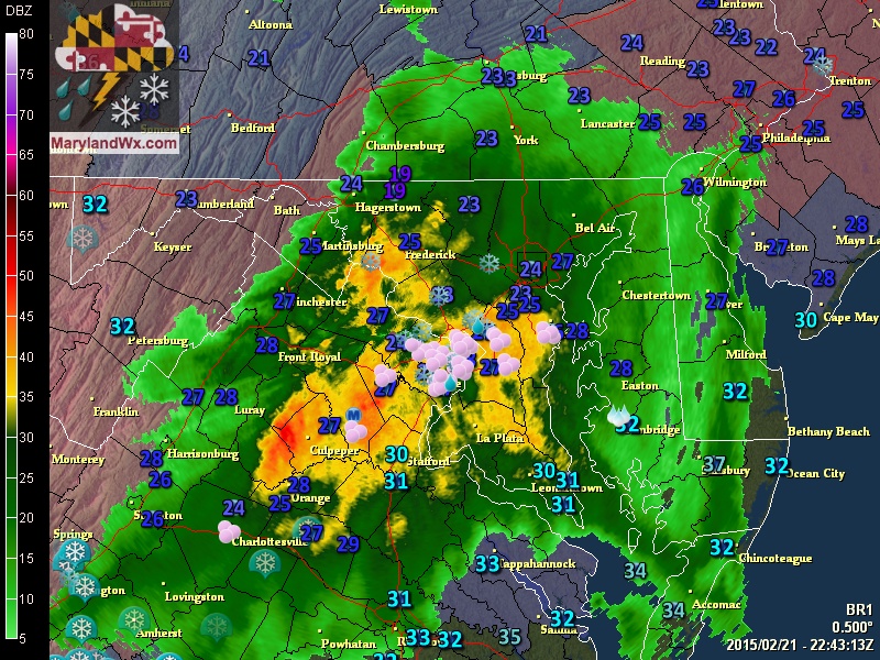
The areas sleet will continue to move northward over the next few hours and everywhere east of the mountains will see sleet, mixing with then changing to a brief period of freezing rain before changing to rain overnight.
The precipitation will end west to east tomorrow morning.
For more frequent updates on the storm, follow along on my Facebook page.