
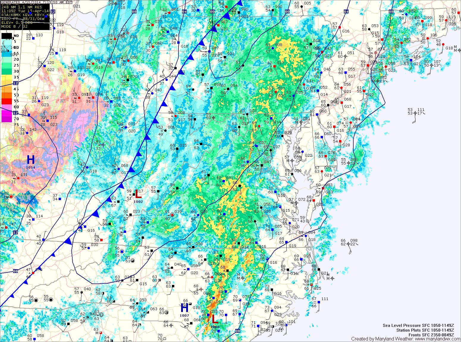
A strong cold front is moving through, spreading showers and thunderstorms into the area. The showers and storms will continue into this evening before tapering off after dark. As colder air moves in behind the front, the rain may end as a brief period of snow, mainly north and west of the cities. Highs today will reach the mid to upper 60s before falling this afternoon.
A Freeze Warning is in effect tonight as temperatures fall into the upper 20s north and west of the cities, and to around 30 in central and eastern Maryland.
Tomorrow will be sunny but breezy and cool, with highs around 50.
Temperatures will warm a bit on Thursday, with highs reaching the upper 50s under mostly sunny skies.
Clouds will increase again on Friday. Highs will be in the upper 50s.
Light showers are possible Friday night into Saturday as another disturbance moves through. Highs on Saturday will be around 60.
Sunday will be partly sunny, with highs in the mid 60s.
Yesterday’s Weather Station Stats:
High Temp: 78.6°
Low Temp: 62.2°
Rain: 0.00″