
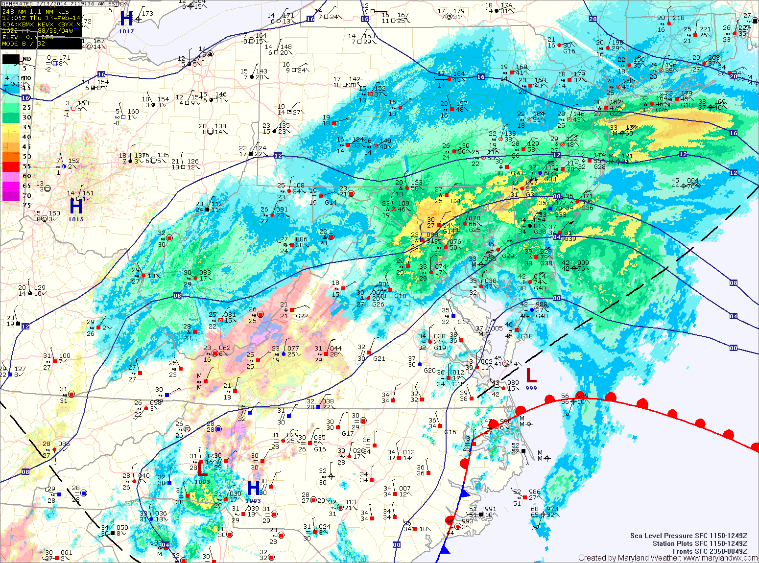
A Winter Storm Warning remains in effect until this afternoon for Anne Arundel, Prince Georges and Charles counties. A Winter Weather Advisory goes in effect for these counties at 5pm until 1am tomorrow.
A Winter Storm Warning remains in effect until tomorrow morning for the eastern shore.
A Winter Weather Advisory remains in effect for Calvert and St. Mary’s, counties until noon.
Moderate to heavy snow fell last night and continues this morning for areas north and west of I-95. East of there, it has changed to a mix of snow, sleet and rain. Anywhere from 3″ in lower St. Mary’s to over a foot in Montgomery county has already fallen.
Moderate snow, sleet and rain will continue for another few hours before winding down this afternoon. Another round of moderate to heavy snow is expected to develop this afternoon across the entire state. Expect an additional 1-3″ of snow this evening and tonight statewide.
The snow will wind down late tonight or early tomorrow morning.
Clouds will decrease through the day tomorrow, with highs in the upper 30s.
A cold front and clipper system will push through tomorrow night, bringing a round of light snow as it does.
This weekend will be dry, with highs on Saturday and Sunday in the low 30s under partly sunny skies.
Monday will be dry as well, but another front will bring a chance of rain or snow Monday night into Tuesday.
Yesterday’s Weather Station Stats:
High Temp: 27.4°
Low Temp: 14.0°
Rain: 0.00″