
 ---
---
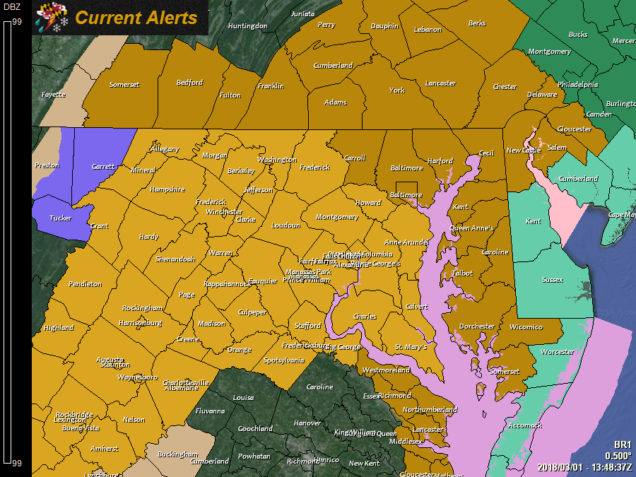
A *HIGH WIND WARNING* has been issued for: Allegany, Anne Arundel, Calvert, Charles, Frederick, Howard, Montgomery, Prince George's, St. Mary's, and Washington counties.
---
A *WINTER WEATHER ADVISORY* has been issued for Garrett county.
---
A *HIGH WIND WATCH* has been issued for: Baltimore, Caroline, Carroll, Cecil, Dorchester, Garrett, Harford, Kent, Queen Anne's, Somerset, Talbot, Wicomico, and Worcester counties.
---
An area of low pressure will bring rainfall to the state today as it passes through. The low will emerge off of the coast tonight and rapidly intensify into a strong nor’easter tonight and tomorrow. As it strengthens, a strong pressure gradient will develop between the low and high pressure to its north. This will cause winds to increase rather rapidly across our area late tonight, lasting into Saturday morning as the storm system remains off of the northeast coastline. Heavy rain and snow is likely to our north, while lighter rainfall is expected across our area, perhaps mixing with or briefly changing to snow showers before ending tomorrow night.
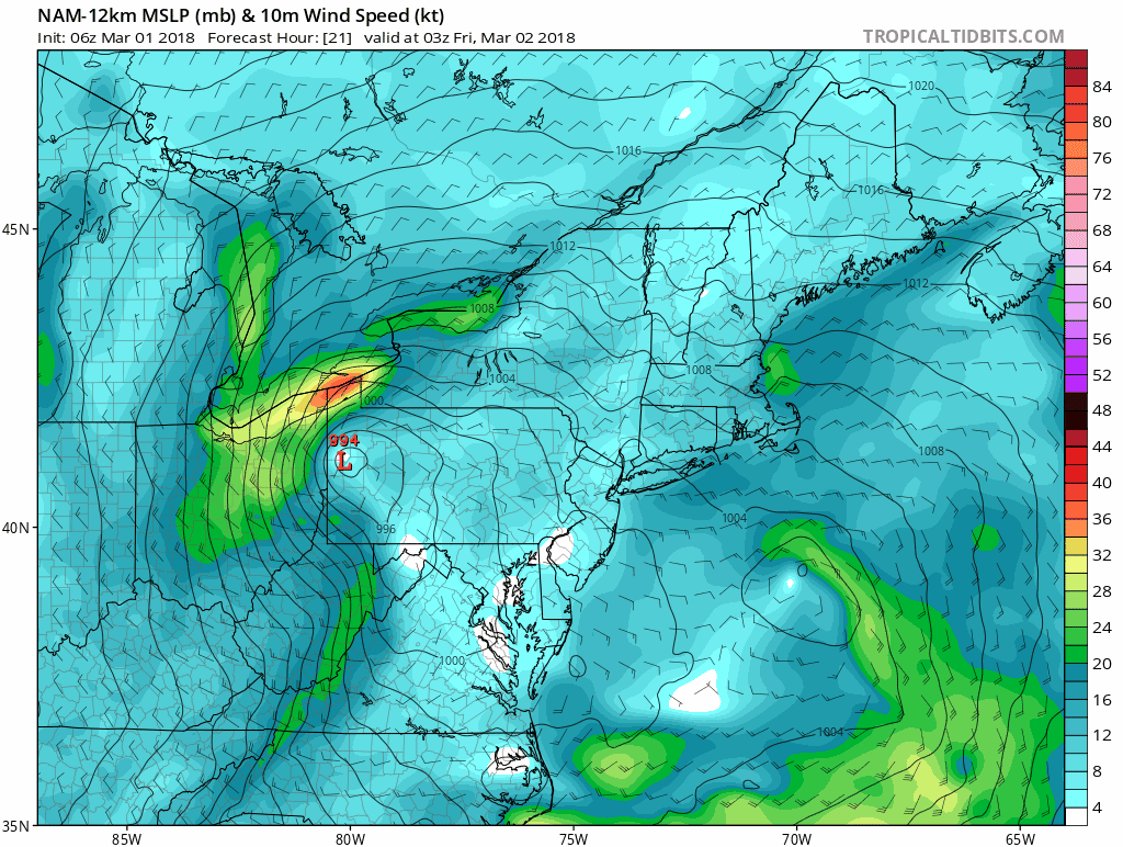
Here is the NAM wind forecast showing sustained winds of 30-40 mph over central Maryland and 40-50 mph winds along the coast tomorrow afternoon:
Without a doubt, the wind will be the main story with this storm, especially in our area. Wind gusts to near 60 mph have the potential to cause downed trees, power outages and other damage to structures across the state. Along the coast, the winds will cause high seas, resulting in moderate coastal flooding.
The winds will begin to slacken on Saturday as the system moves away and high pressure builds back in, resulting in a stretch of calm weather that will last into the middle of next week.
Want the latest blog posts emailed to you?