
A storm system will move into the region tonight, spreading precipitation into our area. With very cold air in place, the precipitation will likely start as snow or a snow/sleet mix around midnight tonight before warmer air moves in, changing the snow and sleet to freezing rain and eventually plain rain.
Here is this morning’s NAM solution, showing snow overspreading the state after 8pm, changing over to a wintry mix around 1am, to freezing rain around 4am lasting until around 7am, then plain rain in most areas around noon:
[slideshow_deploy id=’11666′]
This is just one model solution and shouldn’t be taken as the definite times in which the changeovers will occur, but it gives a good general idea of the expected outcome.
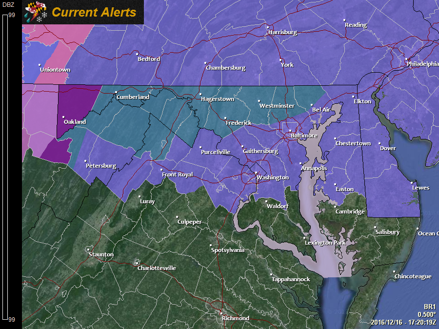
Generally, the National Weather Service expects very little snow/sleet accumulation, but the amount of possible ice accumulation has prompted an Ice Storm Warning for Garrett county, where over .25″ of ice is possible and Winter Storm Watches for the counties along the Mason-Dixon line where up to 1″ of snow/sleet is possible and up to .25″ of ice accumulation is possible. South of there, across most of central Maryland and the Eastern Shore, a Winter Weather Advisory is in effect for up a half inch of snow/sleet and up to .10″ of ice.
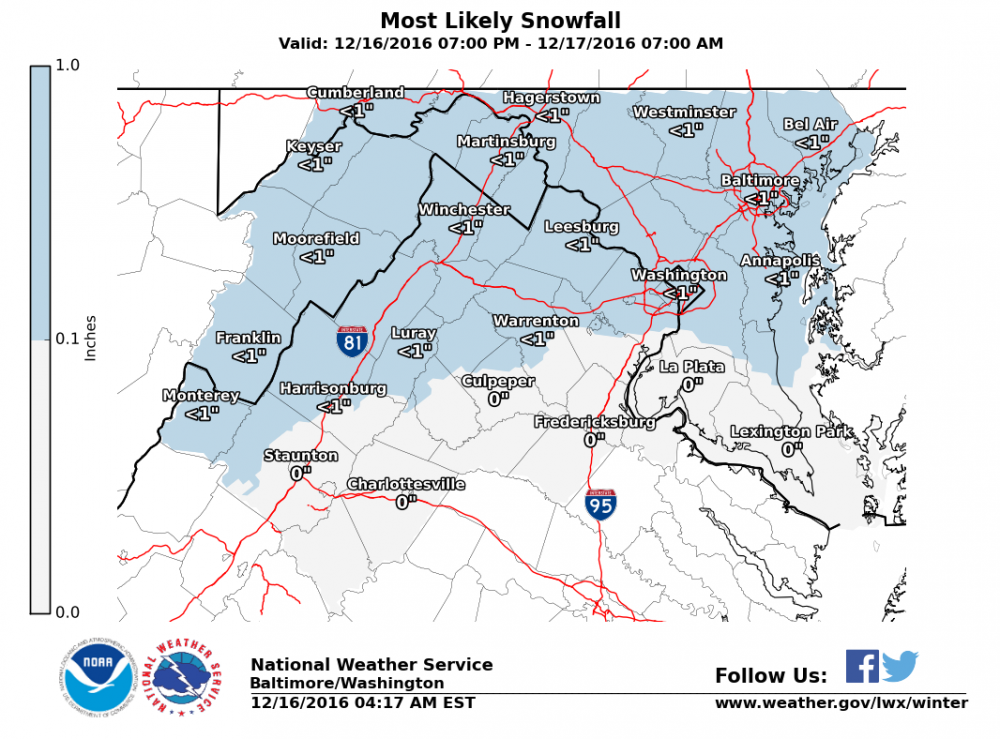
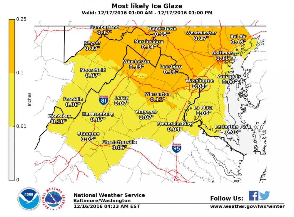
Here are the Baltimore/Washington National Weather Service accumulation forecast:
The good news is that by tomorrow afternoon, temperatures will rise well above freezing and the rainfall will become more sporadic and scattered.
Sunday will see highs into the mid 50s before a cold front crosses with more rain showers and temperatures falling back into the mid 30s for highs on Monday.