
 High pressure will create a very pleasant day in our area today. Highs will be right around 80 with low humidity and plenty of sunshine.
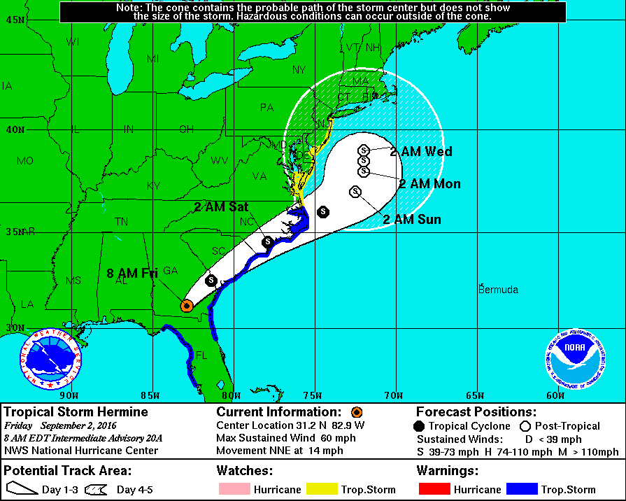
Hurricane Hermine came ashore last night on the Florida Gulf coast. The system has weakened to a tropical storm and continues to move northeastward.
On this track, Hermine is expected to parallel the southeast coastline and move off shore off North Carolina. Despite this track, the system will still impact our weather this weekend.
Tropical Storm Watches are in effect for the lower Chesapeake Bay and the lower Eastern Shore, including Ocean City and the Delaware beaches.
The system is expected to stall out and meander off of the coast for several days. So while we will take a glancing blow from the storm this weekend, its effects will be felt along the shoreline for several days next week.
There is even the possibility that the system wobbles back westward, spreading showers back into eastern portions of the state Monday and Tuesday.
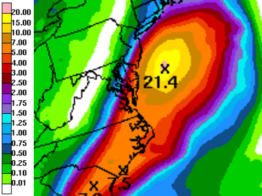
There will be a sharp cut off to the rainfall, with most areas west of I-95 staying dry all weekend. As you move further east, rain chances and totals will increase. Here is the current rainfall forecast through next week but most of this will fall tomorrow through Sunday night.
As you can see, rainfall will be mostly confined to the Eastern Shore, with areas west of the bay on the fringe of the rain shield. Several inches of rain are likely along the coast.
Stay tuned to local media throughout the weekend for updates to the forecast and the track of Hermine as slight shifts can have significant impacts to rainfall totals and overall impact to our state.