
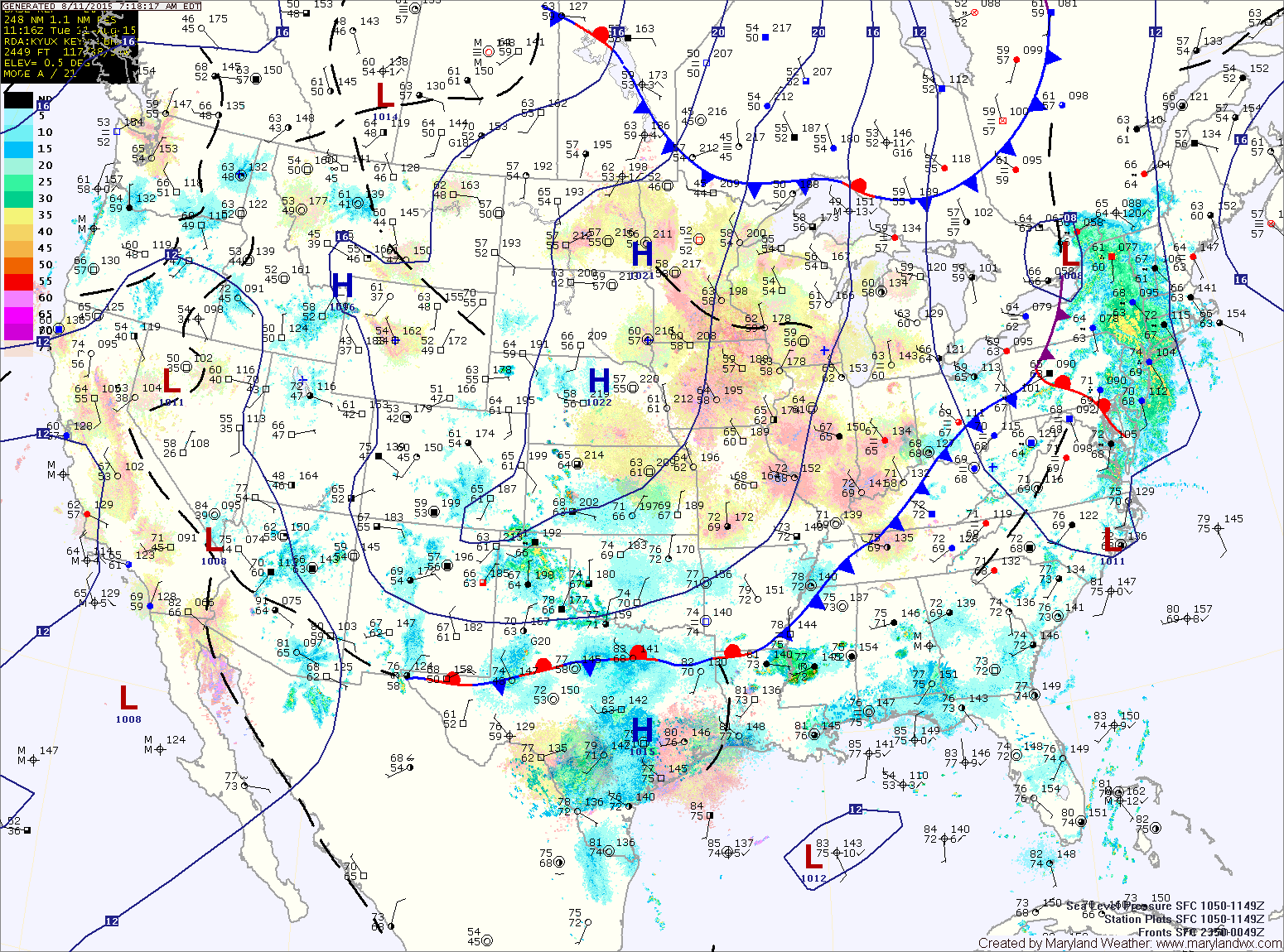
A cold front will continue to march into and through the area today followed by high pressure. High pressure will remain over the area through the remainder of the week and into the weekend.
WEDNESDAY: The front will be east of the area and high pressure will be building in. Expect a mix of clouds and sun with highs in the low 80s.
THURSDAY: Expect mostly sunny skies and highs in the low 80s.
FRIDAY: Mostly sunny, with highs in the mid 80s.
WEEKEND OUTLOOK: Expect mostly dry conditions, with mostly sunny skies both Saturday and Sunday. An isolated pop up shower or thunderstorm is possible but unlikely both days during the afternoon hours. Highs will be in the mid to upper 80s.
Stay up to date with storm information on your favorite social media site!
Follow me on Twitter, Facebook and Google+!