
Summary: An area of low pressure developing over the southeast will move northeastward tomorrow, passing by to our southeast tomorrow night.
The third of a series of storm systems is poised to impact our area tomorrow into tomorrow night. As is generally the case, there will be a tricky rain/snow line, and as usually is the case, it will set up somewhere along the I-95 corridor.
Another tricky aspect to this system is the high March sun angle, and marginal temperatures. A significant chunk of precipitation from this storm will fall during the afternoon hours, with solar radiation limiting possible accumulation.
Nonetheless, the National Weather Service has issued a Winter Storm Watch for western and northern parts of the state, where the heaviest snowfall is expected. I would expect adjustments, with Winter Storm Warnings, and possible Winter Weather Advisories coming this afternoon.
Here is my initial forecast:
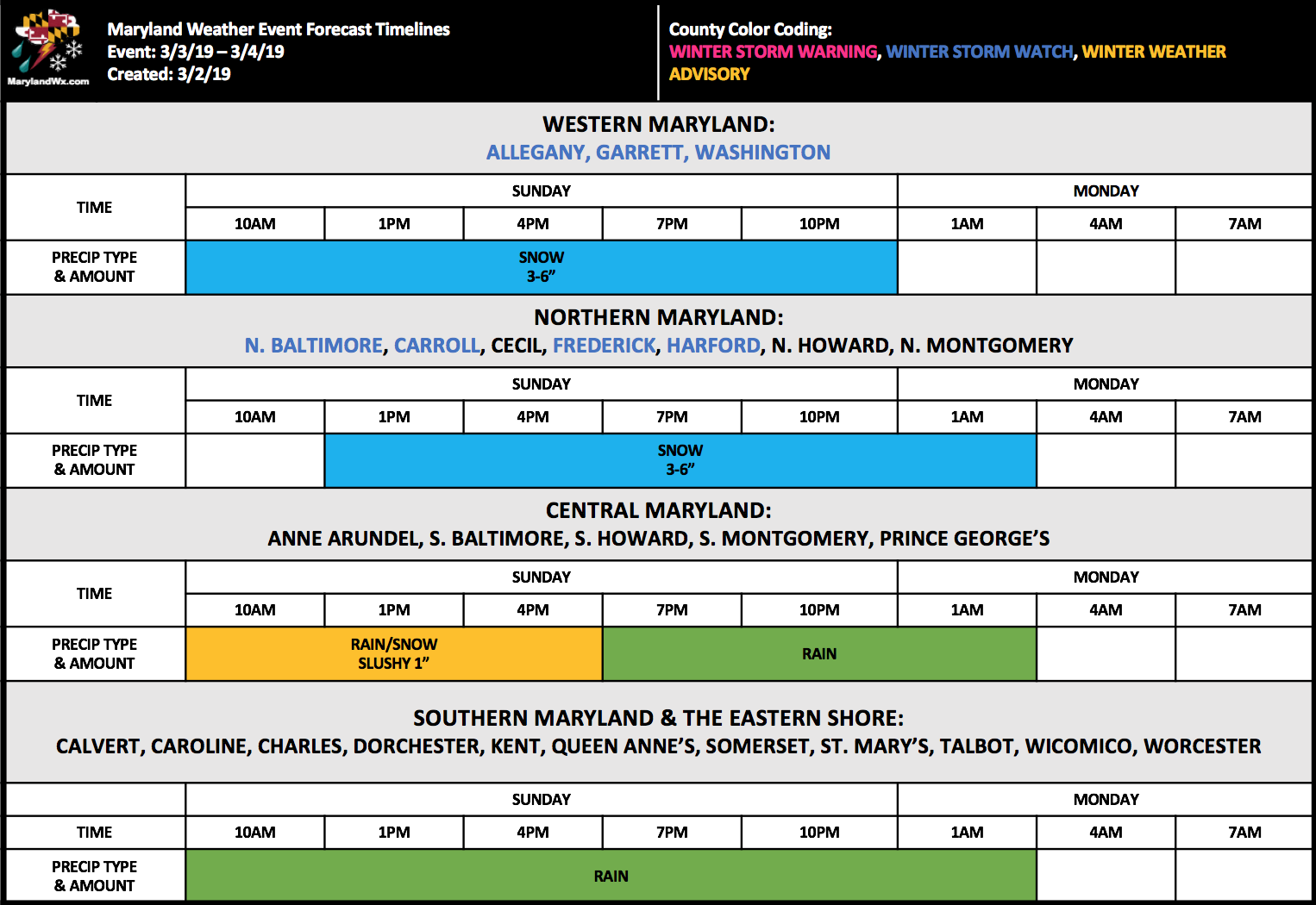
This is an *extremely* tricky forecast, and confidence is fairly low, especially along I-95. I fully expect to have to adjust things later today or early tomorrow morning.
Want the latest blog posts emailed to you?