
This is an update to the original post, which can be found here.
The storm remains on track to begin affecting our state this evening and lasting into tomorrow. Snowfall totals will range from less than an inch west of the metro areas to possibly over a foot along the coastline. Additionally, very strong winds are expected during the morning hours, prompting a Blizzard Warning for the lower Eastern Shore, where winds are expected to gust over 50 mph.
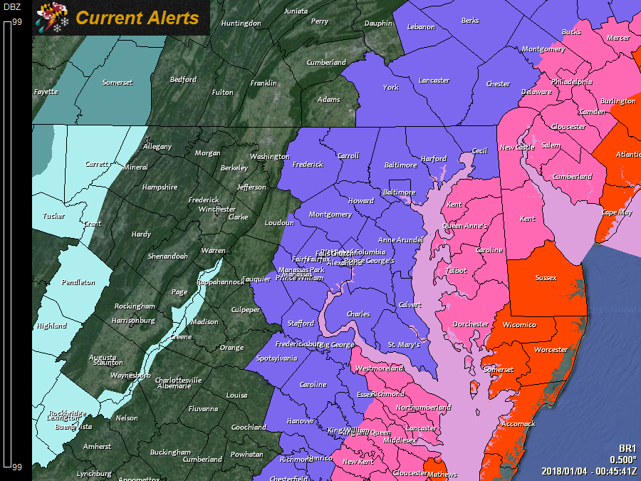
Current Watches, Warnings and Advisories issued by the National Weather Service:

---

A *BLIZZARD WARNING* has been issued for: Somerset, Wicomico, and Worcester counties.

---

A *WINTER STORM WARNING* has been issued for: Caroline, Dorchester, Kent, Queen Anne's, and Talbot counties.

---

A *WINTER WEATHER ADVISORY* has been issued for: Anne Arundel, Baltimore, Calvert, Carroll, Cecil, Charles, Frederick, Harford, Howard, Montgomery, Prince George's, and St. Mary's counties.

---
Final Snowfall Forecast:
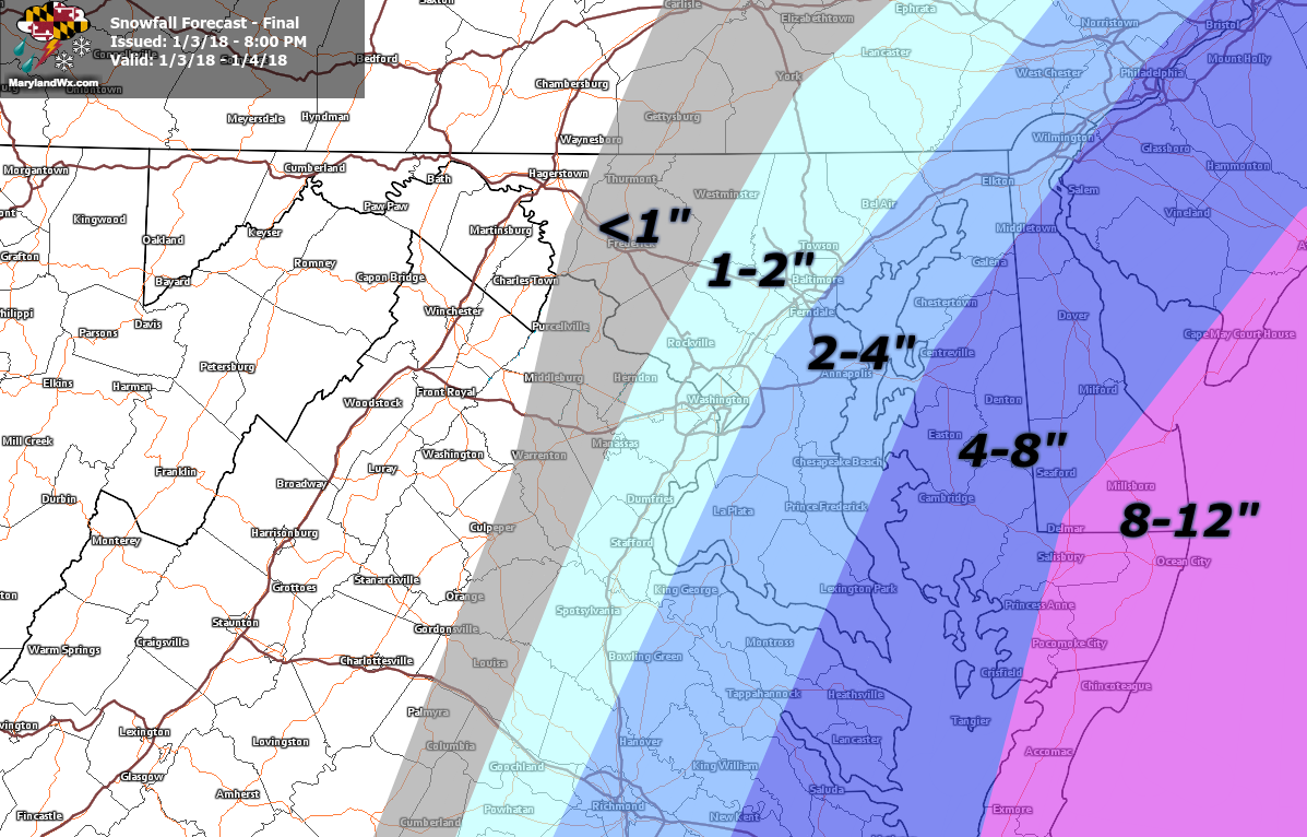
I have increased totals some, especially in eastern portions of the state. There is quite a range of snowfall expected and a sharp gradient remains, with areas just west of Baltimore and Washington, DC seeing very little snowfall while the lower Eastern Shore may top a foot.
I will be posting updates on the storm mainly on Facebook as the event unfolds, so be sure to follow along there and on Twitter.
Want the latest blog posts emailed to you?