
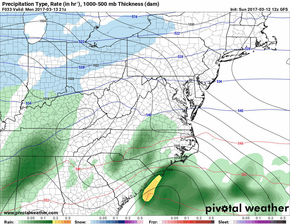
All of the models continue to show agreement that a major Nor’Easter will affect our state tomorrow night into Tuesday. As with any of these storms, precipitation type will be an issue, with mixing and changeovers to sleet or rain cutting down snowfall totals in some areas. A *WINTER STORM WATCH* has been issued for all of the state west of the bay.
Right now, it appears that snow will overspread the state from south to north tomorrow before midnight. The snow will become heavy at times throughout the night as the storm intensifies and moves up the coast. Across lower southern Maryland and the lower Eastern Shore, the snow will likely changeover to rain. The rain/snow line will continue to work northward through the early morning hours on Tuesday. How far north and west the line pushes is still to be determined, but best guess right now is that it does not make it north of roughly Rt. 50. This will not be resolved until tomorrow.
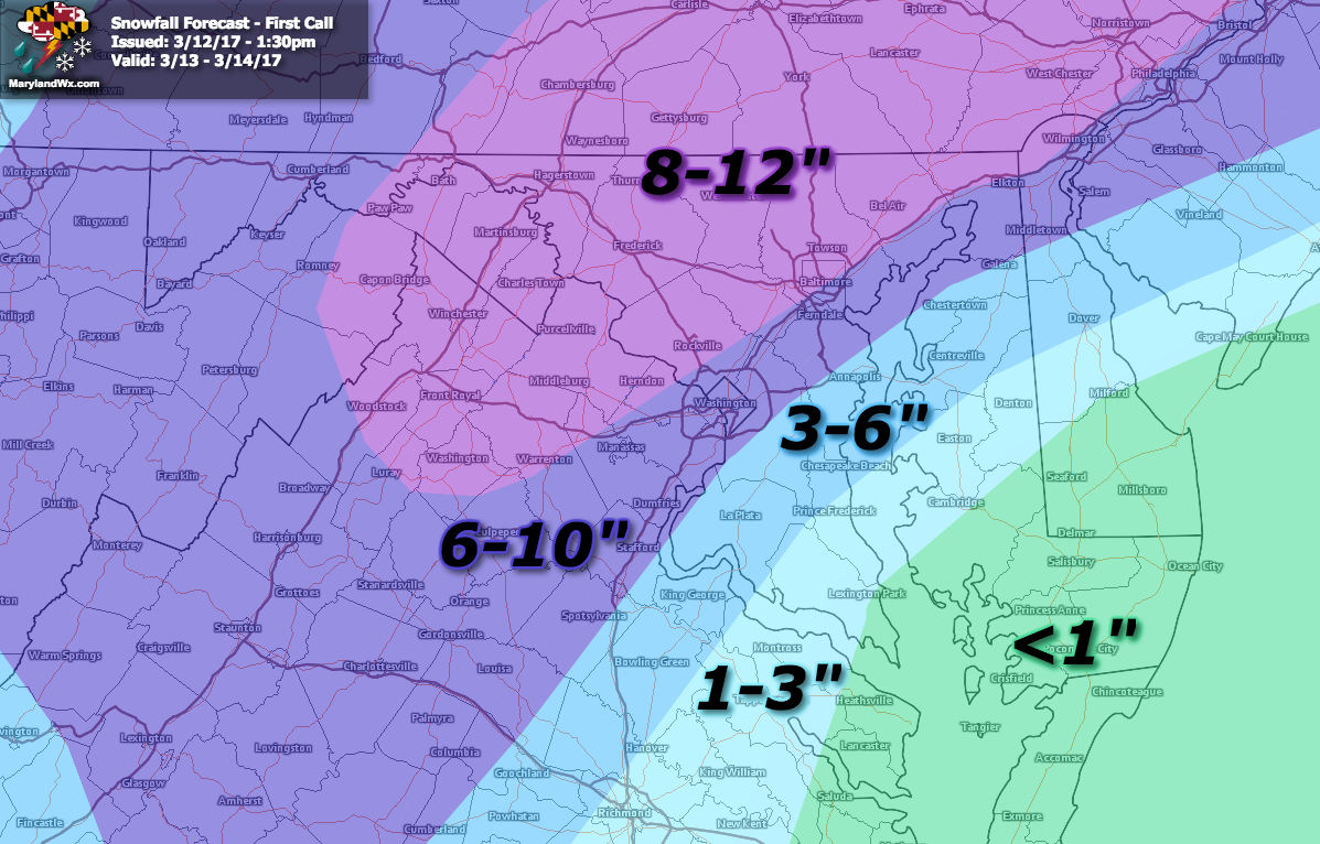
North of there, at this point, it looks like this will be mostly if not all snow, and possibly a lot of it. Snowfall totals of 6-10″ are likely along and north of I-95. North and west of I-95, in the usual “sweet spot”, up to (and possibly over) a foot seems likely.
Here is the 12z Sunday GFS showing the timeline of the storm from 5pm tomorrow to 8am Wednesday:
Here is my first guess snowfall map:
As the next rounds of model data come in, I will review and post an updated forecast tomorrow morning or early afternoon. For now, preparations should be made for a late season winter storm that will dump a disruptive amount of snow across our state.
Want the latest blog posts emailed to you?